MyTopo
Doles Georgia US Topo Map
Couldn't load pickup availability
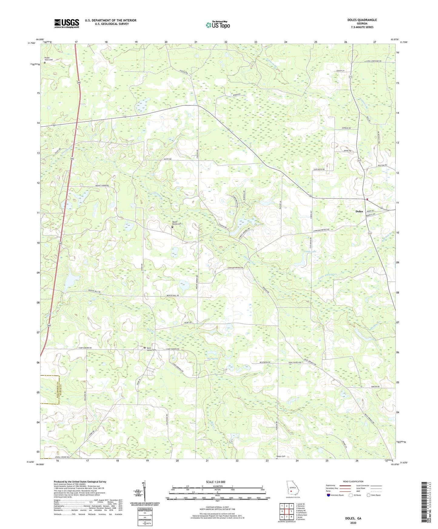
2024 topographic map quadrangle Doles in the state of Georgia. Scale: 1:24000. Based on the newly updated USGS 7.5' US Topo map series, this map is in the following counties: Worth, Dougherty. The map contains contour data, water features, and other items you are used to seeing on USGS maps, but also has updated roads and other features. This is the next generation of topographic maps. Printed on high-quality waterproof paper with UV fade-resistant inks.
Quads adjacent to this one:
West: Albany NE
Northwest: Leslie SE
North: Warwick
Northeast: Pateville
East: Cuffietown
Southeast: Sylvester
South: Acree
Southwest: Albany East
This map covers the same area as the classic USGS quad with code o31083f8.
Contains the following named places: Abrams School, Aultmans, Blue Spring, Buckaloo School, Camp Osborn, Charity Grove Church, Charity Grove School, Davis School, Doles, Doles School, Doles Volunteer Fire Department Station 11, Fords Store, Friendship School, Johnson Branch, Little Abrams Creek, Mercer Mill School, Mercer Millpond, Mercer Millpond Dam, Mount Horeb Cemetery, Mount Horeb Church, New Provisor Church, Pinder Town Cemetery, Red Oak Branch, Rouses Store, Saint James Cemetery, Saint James Church, Saint James School, Saint Johns Church, Salem Cemetery, Tison Lake, Tison Lake Dam, Warwick Division, Zion Grove Church, Zion Grove School, ZIP Code: 31772