MyTopo
Albany NE Georgia US Topo Map
Couldn't load pickup availability
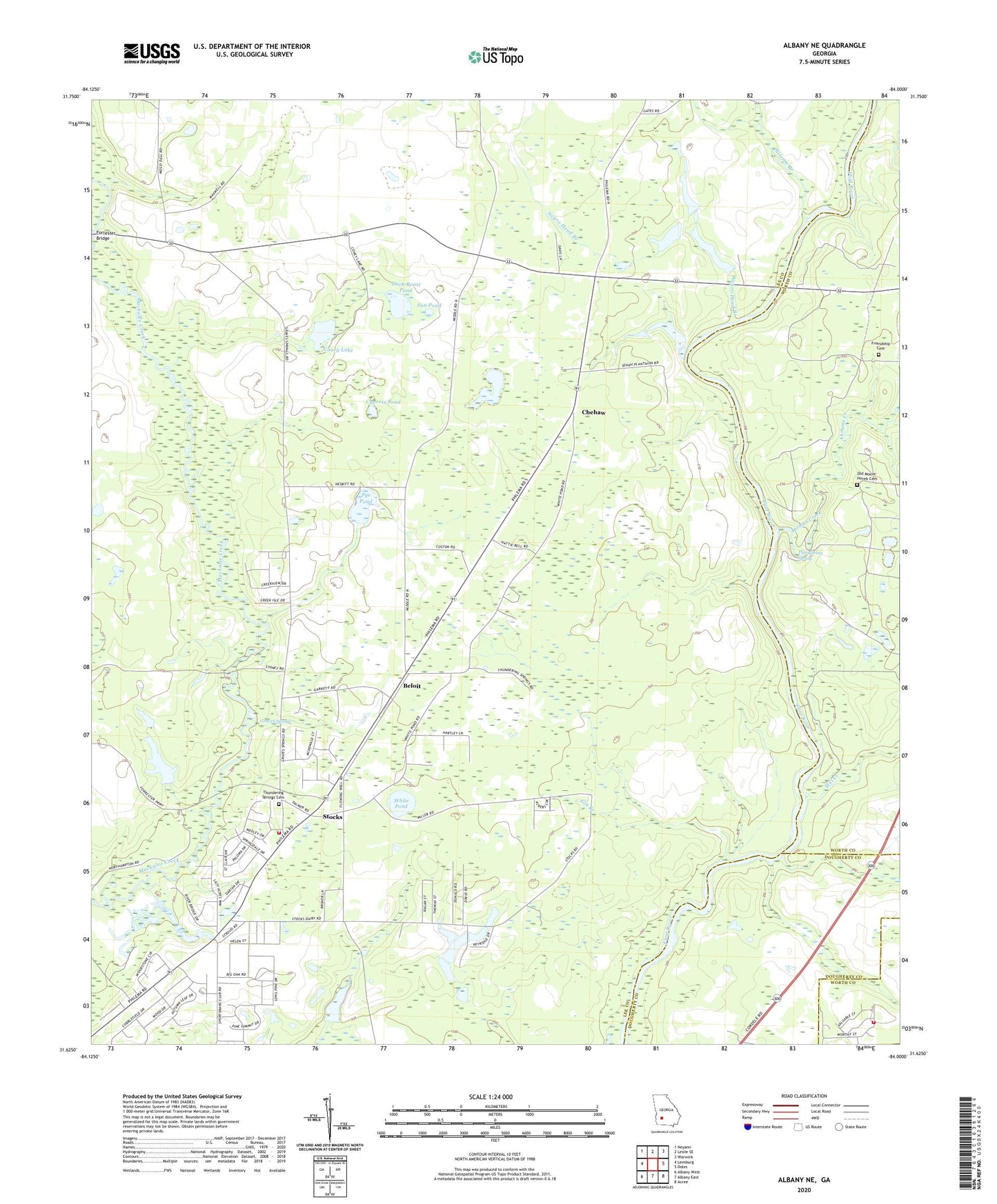
2024 topographic map quadrangle Albany NE in the state of Georgia. Scale: 1:24000. Based on the newly updated USGS 7.5' US Topo map series, this map is in the following counties: Lee, Worth, Dougherty. The map contains contour data, water features, and other items you are used to seeing on USGS maps, but also has updated roads and other features. This is the next generation of topographic maps. Printed on high-quality waterproof paper with UV fade-resistant inks.
Quads adjacent to this one:
West: Leesburg
Northwest: Neyami
North: Leslie SE
Northeast: Warwick
East: Doles
Southeast: Acree
South: Albany East
Southwest: Albany West
This map covers the same area as the classic USGS quad with code o31084f1.
Contains the following named places: Abrams Creek, Beloit, Chehaw, Coney Lake, Cypress Pond, Duck Roost Pond, Fish Pond, Forrester Bridge, Fox Pond, Friendship Cemetery, Friendship Church, Gin Branch, Graves Spring, Hartley Farm, Lee County Emergency Medical Services Redbone Station, Lee County Fire Department Station 5 Redbone, Middle Cypress Pond, Mill Creek, Mount Aily Church, Mount Hope Church, Mount Horeb Church, Mount Pleasant Church, Negro Head Branch, Nutview, Old Mount Horeb Cemetery, Old Piney Grove Church, Philema Branch, Pleasant Green Church, Pye Pond, Redbone School, Saint Stephens Church, Stocks, Stocks Pond, Sun Pond, Thundering Spring, Thundering Springs Cemetery, Thundering Springs Church, White Pond, Worthy Manor Volunteer Fire Department Station 2, WUNV-FM (Albany)