
MyTopo
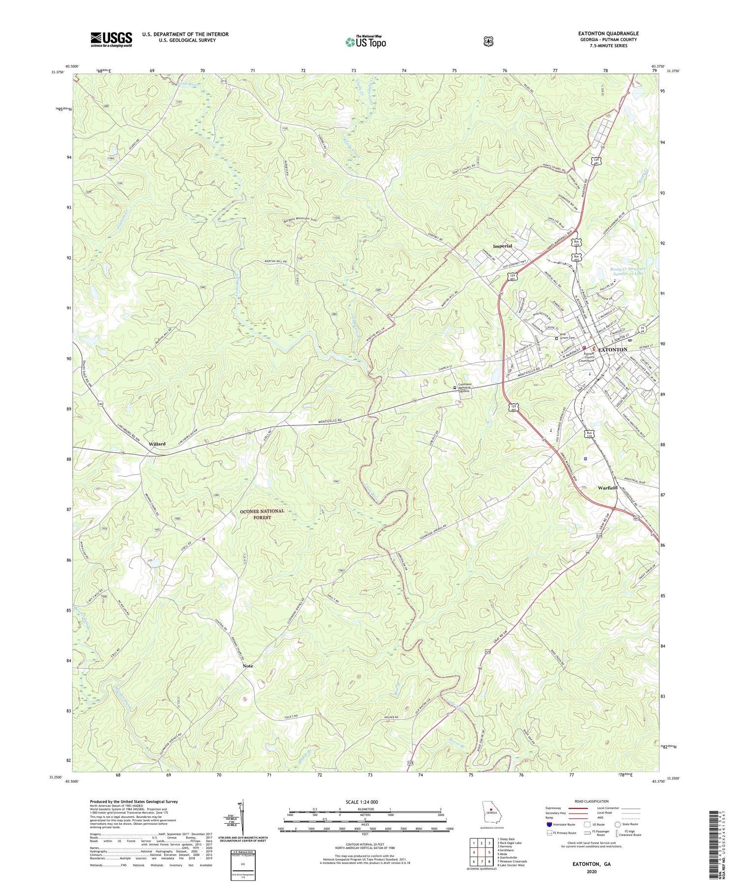
Eatonton Georgia US Topo Map
Couldn't load pickup availability
Also explore the Eatonton Forest Service Topo of this same quad for updated USFS data
2024 topographic map quadrangle Eatonton in the state of Georgia. Scale: 1:24000. Based on the newly updated USGS 7.5' US Topo map series, this map is in the following counties: Putnam. The map contains contour data, water features, and other items you are used to seeing on USGS maps, but also has updated roads and other features. This is the next generation of topographic maps. Printed on high-quality waterproof paper with UV fade-resistant inks.
Quads adjacent to this one:
West: Smithboro
Northwest: Shady Dale
North: Rock Eagle Lake
Northeast: Harmony
East: Meda
Southeast: Lake Sinclair West
South: Resseaus Crossroads
Southwest: Stanfordville
This map covers the same area as the classic USGS quad with code o33083c4.
Contains the following named places: Adiel Sherwood Monument, Beaverdam Creek, Berean Christian School, Big Indian Creek, Bledsoe-Green House Museum, Blue Branch, Brown Chapel, Calvary Church, Central Church, Central Georgia Technical College - Putnam County Center, Central School, City of Eatonton, Crestlawn Memorial Gardens, Eatonton, Eatonton Church, Eatonton City Hall, Eatonton Historic District, Eatonton Police Department, Eatonton Post Office, Eatonton-Putnam North Industrial Park, First Baptist Church, Gatewood Christian School, Glady Creek, Glenwoods Spring, Hunts, Hunts Chapel, Huron, Imperial, Imperial Church, Lazenberrys Mill, Lees Chapel, Linchburg, Little Glady Creek, Little River Hunt Camp, Marshall Church, Martins Hill Church, Martins Mill, Mission Church, Mission School, Mount Coilead Hunt Camp, Mount Gilead Church, Note, Oconee National Forest, Pearson Creek, Pine Grove Cemetery, Putnam County Correctional Institution, Putnam County Courthouse, Putnam County Elementary School, Putnam County Fire Rescue Department Station 1, Putnam County Jail, Putnam County Library, Putnam County Middle School, Putnam County Sheriff's Department, Putnam-Jasper Training Center, Reece Branch, Resseau Church, Rooty Creek Structure Number 21 Dam, Rooty Creek Structure Number 21 Lake, Saints Mission, South Putnam Industrial Park, Uncle Remus Golf Course, Uncle Remus Museum, Warfield, Wheelers Mill, Willard, Willard Hunt Camp, WKVQ-AM (Eatonton), Wright School, ZIP Code: 31024


