MyTopo
Lake Sinclair West Georgia US Topo Map
Couldn't load pickup availability
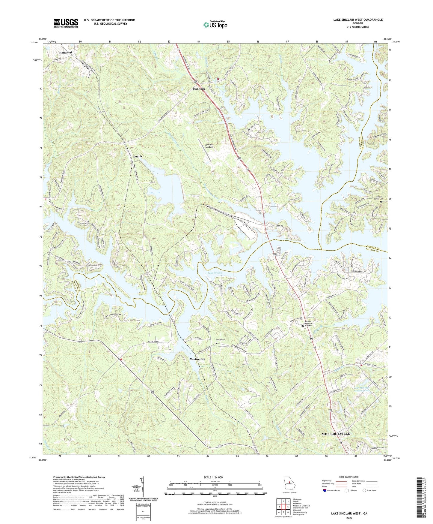
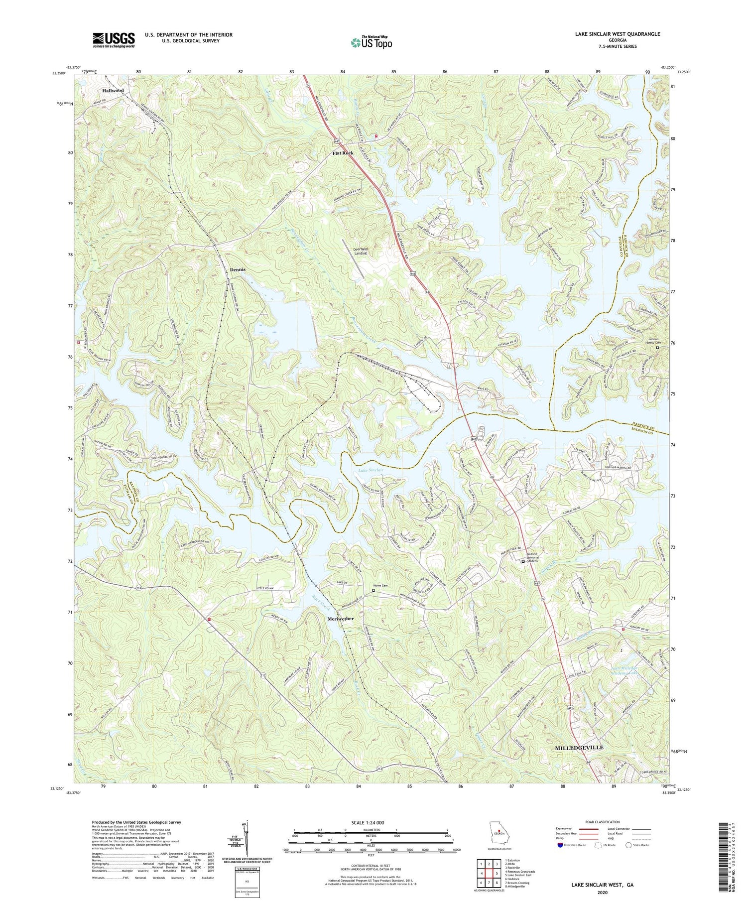
2024 topographic map quadrangle Lake Sinclair West in the state of Georgia. Scale: 1:24000. Based on the newly updated USGS 7.5' US Topo map series, this map is in the following counties: Putnam, Baldwin, Hancock. The map contains contour data, water features, and other items you are used to seeing on USGS maps, but also has updated roads and other features. This is the next generation of topographic maps. Printed on high-quality waterproof paper with UV fade-resistant inks.
Quads adjacent to this one:
West: Resseaus Crossroads
Northwest: Eatonton
North: Meda
Northeast: Rockville
East: Lake Sinclair East
Southeast: Milledgeville
South: Browns Crossing
Southwest: Haddock
This map covers the same area as the classic USGS quad with code o33083b3.
Contains the following named places: Baldwin County Fire and Rescue Department Station 6, Baldwin County Fire and Rescue Department Station 7, Baldwin Memorial Gardens, Beaverdam Creek, Bethel Church, Buck Creek, Cedar Creek, Cold Branch, Deerfield Landing, Dennis, Dennis Grove School, Fellowship Church, Flat Rock, Hallwood, Harllee Branch Power Plant, Howe Cemetery, Humbers Old Ferry, Jackson Family Cemetery, John Milledge Academy Christian School, John Milledge Academy Dam, John Milledge Academy Lake, Lakeside Church, Little Creek, Little River, Meriwether, Mount Ararat Church, Mount Ararat School, Nona, Potato Creek, Putnam County Fire Department Station 2, Putnam County Fire Rescue Department Station 4, Rock Mill Church, Rooty Creek, Rooty Creek Church, Saint Marys Church, Saint Pauls Church, Sinclair Church