
MyTopo
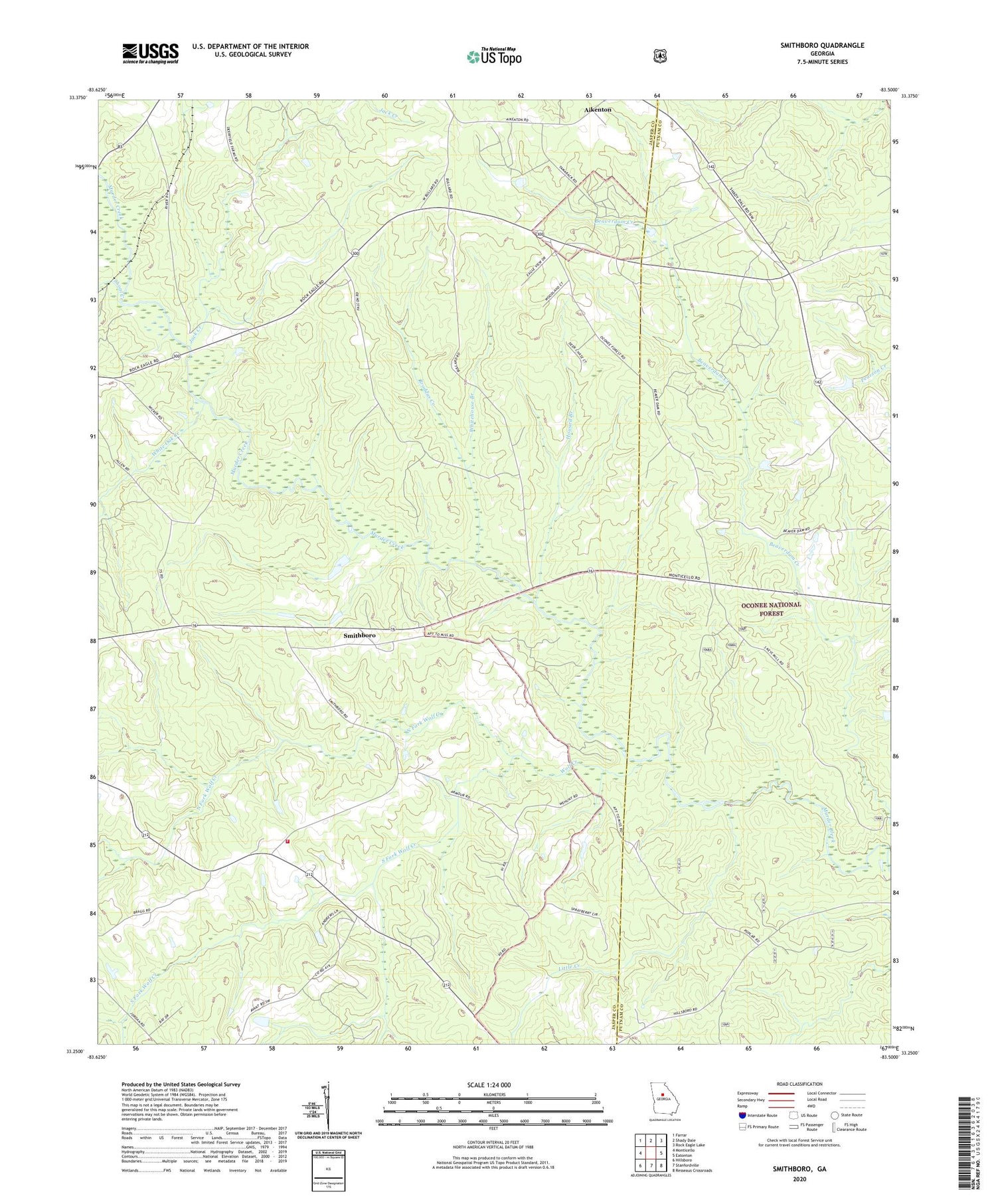
Smithboro Georgia US Topo Map
Couldn't load pickup availability
Also explore the Smithboro Forest Service Topo of this same quad for updated USFS data
2024 topographic map quadrangle Smithboro in the state of Georgia. Scale: 1:24000. Based on the newly updated USGS 7.5' US Topo map series, this map is in the following counties: Jasper, Putnam. The map contains contour data, water features, and other items you are used to seeing on USGS maps, but also has updated roads and other features. This is the next generation of topographic maps. Printed on high-quality waterproof paper with UV fade-resistant inks.
Quads adjacent to this one:
West: Monticello
Northwest: Farrar
North: Shady Dale
Northeast: Rock Eagle Lake
East: Eatonton
Southeast: Resseaus Crossroads
South: Stanfordville
Southwest: Hillsboro
This map covers the same area as the classic USGS quad with code o33083c5.
Contains the following named places: Aikenton, Apollo, Avalona Church, Broddus Creek, Corinth Church, Gammon Bridge, Henderson School, Howard Branch, Howard Store, Jack Creek, Jasper County Fire Department Station 5, Lazenberry Hunt Camp, Little Creek, Murder Creek Hunt Camp, Murder Creek Research Natural Area, New Hope Church, North Fork Wolf Creek, Paw Chapel School, Piedmont, Reids Chapel, Salem School, Shoal Creek, Smith School, Smithboro, Smithboro Baptist Church, South Fork Wolf Creek, White Oak Creek, Whitehouse Branch, Wolf Creek


