
MyTopo
Empire Georgia US Topo Map
Couldn't load pickup availability
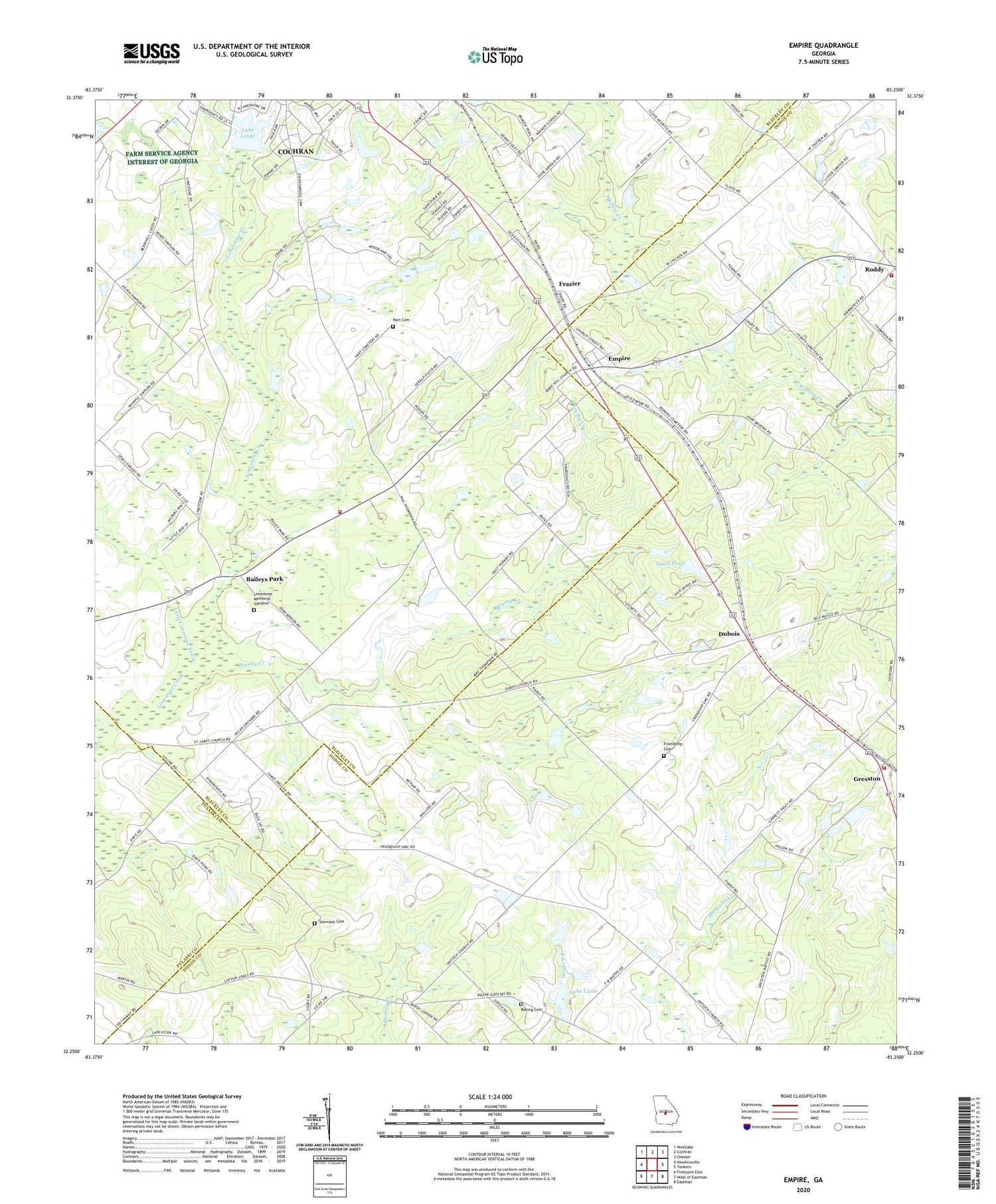
2024 topographic map quadrangle Empire in the state of Georgia. Scale: 1:24000. Based on the newly updated USGS 7.5' US Topo map series, this map is in the following counties: Bleckley, Dodge, Pulaski. The map contains contour data, water features, and other items you are used to seeing on USGS maps, but also has updated roads and other features. This is the next generation of topographic maps. Printed on high-quality waterproof paper with UV fade-resistant inks.
Quads adjacent to this one:
West: Hawkinsville
Northwest: Westlake
North: Cochran
Northeast: Chester
East: Yonkers
Southeast: Eastman
South: West of Eastman
Southwest: Finleyson East
This map covers the same area as the classic USGS quad with code o32083c3.
Contains the following named places: Antioch Number One Baptist Church, Baileys Park, Bledsoe Pond, Bledsoe Pond Dam, Brushy Creek, Carne, Cochran - Bleckley Fire Department Limestone Station, Dubois, Dubois Church, Empire, Empire Census Designated Place, Frazier, Friendship Cemetery, Friendship Church, Gresston, Gresston Baptist Church, Gresston Census Designated Place, Gresston Fire Department, Hart Cemetery, Lake Linda, Lake Linda Dam, Lake Lissie, Limestone Church, Limestone Memorial Gardens, Limestone School, Little Limestone Creek, Livingston Pond, Livingston Pond Dam, Lynwood Church, Mount Horeb Church, New Zion Church, Robing Cemetery, Roddy, Roddy Church, Roddy Volunteer Fire Department, Saint James Church, Simmons Cemetery, Yawn Pond, Yawn Pond Dam


