MyTopo
Finleyson East Georgia US Topo Map
Couldn't load pickup availability
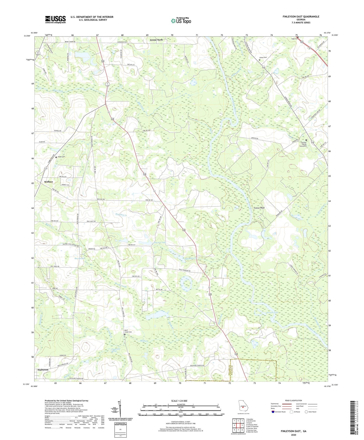
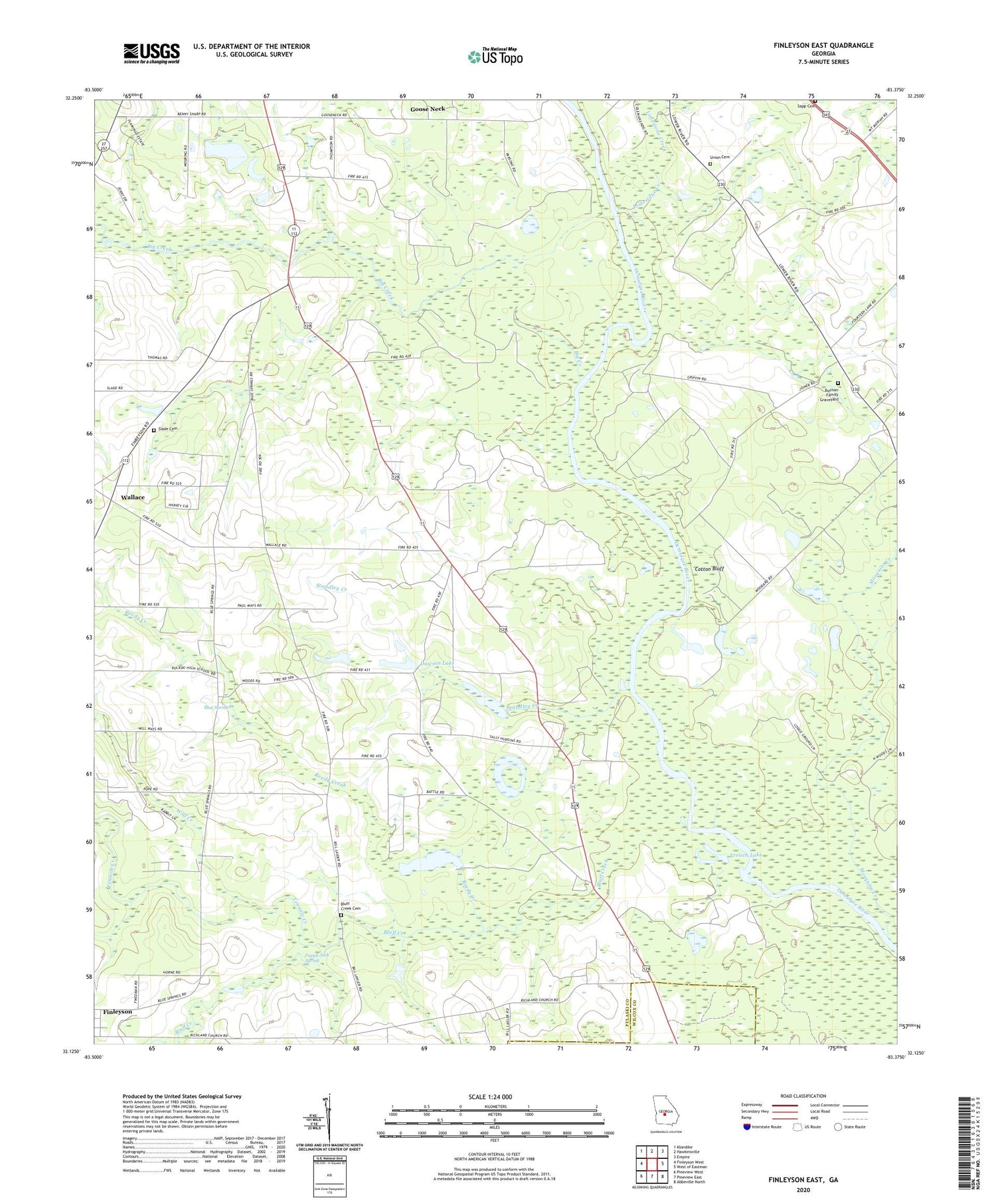
2024 topographic map quadrangle Finleyson East in the state of Georgia. Scale: 1:24000. Based on the newly updated USGS 7.5' US Topo map series, this map is in the following counties: Pulaski, Wilcox. The map contains contour data, water features, and other items you are used to seeing on USGS maps, but also has updated roads and other features. This is the next generation of topographic maps. Printed on high-quality waterproof paper with UV fade-resistant inks.
Quads adjacent to this one:
West: Finleyson West
Northwest: Klondike
North: Hawkinsville
Northeast: Empire
East: West of Eastman
Southeast: Abbeville North
South: Pineview East
Southwest: Pineview West
This map covers the same area as the classic USGS quad with code o32083b4.
Contains the following named places: Big Creek, Blue Springs, Blue Springs Church, Bluff Creek, Bluff Creek Cemetery, Buchan Family Graveyard, Cedar Creek, Cooks Chapel, Cotton Bluff, Dawson Lake, Dawson Lake Dam, Goose Neck, Hartford Division, Limestone Creek, Mosquito Creek, Pappy Jack Spring, Piney Grove Church, Pulaski County, Reedy Creek, Richland Church, Sandridge Church, Sapp Cemetery, Slade Cemetery, Standley Creek, Tenmile Creek, Treisch Lake, Union Cemetery, Wallace, Wolf Creek