MyTopo
Eastman Georgia US Topo Map
Couldn't load pickup availability
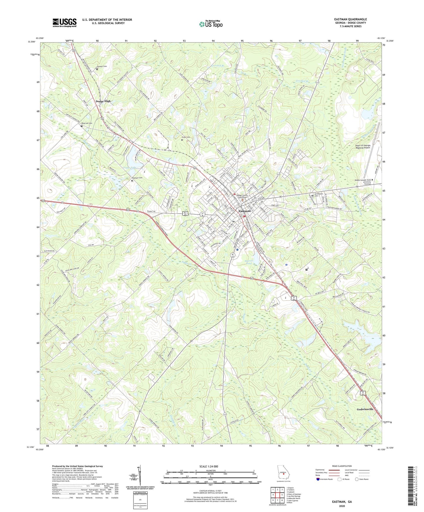
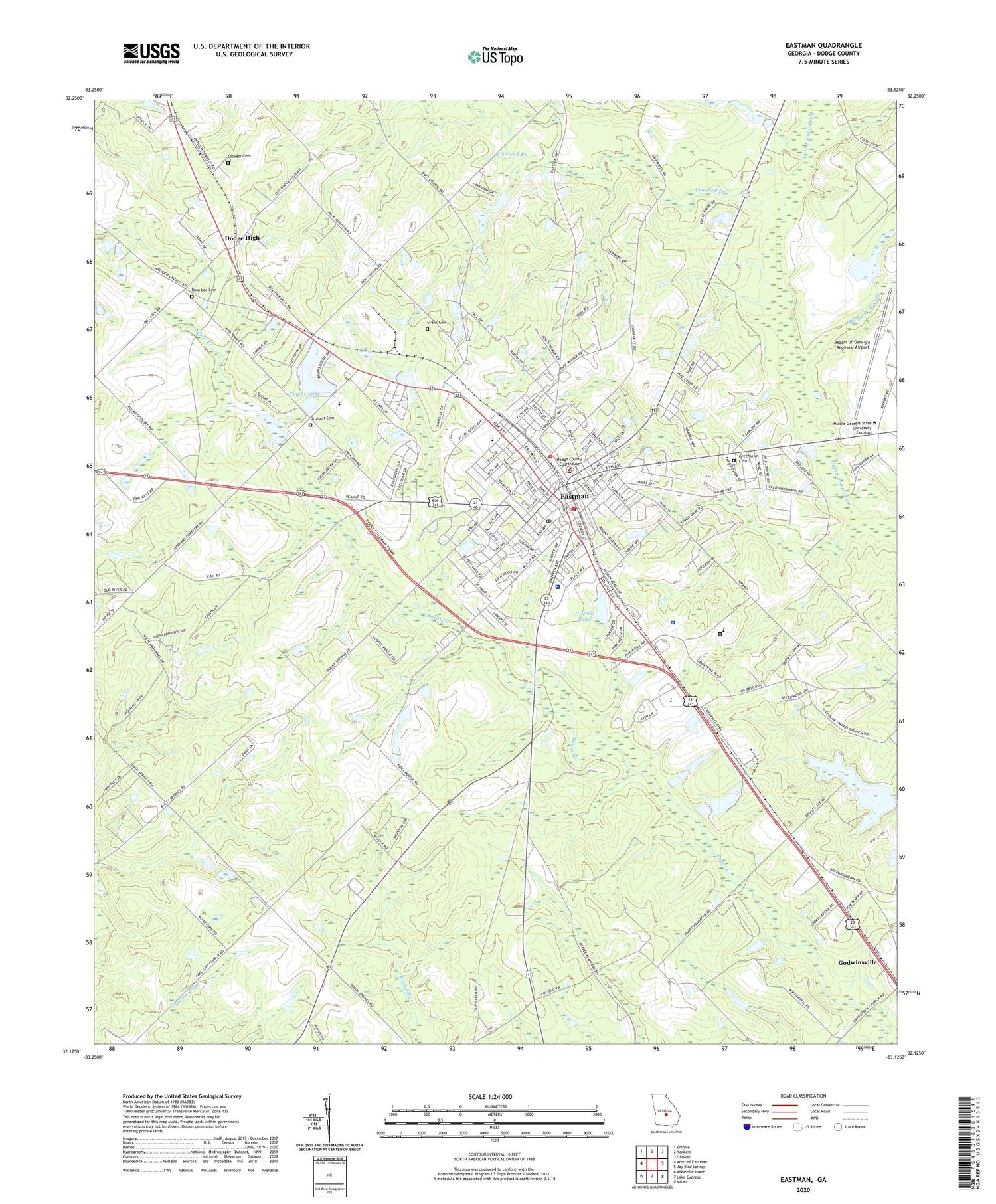
2024 topographic map quadrangle Eastman in the state of Georgia. Scale: 1:24000. Based on the newly updated USGS 7.5' US Topo map series, this map is in the following counties: Dodge. The map contains contour data, water features, and other items you are used to seeing on USGS maps, but also has updated roads and other features. This is the next generation of topographic maps. Printed on high-quality waterproof paper with UV fade-resistant inks.
Quads adjacent to this one:
West: West of Eastman
Northwest: Empire
North: Yonkers
Northeast: Cadwell
East: Jay Bird Springs
Southeast: Milan
South: Lake Cypress
Southwest: Abbeville North
This map covers the same area as the classic USGS quad with code o32083b2.
Contains the following named places: Amoskeag, City of Eastman, Crooked Branch, Dempsey, Dempsey Church, Dodge County, Dodge County High School, Dodge County Hospital, Dodge County Jail, Dodge County Sheriff's Office, Dodge Elementary School, Dodge High, Dodge Plaza Shopping Center, Eastman, Eastman Division, Eastman Elementary School, Eastman Fire Department Coleman Station 1, Eastman Fire Department Station 2, Eastman Methodist Church, Eastman Middle School, Eastman Police Department, Eastman Post Office, Eastman Regional Youth Detention Center, Eastman Youth Development Campus - Correctional Facility, Evans Cemetery, First Baptist Church of Eastman, Godwinsville, Greenlawn Cemetery, Harrell Pond, Harrell Pond Dam, Heart of Georgia Regional Airport, Jamieson Pond, Jamieson Pond Dam, Lockett Cemetery, Love All Church, Lowery, Orphans Cemetery, Parkerson Gift Church, Piney Grove Church, Pleasant Hill Church, Rosa Lee Cemetery, Saint Marks Church, Sheffield Branch, Tripps Lake, Tripps Lake Dam, WUFF-AM (Eastman), WUFF-FM (Eastman), Zebulon Church, ZIP Code: 31023