MyTopo
Fickling Mill Georgia US Topo Map
Couldn't load pickup availability
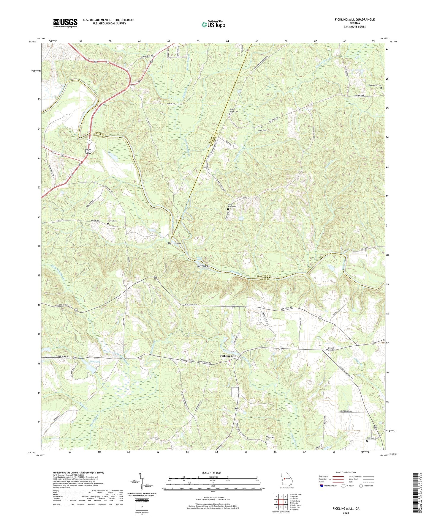
2024 topographic map quadrangle Fickling Mill in the state of Georgia. Scale: 1:24000. Based on the newly updated USGS 7.5' US Topo map series, this map is in the following counties: Taylor, Crawford, Upson. The map contains contour data, water features, and other items you are used to seeing on USGS maps, but also has updated roads and other features. This is the next generation of topographic maps. Printed on high-quality waterproof paper with UV fade-resistant inks.
Quads adjacent to this one:
West: Prattsburg
Northwest: Lincoln Park
North: Logtown
Northeast: Culloden
East: Roberta
Southeast: Reynolds
South: Butler East
Southwest: Butler West
This map covers the same area as the classic USGS quad with code o32084f2.
Contains the following named places: Auchumpkee Creek, Bailey Branch, Carsonville Division, Crowell Church Cemetery, Crowells Church, Damascus Church, Damascus School, Elam Cemetery, Fickling Mill, Grays Ferry, Harris Cemetery, Harris Island, Hollis Road Cemetery, Islands Ford, Lake Mary, Lake Mary Dam, Little Patsiliga Creek, Lockhart Cemetery, Macedonia Cemetery, Midway Cemetery, Midway Church, Mount Gilliard Church, Olive Grove Cemetery, Olive Grove Church, Raines Branch, Reeves Island, Reeves Shoals, Sulenojuhnene Ford, Taylor County Fire and Rescue Department Panhandle Station, Taylor County Holiness Camp Ground, Taylor Creek, Timms Creek, Trices Ferry, Ulcohatchee Creek, Wainwright Cemetery