MyTopo
Reynolds Georgia US Topo Map
Couldn't load pickup availability
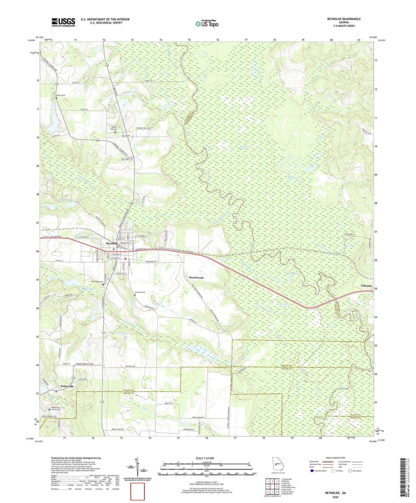
2024 topographic map quadrangle Reynolds in the state of Georgia. Scale: 1:24000. Based on the newly updated USGS 7.5' US Topo map series, this map is in the following counties: Taylor, Crawford, Macon, Peach. The map contains contour data, water features, and other items you are used to seeing on USGS maps, but also has updated roads and other features. This is the next generation of topographic maps. Printed on high-quality waterproof paper with UV fade-resistant inks.
Quads adjacent to this one:
West: Butler East
Northwest: Fickling Mill
North: Roberta
Northeast: Knoxville
East: Fort Valley West
Southeast: Marshallville
South: Garden Valley
Southwest: Ideal North
This map covers the same area as the classic USGS quad with code o32084e1.
Contains the following named places: Beaver Creek, Beechwood, Beechwood Swamp, Black Bottom Creek, Brunson Lake, Brunson Lake Dam, City of Reynolds, Dead River, Fraser Branch, Glover Cemetery, Gordon Grove Church, Griffin Branch, Little Vine Creek, Magnolia Swamp, Mount Olive Church, Mount Olive Church Cemetery, Nakomis, New Free Run Church, New Hope Cemetery, New Hope Church, Newsom Cemetery, Patsiliga Creek, Potterville, Reynolds, Reynolds Division, Reynolds Police Department, Reynolds Post Office, Ricks Lake, Ricks Lake Dam, Taylor County Fire and Rescue Department Potterville Station, Taylor County Fire and Rescue Department Reynolds Station, Taylor Mill Church Cemetery, Taylor Mill Missionary Church, Wainwright Lake, Wainwright Lake Dam, Whatley Lake, Whatley Lake Dam, White Hill Cemetery, White Hill Church, ZIP Code: 31076