MyTopo
Prattsburg Georgia US Topo Map
Couldn't load pickup availability
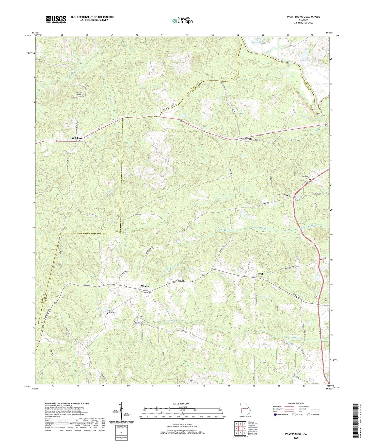
2024 topographic map quadrangle Prattsburg in the state of Georgia. Scale: 1:24000. Based on the newly updated USGS 7.5' US Topo map series, this map is in the following counties: Taylor, Talbot, Upson. The map contains contour data, water features, and other items you are used to seeing on USGS maps, but also has updated roads and other features. This is the next generation of topographic maps. Printed on high-quality waterproof paper with UV fade-resistant inks.
Quads adjacent to this one:
West: Baldwinville
Northwest: Roland
North: Lincoln Park
Northeast: Logtown
East: Fickling Mill
Southeast: Butler East
South: Butler West
Southwest: Junction City
This map covers the same area as the classic USGS quad with code o32084f3.
Contains the following named places: Antioch Baptist Church, Antioch Cemetery, Antioch Church, Barfield Creek, Bethel Church, Carsonville, Corinth Methodist Church, Crossroad Church, Duck Creek, Five Points, Green Lake, Green Lake Dam, Hobar Church, Jarrell, Prattsburg, Prattsburg Airport, Scott-Bussy Cemetery, Shiloh Church, Swift Creek, Taylor County Fire Rescue Department Central Station, Union Church, Wesley, Wesley Church, Wesley Church Cemetery, Zion Hill Church