
MyTopo
Abbeville North Georgia US Topo Map
Couldn't load pickup availability
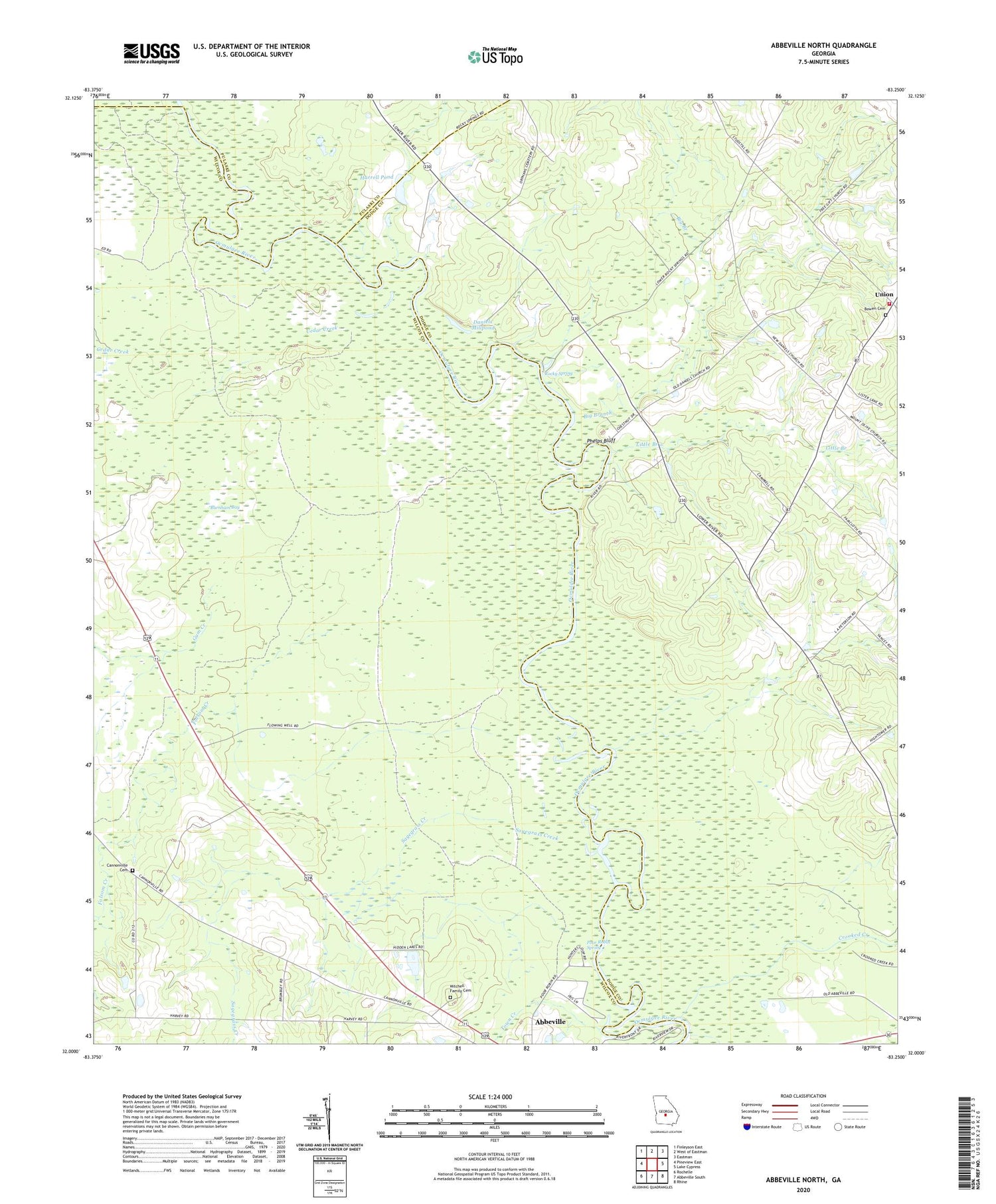
2024 topographic map quadrangle Abbeville North in the state of Georgia. Scale: 1:24000. Based on the newly updated USGS 7.5' US Topo map series, this map is in the following counties: Wilcox, Dodge, Pulaski. The map contains contour data, water features, and other items you are used to seeing on USGS maps, but also has updated roads and other features. This is the next generation of topographic maps. Printed on high-quality waterproof paper with UV fade-resistant inks.
Quads adjacent to this one:
West: Pineview East
Northwest: Finleyson East
North: West of Eastman
Northeast: Eastman
East: Lake Cypress
Southeast: Rhine
South: Abbeville South
Southwest: Rochelle
This map covers the same area as the classic USGS quad with code o32083a3.
Contains the following named places: Big Branch, Bowen Cemetery, Burnham Bay, Cannonville Cemetery, Cannonville Church, Cedar Creek, County Line Church, Crooked Creek, Daniels Millpond, Englewood Church, Folsom Creek, Free Gift Church, Gum Creek, Harrell Pond, Harrell Pond Dam, Little Branch, Manley Estate Dam, Manley Estate Lake, Mitchell Family Cemetery, Mitchell Volunteer Fire Department, New Daniels Church, Old Daniels Church, Phelps Bluff, Poor Robin Spring, Rocky Spring, Sagegrass Creek, Springfield Church, Town Creek, Union, Wilcox County Public Boat Ramp


