MyTopo
Glennville SE Georgia US Topo Map
Couldn't load pickup availability
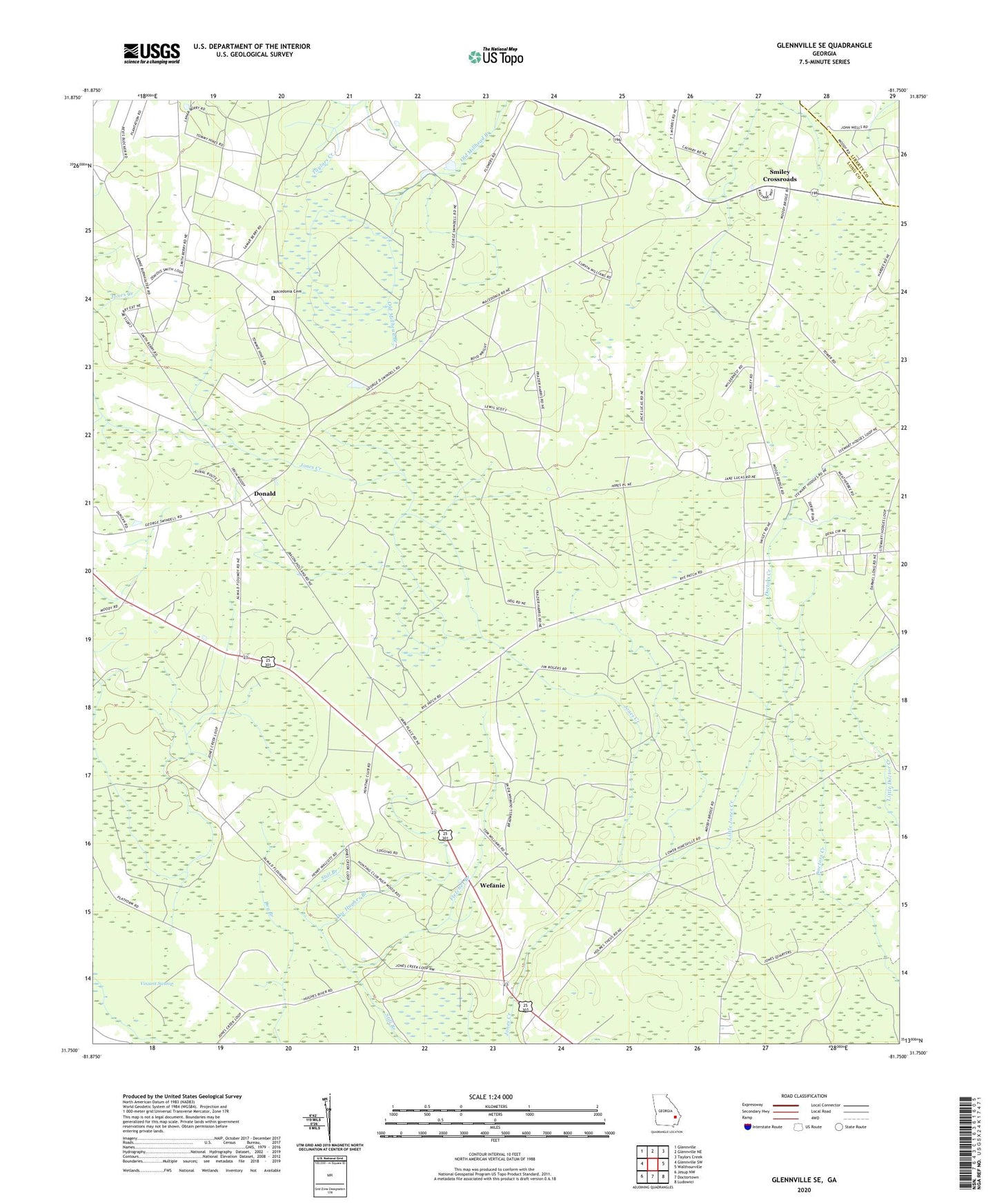
2024 topographic map quadrangle Glennville SE in the state of Georgia. Scale: 1:24000. Based on the newly updated USGS 7.5' US Topo map series, this map is in the following counties: Long, Liberty. The map contains contour data, water features, and other items you are used to seeing on USGS maps, but also has updated roads and other features. This is the next generation of topographic maps. Printed on high-quality waterproof paper with UV fade-resistant inks.
Quads adjacent to this one:
West: Glennville SW
Northwest: Glennville
North: Glennville NE
Northeast: Taylors Creek
East: Walthourville
Southeast: Ludowici
South: Doctortown
Southwest: Jesup NW
This map covers the same area as the classic USGS quad with code o31081g7.
Contains the following named places: Beulah School, Cross Road School, Doc Hughes Branch, Donald, Donald School, Fletcher Branch, Fletcher Branch Lookout Tower, Jones Creek Church, Jones Creek School, Little Jones Creek, Ludowici North Division, Macedonia Cemetery, Macedonia Church, Macedonia School, Ochs Grove School, Persimmon Grove School, Poplar Head Church, Roderick, Rye Patch Church, Rye Patch School, Saint Thomas Church, Smiley Crossroads, Vinzant Swamp, Wefanie