MyTopo
Glennville SW Georgia US Topo Map
Couldn't load pickup availability
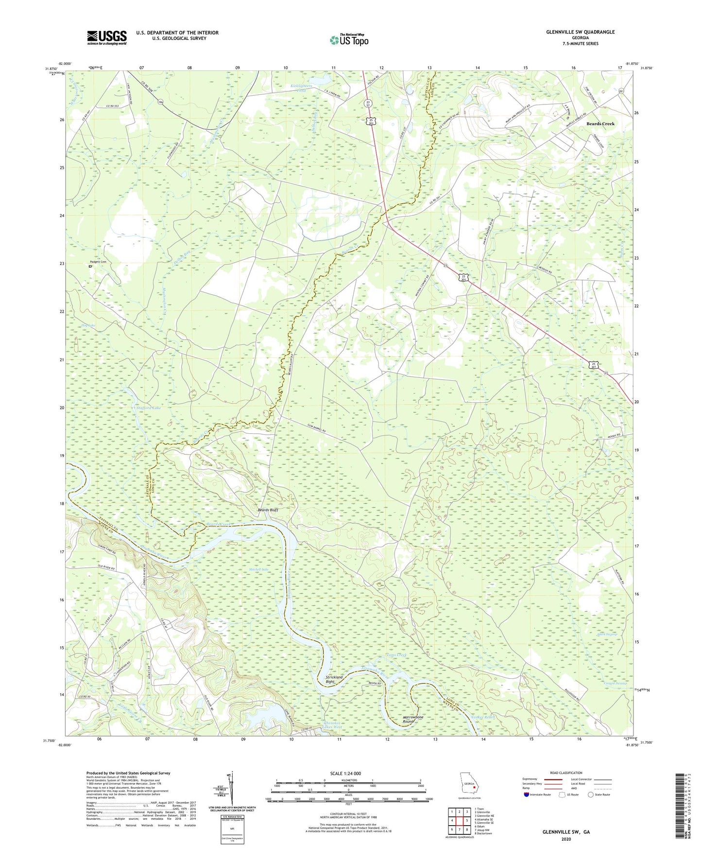
2024 topographic map quadrangle Glennville SW in the state of Georgia. Scale: 1:24000. Based on the newly updated USGS 7.5' US Topo map series, this map is in the following counties: Long, Tattnall, Wayne. The map contains contour data, water features, and other items you are used to seeing on USGS maps, but also has updated roads and other features. This is the next generation of topographic maps. Printed on high-quality waterproof paper with UV fade-resistant inks.
Quads adjacent to this one:
West: Altamaha SE
Northwest: Tison
North: Glennville
Northeast: Glennville NE
East: Glennville SE
Southeast: Doctortown
South: Jesup NW
Southwest: Odum
This map covers the same area as the classic USGS quad with code o31081g8.
Contains the following named places: Beards Bluff, Beards Bluff Ferry, Beards Creek, Beaverdam School, Black Swamp, Central School, Cherokee Lakes, Cherokee Lakes Dam West, Delbos Bay, Ebenezer Church, Grace Church, Hog Lake, Howard Chapel School, Kicklighters Pond, Kicklighters Pond Dam, Lumber Bridge, Marrowbone Round, Mitchell Lake, Mushmelon Creek, New Hope Church, New Hope School, Noble, Padgett Cemetery, Pigott Branch Church, Stafford Lake, Stooping Gum Island, Strickland Bight, Tar Landing, Toms Creek, Yankee Reach