MyTopo
Ludowici Georgia US Topo Map
Couldn't load pickup availability
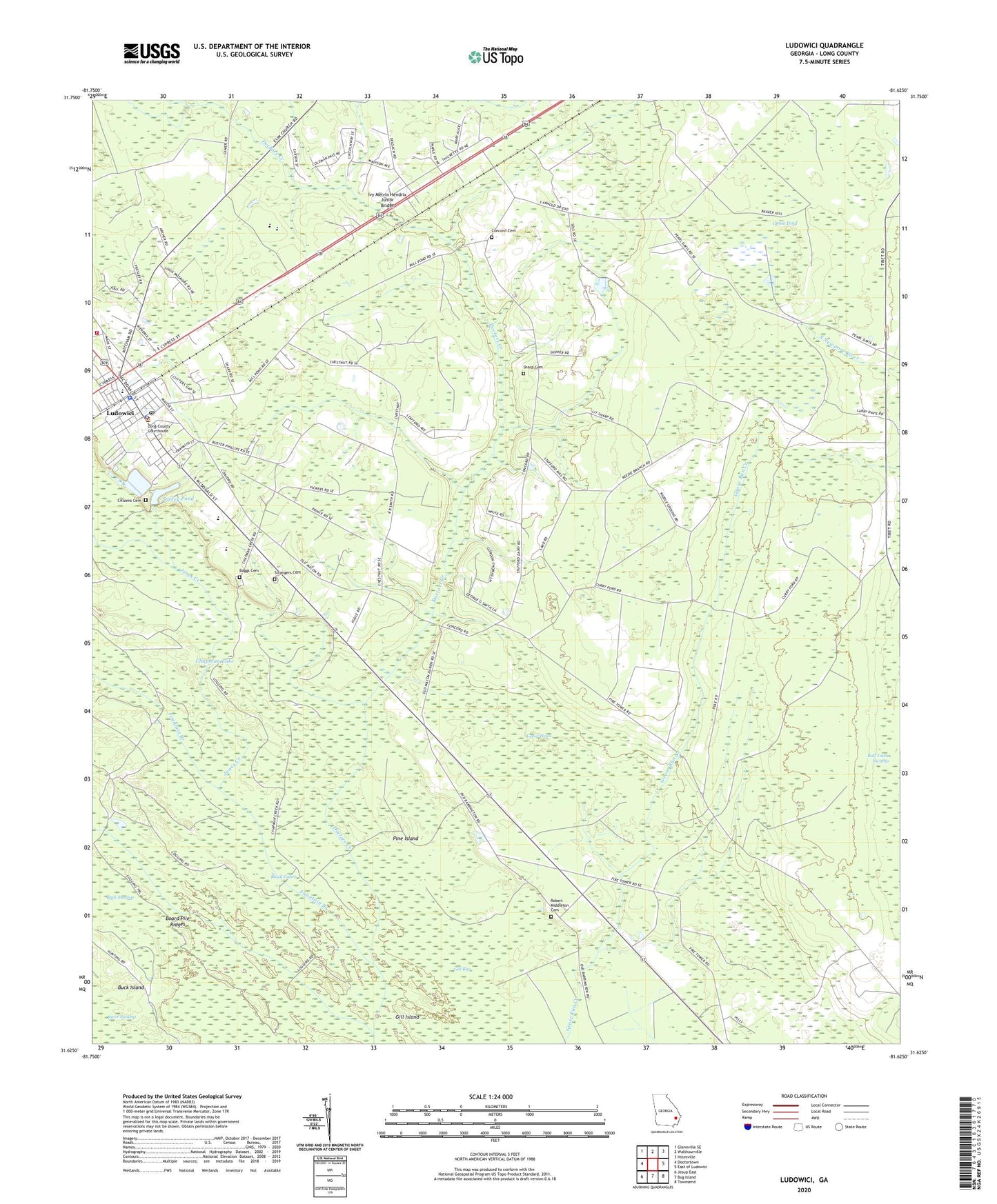
2024 topographic map quadrangle Ludowici in the state of Georgia. Scale: 1:24000. Based on the newly updated USGS 7.5' US Topo map series, this map is in the following counties: Long. The map contains contour data, water features, and other items you are used to seeing on USGS maps, but also has updated roads and other features. This is the next generation of topographic maps. Printed on high-quality waterproof paper with UV fade-resistant inks.
Quads adjacent to this one:
West: Doctortown
Northwest: Glennville SE
North: Walthourville
Northeast: Hinesville
East: East of Ludowici
Southeast: Townsend
South: Bug Island
Southwest: Jesup East
This map covers the same area as the classic USGS quad with code o31081f6.
Contains the following named places: Baggs Cemetery, Black Calico, Board Pile Ridges, Brewer, Buck Island, Chapman Lake, Church of God, Citizens Cemetery, City of Ludowici, Concord Cemetery, Faith Baptist Christian Academy, Faith Baptist Church, Fountain Branch, Gator Head, Gill Bay, Gill Island, Goose Pond, Ivy Melvin Hendrix Junior Bridge, Jones Creek, Little Doctor Creek, Long County Courthouse, Long County Emergency Medical Service, Long County High School, Long County Sheriff's Office, Ludowici, Ludowici - Long County Volunteer Fire Department, Ludowici - Long County Volunteer Fire Department Station 1, Ludowici Police Department, Ludowici Post Office, Ludowici South Division, Ludowici Water Pollution Control Plant, Mount Sinai Church, Pine Island, Pleasant Hill Church, Robert Middleton Cemetery, Sharp Cemetery, Smiley Elementary School, Smiley Pond, Smiley Pond Dam, Strangers Cemetery, Three Rivers Regional Library System Long County Public Library, Walker Middle School, ZIP Code: 31316