MyTopo
Grantville Georgia US Topo Map
Couldn't load pickup availability
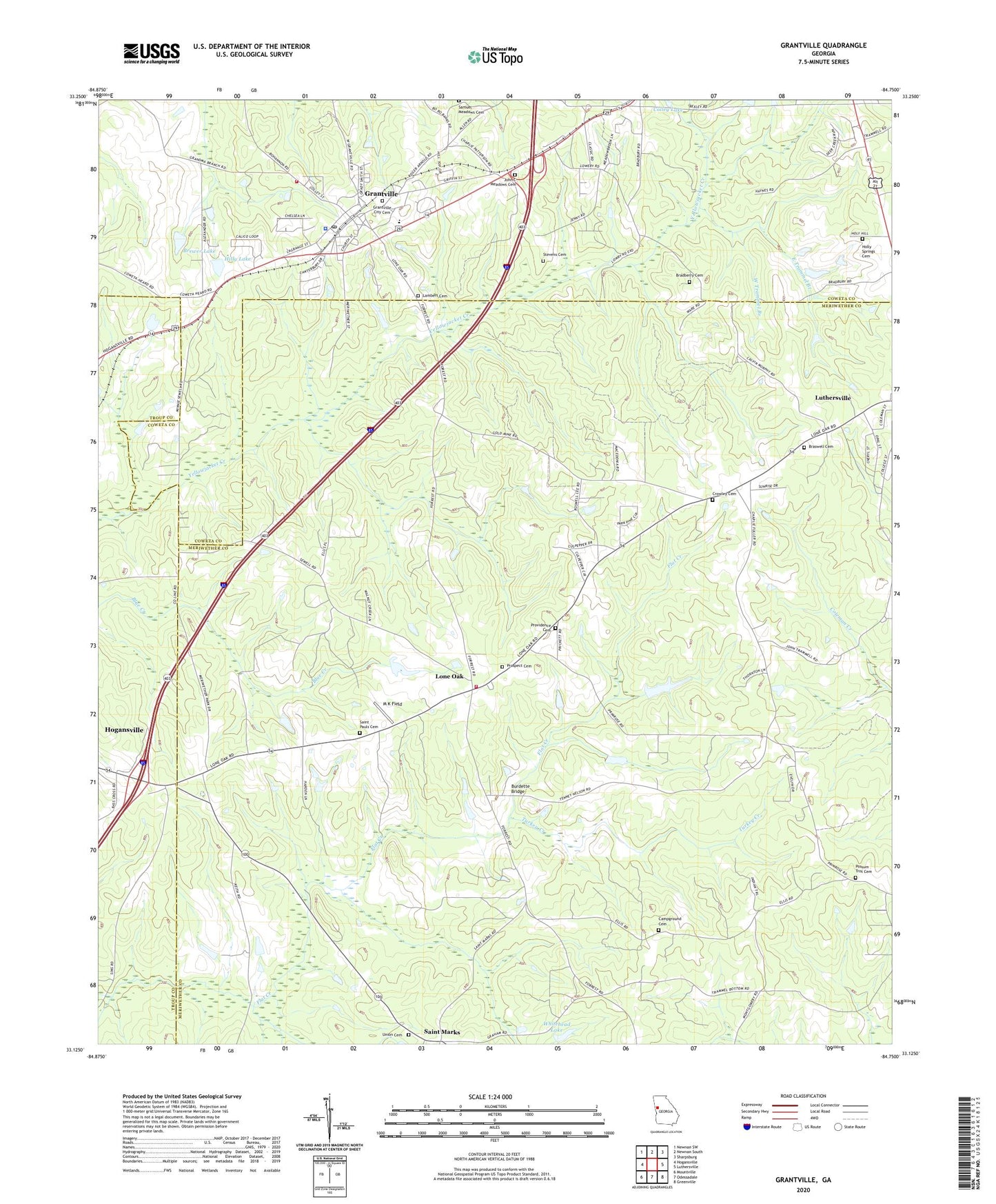
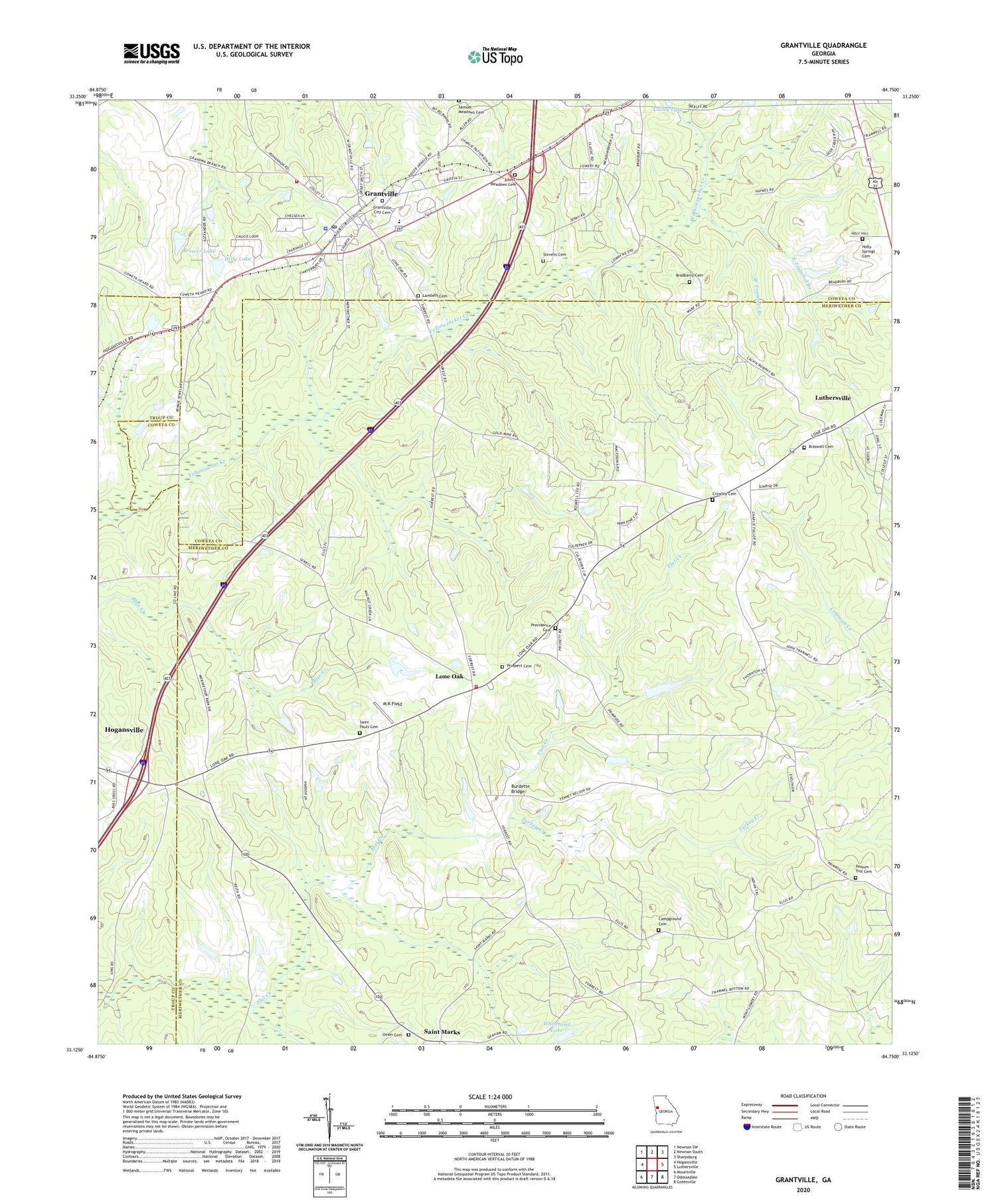
2024 topographic map quadrangle Grantville in the state of Georgia. Scale: 1:24000. Based on the newly updated USGS 7.5' US Topo map series, this map is in the following counties: Meriwether, Coweta, Troup. The map contains contour data, water features, and other items you are used to seeing on USGS maps, but also has updated roads and other features. This is the next generation of topographic maps. Printed on high-quality waterproof paper with UV fade-resistant inks.
Quads adjacent to this one:
West: Hogansville
Northwest: Newnan SW
North: Newnan South
Northeast: Sharpsburg
East: Luthersville
Southeast: Greenville
South: Odessadale
Southwest: Mountville
This map covers the same area as the classic USGS quad with code o33084b7.
Contains the following named places: Allen-Lee Memorial Church, Bradberry Cemetery, Braswell Cemetery, Brewer Lake, Brewer Lake Dam, Burdette Bridge, Campground Cemetery, City of Grantville, Colley Lake, Coweta County Fire Department Station 11, Crowley Cemetery, East Trammel Branch, Emmaus Progressive Baptist Church, Glanton Elementary School, Grantville, Grantville Brown School, Grantville City Cemetery, Grantville High School, Grantville Historic District, Grantville Police Department, Grantville Post Office, Hilly Lake, Hilly Lake Dam, Holly Springs Baptist Church, Holly Springs Cemetery, John C Meadows Cemetery, Lambert Cemetery, Lone Oak, Lone Oak Fire Department, Luthersville Division, M K Field, Macedonia Church, Possum Trot Cemetery, Prospect Cemetery, Providence Cemetery, Providence Primitive Baptist Church, Saint Marks, Saint Pauls Cemetery, Saint Pauls Church, Samuel Meadows Cemetery, Stevens Cemetery, Town of Lone Oak, Turkey Creek, Union Cemetery, Union Church, West Trammel Branch, Whitehead Lake, Whitehead Lake Dam, Zion Hill Church, ZIP Code: 30220