MyTopo
Hillcrest Georgia US Topo Map
Couldn't load pickup availability
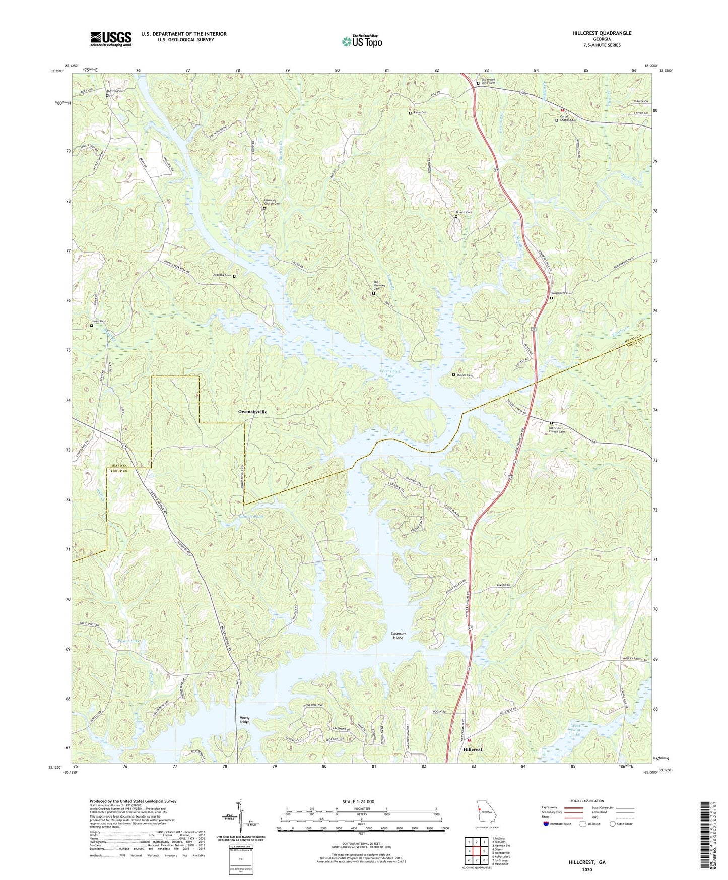
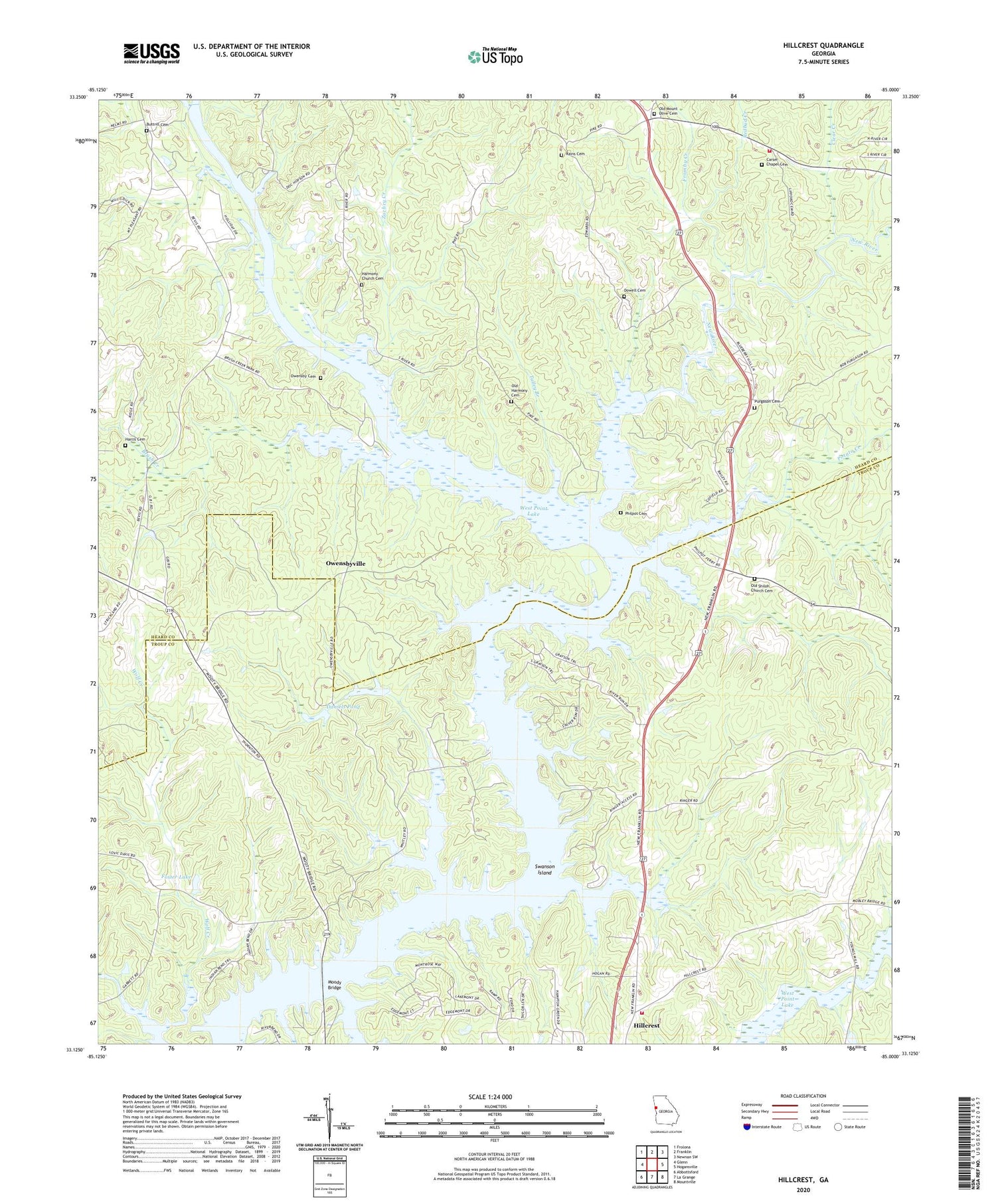
2024 topographic map quadrangle Hillcrest in the state of Georgia. Scale: 1:24000. Based on the newly updated USGS 7.5' US Topo map series, this map is in the following counties: Heard, Troup. The map contains contour data, water features, and other items you are used to seeing on USGS maps, but also has updated roads and other features. This is the next generation of topographic maps. Printed on high-quality waterproof paper with UV fade-resistant inks.
Quads adjacent to this one:
West: Glenn
Northwest: Frolona
North: Franklin
Northeast: Newnan SW
East: Hogansville
Southeast: Mountville
South: La Grange
Southwest: Abbottsford
This map covers the same area as the classic USGS quad with code o33085b1.
Contains the following named places: Brown Crossroad, Brush Creek, Brush Creek Recreation Area, Buena Vista, Buttrill Cemetery, Capstan, Carser Chapel, Carser Chapel Cemetery, Carter Creek Recreational Area, Chattahoochee Park, Clear Creek, Cooksville Fire Department Station 8, Crossroad Recreation Area, Daniels Pond, Dowell Cemetery, Five Points, Foster Dam, Foster Lake, Fromby Creek, Georgia Recreation Area, Graysons Landing, Harbor Hospital, Harmony Church Cemetery, Harmony School, Harris Cemetery, Hillabahatchee Creek, Hillcrest, Hillcrest Baptist Church, Hillcrest Division, Hillcrest Methodist Church, Indian Bend, Moody Bridge, Mooty Ferry, Mount Olive Church, New Harmony Church, New River, New River Recreation Area, North Lakeside, Old Harmony Cemetery, Old Mount Olive Cemetery, Old Philpot Ferry, Old Shiloh Church Cemetery, Owensby Cemetery, Owensbyville, Philpot Cemetery, Point North, Potato Creek, Purgason Cemetery, Rains Cemetery, Redbud Creek, Ringer Recreation Area, Rocky Mount Church, Shiloh Church, Snake Creek Recreation Area, Swanson Island, Talley Branch, Troup County Fire Department Station 2, Western Baptist Church, Zachry Creek