MyTopo
Abbottsford Georgia US Topo Map
Couldn't load pickup availability
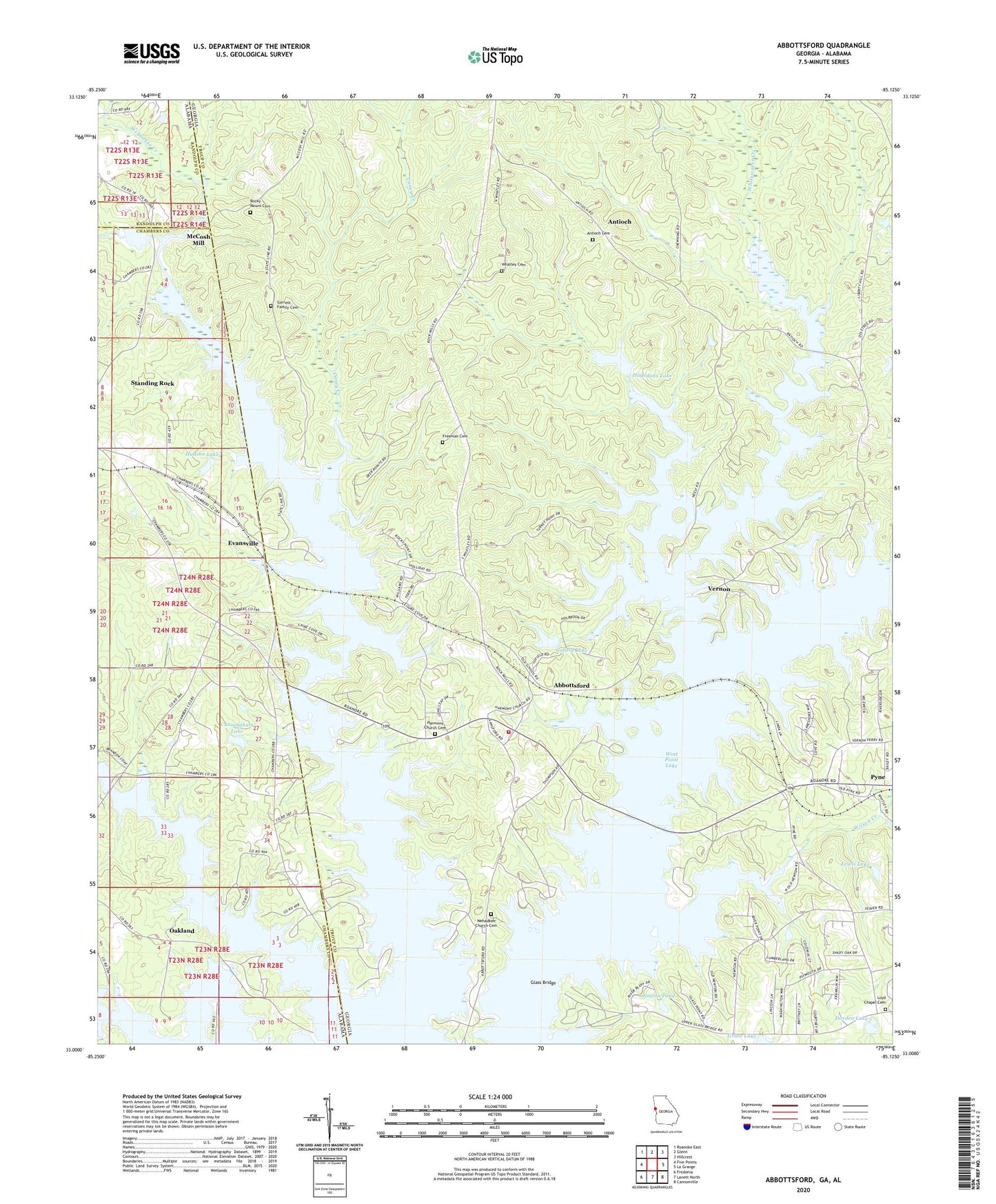
2024 topographic map quadrangle Abbottsford in the states of Georgia, Alabama. Scale: 1:24000. Based on the newly updated USGS 7.5' US Topo map series, this map is in the following counties: Troup, Chambers, Randolph. The map contains contour data, water features, and other items you are used to seeing on USGS maps, but also has updated roads and other features. This is the next generation of topographic maps. Printed on high-quality waterproof paper with UV fade-resistant inks.
Quads adjacent to this one:
West: Five Points
Northwest: Roanoke East
North: Glenn
Northeast: Hillcrest
East: La Grange
Southeast: Cannonville
South: Lanett North
Southwest: Fredonia
This map covers the same area as the classic USGS quad with code o33085a2.
Contains the following named places: Abbottsford, Abbottsford Division, Antioch, Antioch Cemetery, Autry Day Use Park, Bethlehem Church, Birdsong Bridge, Birdsongs Store, Briarcreek Estates, Caney Creek, Caney Creek Recreational Area, Chattahoochee Boy Scout Reservation, Cofield Dam, Cofield Lake, Colony Heights, Covered Bridge, Crowder, Cunningham Dam, Cunningham Lake, Cuss Creek, Darden Dam, Darden Lake, Dewberry Recreation Area, Evansville, Evansville Recreation Area, Fellowship Lake, Freeman Cemetery, Garrett Family Cemetery, Glass Bridge, Glass Bridge Recreation Area, Hagedon Lake Dam, Hagedons Lake, Harmony Church, Harmony Church Cemetery, Hawthorn Ferry, Heatherbrook, Heritage Hills, Holiday Park, Hudson Dam, Hudson Lake, Huntington, Lakeshore Estates, Lanier Lake, Lewis Lake, Lewis Lake Dam, Liberty Hill Recreation Area, Loyd Chapel Cemetery, Loyd Church, McCosh Mill, McGee Bridge, Midway Church, North Lake, Oakland, Pleasant Grove Church, Pleasant Grove School, Pyne, Pyne Park, River Trace, Rivercrest, Riverridge, Riverside, Riverview, Rocky Mount Cemetery, Rosamond, Shady Oaks, Smiths Pond, Standing Rock Census Designated Place, State Line Church, State Line Park, Stroud Creek, Timber Ridge, Troup County Fire Department Station 10, Turkey Point, Veasey Creek, Vernon, Vernon Ferry Estates, Wehadkee Church, Wehadkee Church Cemetery, Wehadkee Creek Recreation Area, West Lake Village, Whatley Cemetery, Whitewater Creek, Whitewater Estates, Whitewater Recreation Area, Whitewater Woods, Wilson Creek