MyTopo
Jacksons Crossroads Georgia US Topo Map
Couldn't load pickup availability
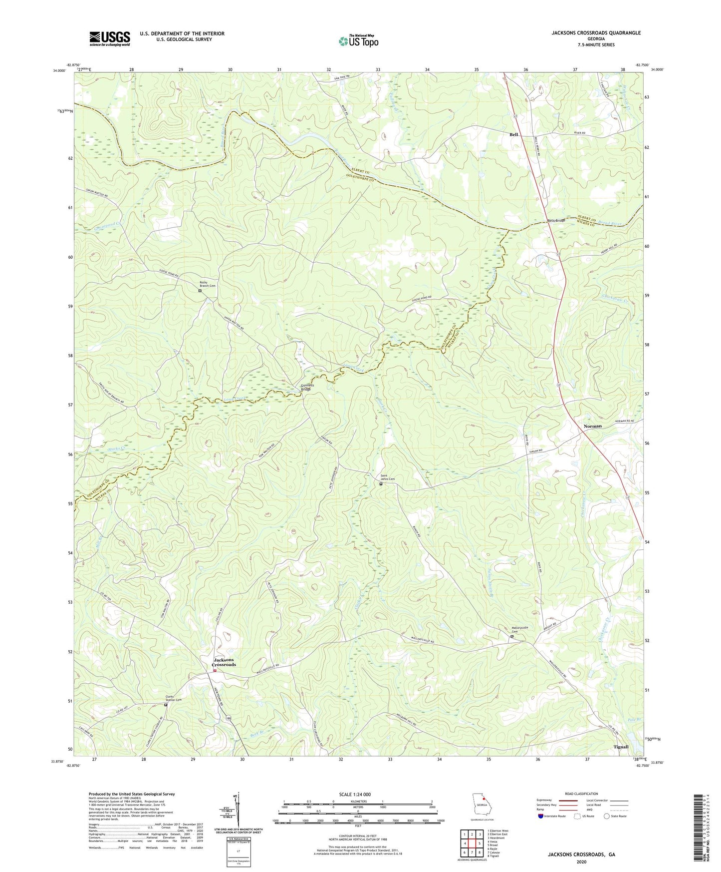
2024 topographic map quadrangle Jacksons Crossroads in the state of Georgia. Scale: 1:24000. Based on the newly updated USGS 7.5' US Topo map series, this map is in the following counties: Wilkes, Oglethorpe, Elbert. The map contains contour data, water features, and other items you are used to seeing on USGS maps, but also has updated roads and other features. This is the next generation of topographic maps. Printed on high-quality waterproof paper with UV fade-resistant inks.
Quads adjacent to this one:
West: Vesta
Northwest: Elberton West
North: Elberton East
Northeast: Heardmont
East: Broad
Southeast: Tignall
South: Celeste
Southwest: Rayle
This map covers the same area as the classic USGS quad with code o33082h7.
Contains the following named places: Beck Branch, Bell, Bells Bridge, Bullards Ferry, Bunchs Mill, Chatfield, Clark Creek, Clark Station Church, Clarks Station Cemetery, Clifford Grove Church, Falling Creek, Goose Pond, Goosepond Creek, Gunnells Bridge, Hills Chapel, Hoggs High School, Jackson Cross Roads Fire Department, Jacksons Crossroads, Kennedys Gate, Long Creek, Macks Creek, Mallorysville, Mallorysville Cemetery, Mallorysville Church, Mill Branch, New Ferry, Norman, Pole Branch, Rocky Branch Cemetery, Saint Johns Cemetery, Susan Smith Branch