MyTopo
Jesup East Georgia US Topo Map
Couldn't load pickup availability
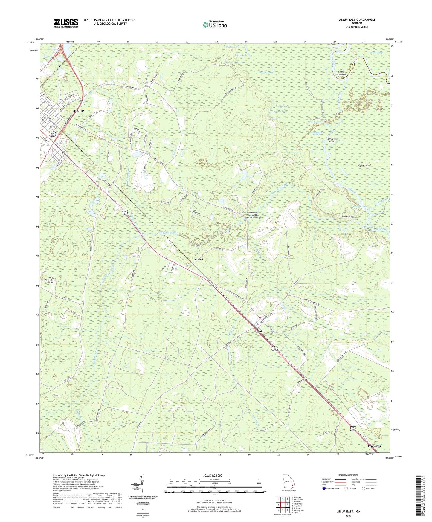
2024 topographic map quadrangle Jesup East in the state of Georgia. Scale: 1:24000. Based on the newly updated USGS 7.5' US Topo map series, this map is in the following counties: Wayne, Long. The map contains contour data, water features, and other items you are used to seeing on USGS maps, but also has updated roads and other features. This is the next generation of topographic maps. Printed on high-quality waterproof paper with UV fade-resistant inks.
Quads adjacent to this one:
West: Jesup West
Northwest: Jesup NW
North: Doctortown
Northeast: Ludowici
East: Bug Island
Southeast: Everett
South: Manningtown
Southwest: McKinnon
This map covers the same area as the classic USGS quad with code o31081e7.
Contains the following named places: Bethlehem Church, Bonnet Lake, Coleman Branch, Diana Slough, Gardi, Gardi Census Designated Place, Gardi Church, Gardi Creek, Gardner Lake, Gentles Lake, Inside Lake, Jesup Division, Jesup Fire Department Station 2, Jesup Water Pollution Control Plant, John Henry Lane Junior Memorial Bridge, Kentucky Island, Kicklighter School, Little Creek, Little Diana Slough, Little McMillen Creek, Little Wateroak Round, Long Ford School, Mac Fishery Landing, Memorial Baptist Church, Midway Church, New Life Christian Center, New Life Ministries Church, Oak Landing, Odessa, Old River, Parkway Church of God, Pendarvis, Plank Landing, Sandy Lake, Smith Grove Church, Victory Tabernacle Church, Wayne County Fire Department Gardi Station, Whaley Lake, ZIP Code: 31546