MyTopo
Bug Island Georgia US Topo Map
Couldn't load pickup availability
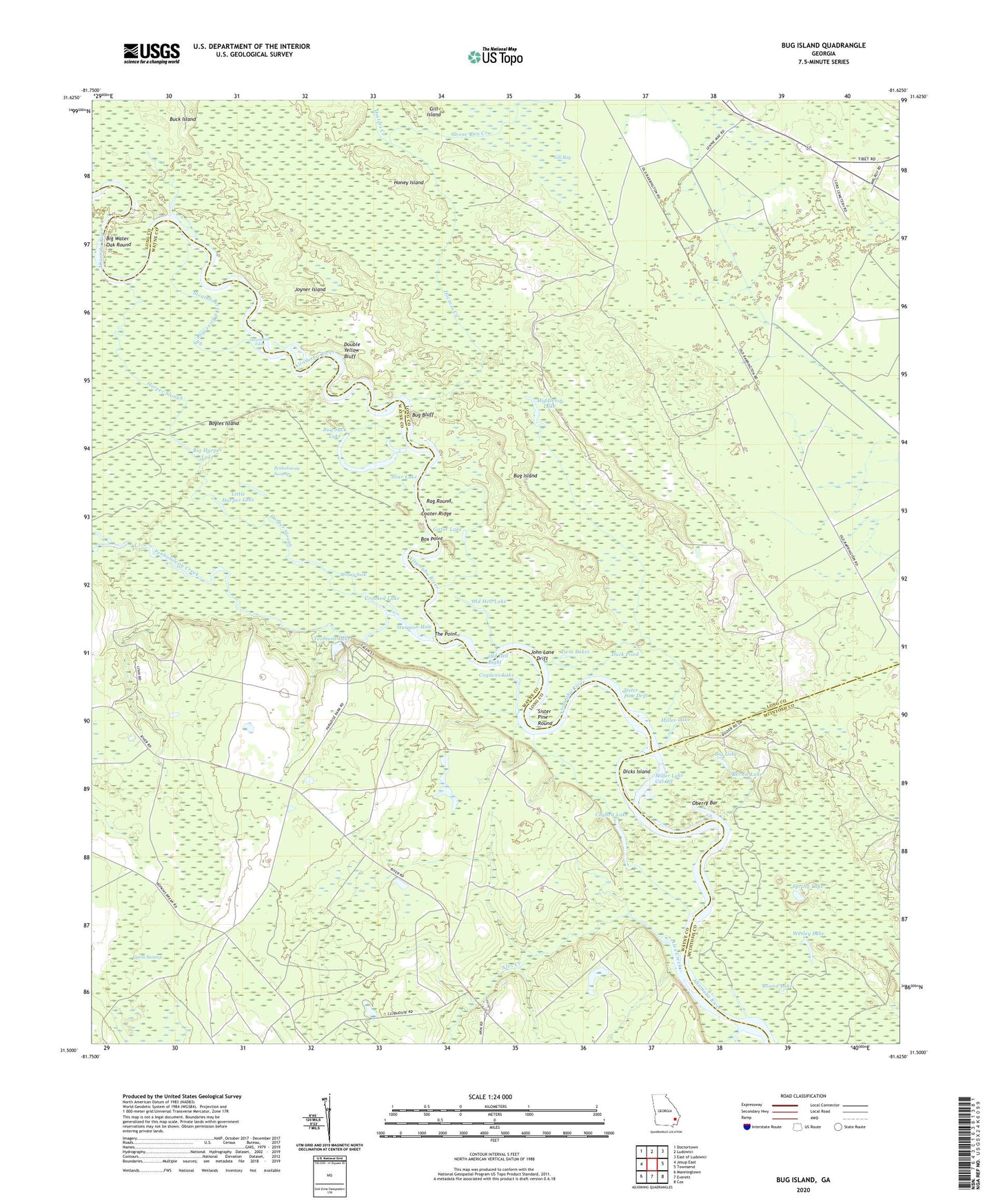
2024 topographic map quadrangle Bug Island in the state of Georgia. Scale: 1:24000. Based on the newly updated USGS 7.5' US Topo map series, this map is in the following counties: Long, Wayne, McIntosh. The map contains contour data, water features, and other items you are used to seeing on USGS maps, but also has updated roads and other features. This is the next generation of topographic maps. Printed on high-quality waterproof paper with UV fade-resistant inks.
Quads adjacent to this one:
West: Jesup East
Northwest: Doctortown
North: Ludowici
Northeast: East of Ludowici
East: Townsend
Southeast: Cox
South: Everett
Southwest: Manningtown
This map covers the same area as the classic USGS quad with code o31081e6.
Contains the following named places: Alex Creek, Bernie Lake, Big Harper Lake, Big Lake, Big Water Oak Round, Box Point, Boyles Island, Brosay Suck, Bug Bluff, Bug Island, Bug Suck Lake, Cogden Lake, Cogdens Lake, Cooter Ridge, Crooked Lake, Dicks Island, Doctors Creek, Double Yellow Bluff, Duck Pond, Gardi Swamp, Gator Lake, Goose Run Creek, Harper Slough, Honey Island, Horse Ford, John Lane Drift, Joyner Island, Little Harper Lake, Middleton Church, Middleton Lake, Miller Lake, Miller Lake Cut Off, Oberry Bar, Old Hell Bight, Old Hell Lake, Old Landing, Oxlot Landing, Paradise Park, Penholoway Creek, Penholoway Swamp, Rag Round, Round Lake, Sister Pine Drift, Sister Pine Round, Sour Lake, Spring Lake, Steamboat Eddy, Steamboat Old River Slough, Sturgeon Hole, The Point, Twin Lakes, Union Church, Upper Sansavilla Landing, Wesley Lake, Yeomans Lake