MyTopo
Rockville Georgia US Topo Map
Couldn't load pickup availability
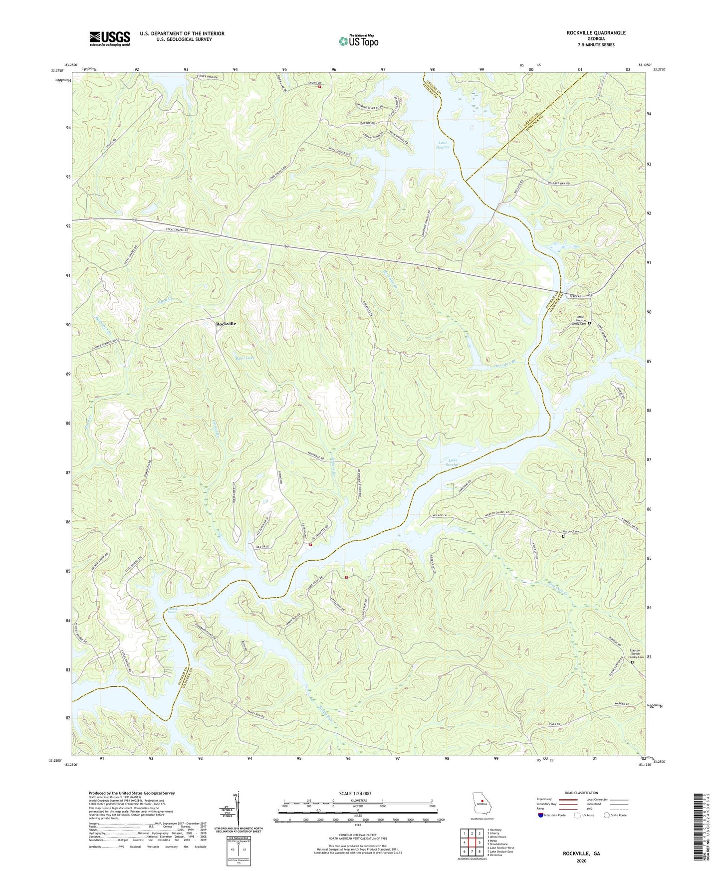
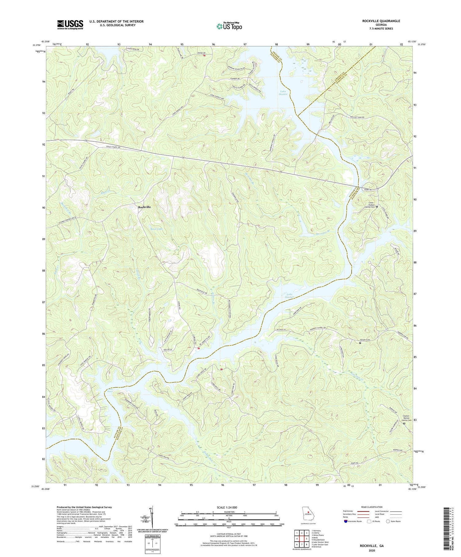
2024 topographic map quadrangle Rockville in the state of Georgia. Scale: 1:24000. Based on the newly updated USGS 7.5' US Topo map series, this map is in the following counties: Putnam, Hancock, Greene. The map contains contour data, water features, and other items you are used to seeing on USGS maps, but also has updated roads and other features. This is the next generation of topographic maps. Printed on high-quality waterproof paper with UV fade-resistant inks.
Quads adjacent to this one:
West: Meda
Northwest: Harmony
North: Liberty
Northeast: White Plains
East: Shoulderbone
Southeast: Devereux
South: Lake Sinclair East
Southwest: Lake Sinclair West
This map covers the same area as the classic USGS quad with code o33083c2.
Contains the following named places: Basil Lake, Basil Lake Dam, Buckshot Branch, Cattail Branch, Clayton - Bonner Family Cemetery, Grabel Shoals, Gregory Mission, Harper Cemetery, Herndon Branch, Holiday Shores Fire Station 5, Jenkins Branch, Jenkins Grove Chapel, Little - Hudson Family Cemetery, Little Hudson Park, Littles Ferry, Log Dam Creek, Mount Zion Church, Mount Zion School, Oconee Church, Oconee Springs, Oconee Springs Park, Old Millen Ferry, Putnam County Fire Rescue Department Station 7, Rockville, Rockville Fire Department Station 6, Rockville Lookout Tower, Saint Pauls Church, Sandy Run, Sandy Run Church