MyTopo
Leary Georgia US Topo Map
Couldn't load pickup availability
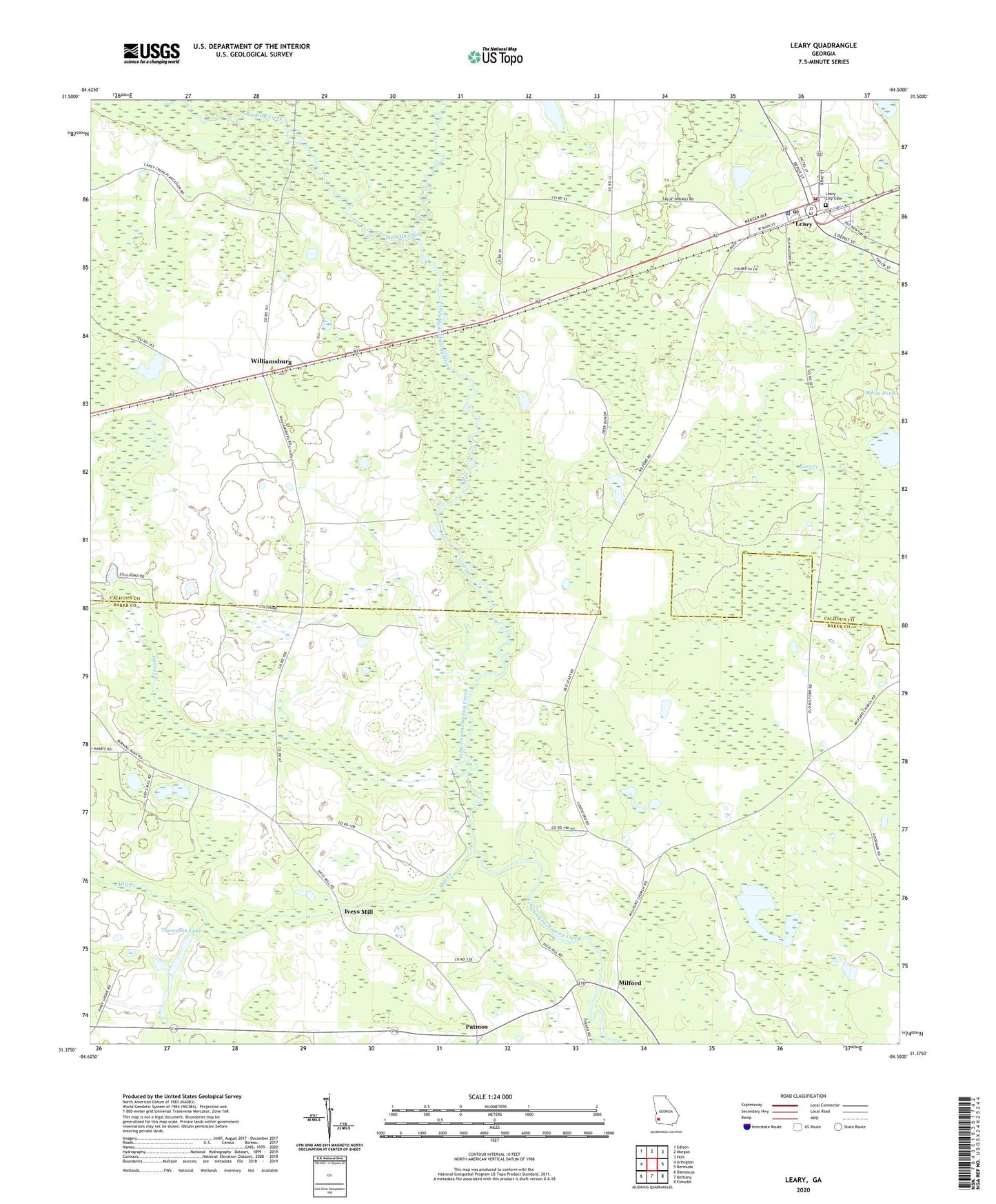
2024 topographic map quadrangle Leary in the state of Georgia. Scale: 1:24000. Based on the newly updated USGS 7.5' US Topo map series, this map is in the following counties: Calhoun, Baker. The map contains contour data, water features, and other items you are used to seeing on USGS maps, but also has updated roads and other features. This is the next generation of topographic maps. Printed on high-quality waterproof paper with UV fade-resistant inks.
Quads adjacent to this one:
West: Arlington
Northwest: Edison
North: Morgan
Northeast: Holt
East: Bermuda
Southeast: Elmodel
South: Bethany
Southwest: Damascus
This map covers the same area as the classic USGS quad with code o31084d5.
Contains the following named places: Bethel Church, Caney Creek, City of Leary, Iveys Mill, Leary, Leary Baptist Church, Leary City Cemetery, Leary Police Department, Leary Post Office, Leary Volunteer Fire Department, Macedonia Church, Milford, Milford Baptist Church, Milford Church, Mill Creek, Pachitla Creek, Patmos, Patmos Church, Pine Bloom Church, Thompson Lake, Thompson Lake Dam, Williamsburg, Williamsburg Church, ZIP Code: 39862