MyTopo
Leesburg Georgia US Topo Map
Couldn't load pickup availability
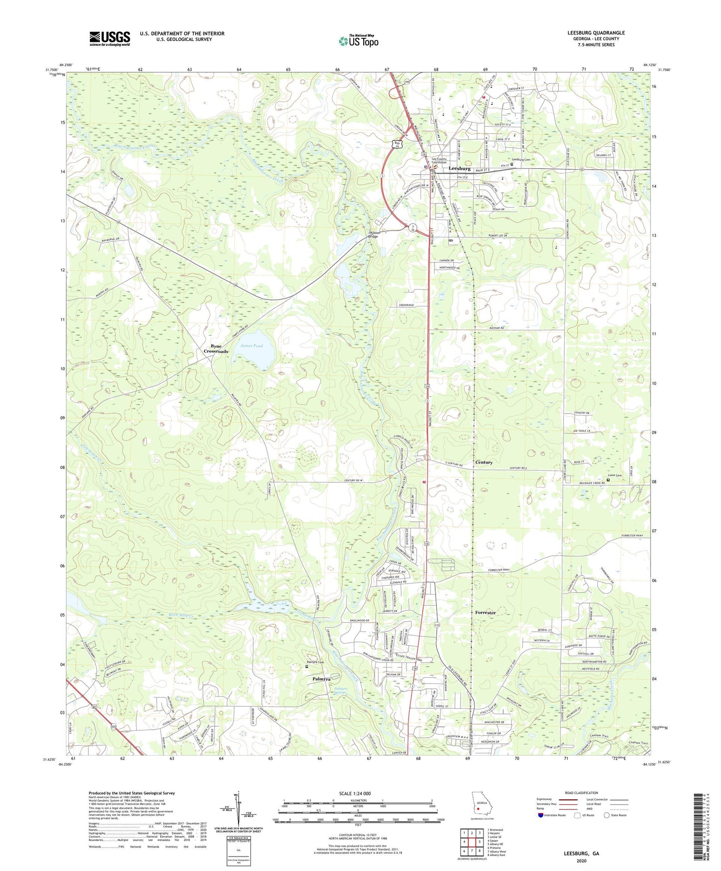
2024 topographic map quadrangle Leesburg in the state of Georgia. Scale: 1:24000. Based on the newly updated USGS 7.5' US Topo map series, this map is in the following counties: Lee. The map contains contour data, water features, and other items you are used to seeing on USGS maps, but also has updated roads and other features. This is the next generation of topographic maps. Printed on high-quality waterproof paper with UV fade-resistant inks.
Quads adjacent to this one:
West: Sasser
Northwest: Bronwood
North: Neyami
Northeast: Leslie SE
East: Albany NE
Southeast: Albany East
South: Albany West
Southwest: Pretoria
This map covers the same area as the classic USGS quad with code o31084f2.
Contains the following named places: Alpha Church, Bethlehem-Lee Church, Byne Crossroads, Century, City of Leesburg, Forrester, Fowltown Creek, Haley Plantation, Jackson Bridge, James Pond, Kinchafoonee Church, Lee County Courthouse, Lee County Elementary School, Lee County Emergency Medical Services Century Station, Lee County Fire Department Station 1 Leesburg, Lee County Fire Department Station 2, Lee County High School, Leesburg, Leesburg Cemetery, Leesburg Division, Leesburg Police Department, Leesburg Post Office, Lowe Cemetery, Mount Calvary Church, Palmyra, Palmyra Cemetery, Palmyra Springs, Reedy Creek, Rock Hole Creek, Spring Hill Church, Upper School, WIKX-FM (Leesburg), WJIZ-FM (Albany), Wooten Church