MyTopo
Neyami Georgia US Topo Map
Couldn't load pickup availability
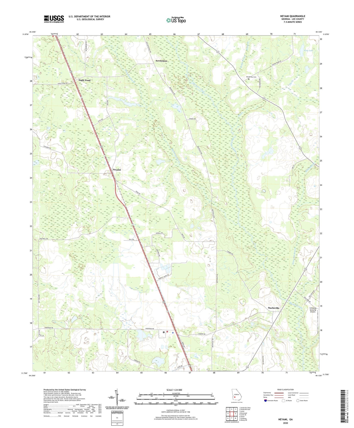
2024 topographic map quadrangle Neyami in the state of Georgia. Scale: 1:24000. Based on the newly updated USGS 7.5' US Topo map series, this map is in the following counties: Lee. The map contains contour data, water features, and other items you are used to seeing on USGS maps, but also has updated roads and other features. This is the next generation of topographic maps. Printed on high-quality waterproof paper with UV fade-resistant inks.
Quads adjacent to this one:
West: Bronwood
Northwest: Smithville West
North: Smithville East
Northeast: Leslie
East: Leslie SE
Southeast: Albany NE
South: Leesburg
Southwest: Sasser
This map covers the same area as the classic USGS quad with code o31084g2.
Contains the following named places: Boggy Branch, Chehaw Indian Monument, Chehaw Park, Eagle Pond, Fox Creek, Griffith Farm, Henderson Cemetery, Jordan Place, King Lake, King Lake Dam, Lee County, Lee County Fire Department Station 4 Smithville, Lee County Jail, Lee County Sheriff's Office, Lee State Prison, Lee State Prison Fire Station, Leesburg Spraying Airport, Maedonia Church, McAfee Church, Midway Church, Muckaloochee Creek, Neyami, Oak Springs Ranch, Pentahope Farms, Pineland Plantation, Piney Grove Church, Scrutchins, Shady Grove Church, Smithville Division, Starksville, Starksville Bridge, White Oak Branch, ZIP Code: 31763