
MyTopo
Lloyd Shoals Dam Georgia US Topo Map
Couldn't load pickup availability
Also explore the Lloyd Shoals Dam Forest Service Topo of this same quad for updated USFS data
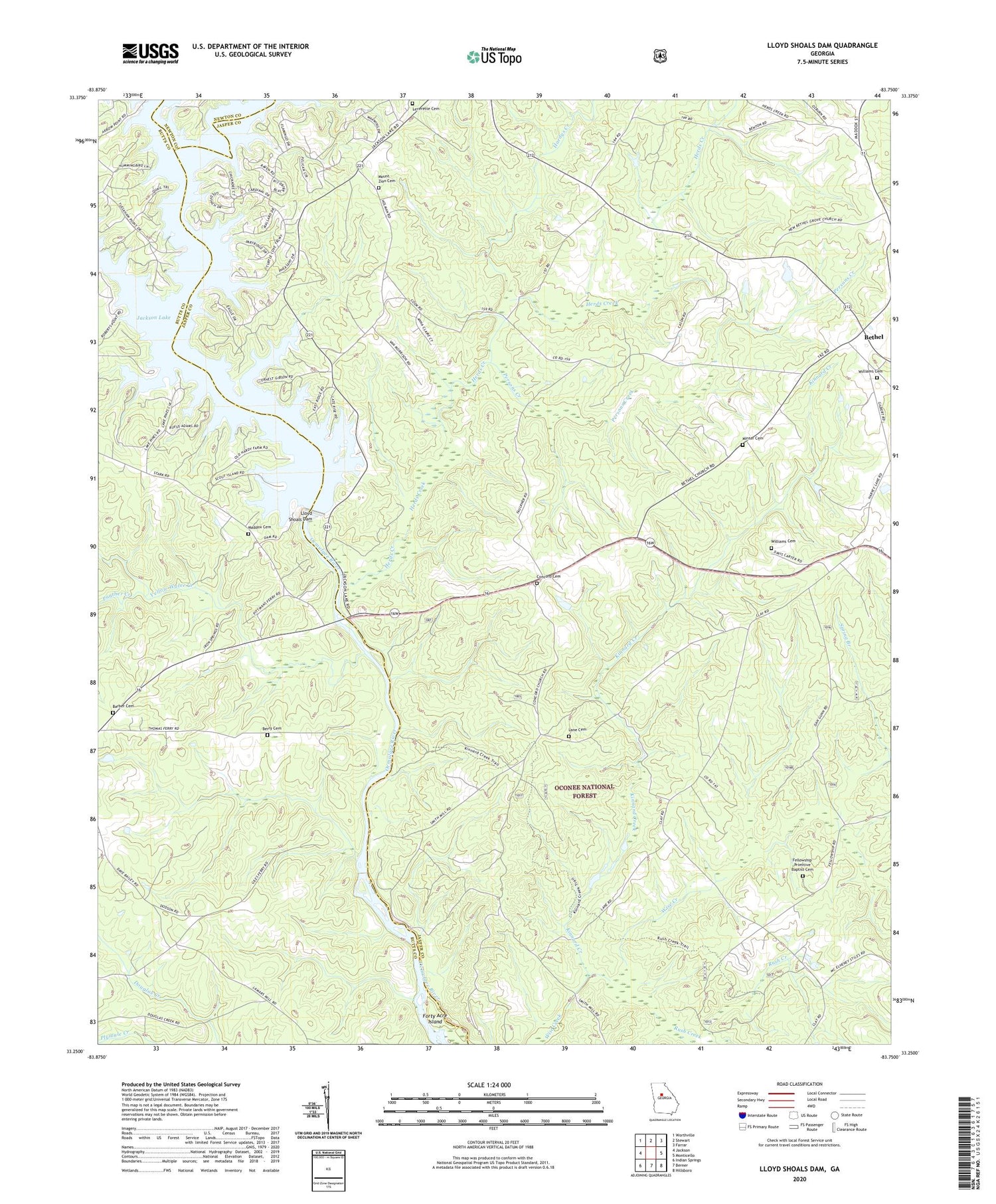
2024 topographic map quadrangle Lloyd Shoals Dam in the state of Georgia. Scale: 1:24000. Based on the newly updated USGS 7.5' US Topo map series, this map is in the following counties: Jasper, Butts, Newton. The map contains contour data, water features, and other items you are used to seeing on USGS maps, but also has updated roads and other features. This is the next generation of topographic maps. Printed on high-quality waterproof paper with UV fade-resistant inks.
Quads adjacent to this one:
West: Jackson
Northwest: Worthville
North: Stewart
Northeast: Farrar
East: Monticello
Southeast: Hillsboro
South: Berner
Southwest: Indian Springs
This map covers the same area as the classic USGS quad with code o33083c7.
Contains the following named places: Alcovy River, Barber Cemetery, Berry Cemetery, Berry Church, Bethel, Bethel Baptist Church, Bethel Grove Church, Bethlehem Church, Concord Cemetery, Concord Church, Concord Hunt Camp, Concord Primitive Baptist Church, Edwards Store, Elizabeth Church, Fellowship Church, Fellowship Primitive Baptist Cemetery, Friendship Cemetery, Friendship Church, Friendship Hunt Camp, Friendship School, Giles Ferry, Hardys Creek, Harmon Pye Branch, Herds Creek, Horse Hunt Camp, Jackson Lake, Keys Store, Kinnard Creek, Kinnard Horse Trail, Lane Cemetery, Leverette Cemetery, Leverette Neck, Lloyd Shoals Dam, Maddox Cemetery, Mechanicsville, Minter Cemetery, Moores Chapel, Mount Olive Church, Mount Zion Cemetery, Mount Zion Church, Oak Hill School, Old Dempsey Ferry, Old Keys Ferry, Panther Creek, Persons Creek, Pittman Ferry, Rush Creek, Rush Creek Hunt Camp, Sardis Church, Smith Ferry, Smiths Mill, South River, Spring Branch, Thomas Ferry, Tussahaw Creek, Tyler Crossroads, Union Ridge Church, Wallers Academy, Warren Academy, Williams Cemetery, Yellow Water Creek


