MyTopo
Marshallville SW Georgia US Topo Map
Couldn't load pickup availability
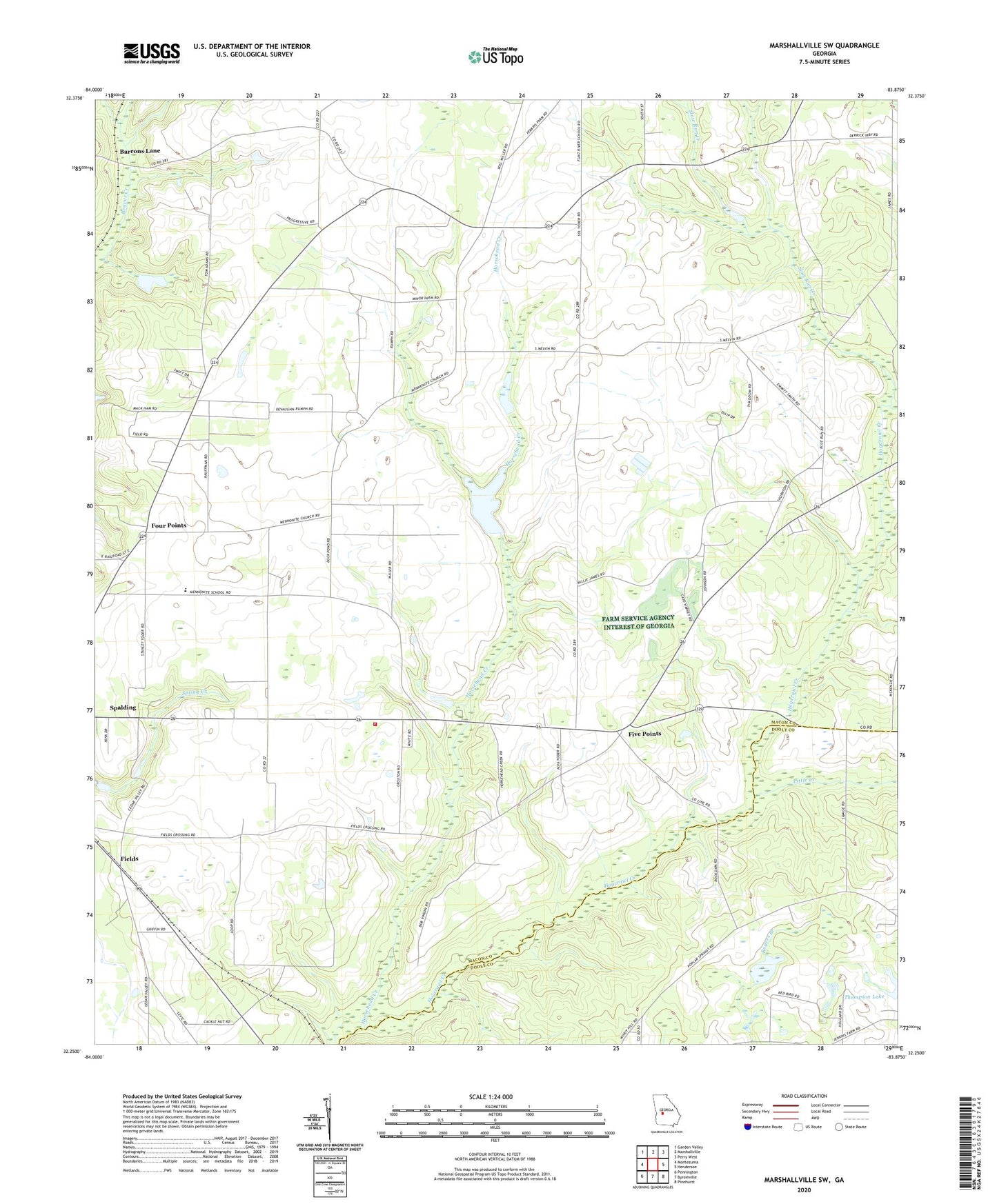
2024 topographic map quadrangle Marshallville SW in the state of Georgia. Scale: 1:24000. Based on the newly updated USGS 7.5' US Topo map series, this map is in the following counties: Macon, Dooly. The map contains contour data, water features, and other items you are used to seeing on USGS maps, but also has updated roads and other features. This is the next generation of topographic maps. Printed on high-quality waterproof paper with UV fade-resistant inks.
Quads adjacent to this one:
West: Montezuma
Northwest: Garden Valley
North: Marshallville
Northeast: Perry West
East: Henderson
Southeast: Pinehurst
South: Byromville
Southwest: Pennington
This map covers the same area as the classic USGS quad with code o32083c8.
Contains the following named places: Arnold Church, Barrons Lane, Brown Chapel, C E Thompson Dam Two, Fields, Five Points, Four Points, Horsehead Creek, Horsehead Creek Lake, Horsehead Creek Lake Dam, Little Creek, Macon County Fire Department, Montezuma Division, New Hope Church, Phillips Church, Rock Dam Church, Slow Run Creek, Spalding, Thompson Lake, Zion Grove Church, Zion Hill Church, ZIP Code: 31063