MyTopo
Marshallville Georgia US Topo Map
Couldn't load pickup availability
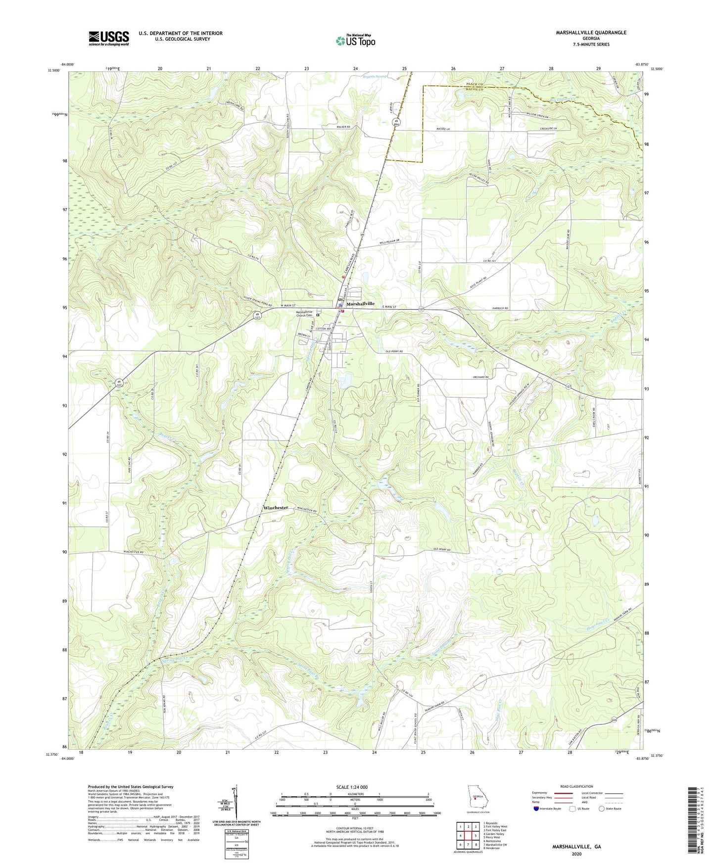
2024 topographic map quadrangle Marshallville in the state of Georgia. Scale: 1:24000. Based on the newly updated USGS 7.5' US Topo map series, this map is in the following counties: Macon, Peach. The map contains contour data, water features, and other items you are used to seeing on USGS maps, but also has updated roads and other features. This is the next generation of topographic maps. Printed on high-quality waterproof paper with UV fade-resistant inks.
Quads adjacent to this one:
West: Garden Valley
Northwest: Reynolds
North: Fort Valley West
Northeast: Fort Valley East
East: Perry West
Southeast: Henderson
South: Marshallville SW
Southwest: Montezuma
This map covers the same area as the classic USGS quad with code o32083d8.
Contains the following named places: Bethel Baptist Church, City of Marshallville, East Main Street Residential Historic District, First Baptist Church, First Baptist Church Cemetery, Friendship Church, Glorious Hope Primitive Baptist Church, Harden Chapel, J W Frederick Memorial Library, Lowes Crossing, Marshallville, Marshallville Church Cemetery, Marshallville City Hall, Marshallville Division, Marshallville Fire Department, Marshallville Methodist Church, Marshallville Police Department, Marshallville Post Office, Richardson School, Saint James Christian Church Cemetery, Saint James Christian Methodist Episcopal Church, Saint Johns African Methodist Episcopal Church, Saint Paul Branch, Saint Pauls Church, Spring Hill Church, Spring Hill Creek, Willow Lake, Winchester, ZIP Code: 31057