MyTopo
Register Georgia US Topo Map
Couldn't load pickup availability
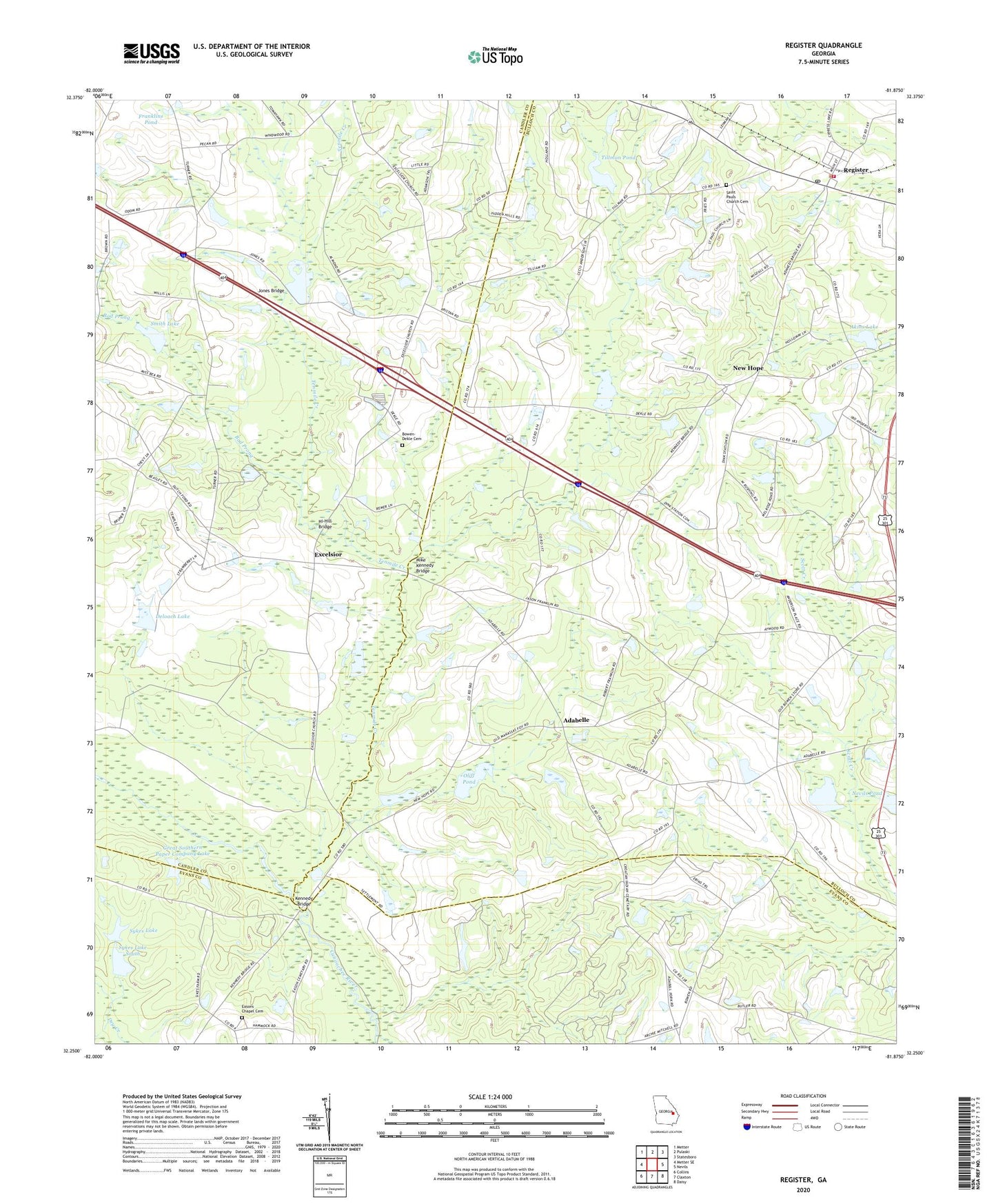
2024 topographic map quadrangle Register in the state of Georgia. Scale: 1:24000. Based on the newly updated USGS 7.5' US Topo map series, this map is in the following counties: Bulloch, Candler, Evans. The map contains contour data, water features, and other items you are used to seeing on USGS maps, but also has updated roads and other features. This is the next generation of topographic maps. Printed on high-quality waterproof paper with UV fade-resistant inks.
Quads adjacent to this one:
West: Metter SE
Northwest: Metter
North: Pulaski
Northeast: Statesboro
East: Nevils
Southeast: Daisy
South: Claxton
Southwest: Collins
This map covers the same area as the classic USGS quad with code o32081c8.
Contains the following named places: Adabelle, Akins Lake, Akins Lake Dam, Atwood Pond, Atwood Pond Dam, Bad Prong, Bowen - Dekle Cemetery, Brewer Pond, Cliff Pond Dam, Croatan School, Deloach Lake, Deloach Lake Dam, Eason Chapel, Easons Chapel Cemetery, Excelsior, Excelsior Church, Franklin School, Franklins Pond, Great Southern Paper Company Lake, Great Southern Paper Company Lake Dam, Grinner School, Hi-Hill Bridge, Jones Bridge, Jones Lake, Jones Lake Dam, Kennedy Bridge, Mike Kennedy Bridge, Nevils Pond, Nevils Pond Dam, New Bedford Church, New Hope, New Hope Church, Oliff Pond, Pulaski Division, Register, Register Division, Register Police Department, Register Post Office, Register Volunteer Fire Department, Saint Pauls Church, Saint Pauls Church Cemetery, Smith Lake, Smith Lake Dam, Sykes Lake, Sykes Lake Dam, Sykes Lake South, Sykes Lake South Dam, Tenmile Creek, Tillman Pond, Tillman Pond Dam, Town of Register, ZIP Code: 30452