MyTopo
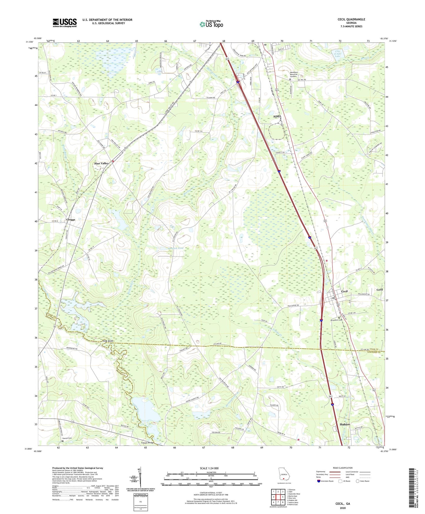
Cecil Georgia US Topo Map
Couldn't load pickup availability
2024 topographic map quadrangle Cecil in the state of Georgia. Scale: 1:24000. Based on the newly updated USGS 7.5' US Topo map series, this map is in the following counties: Cook, Lowndes, Brooks. The map contains contour data, water features, and other items you are used to seeing on USGS maps, but also has updated roads and other features. This is the next generation of topographic maps. Printed on high-quality waterproof paper with UV fade-resistant inks.
Quads adjacent to this one:
West: Berlin East
Northwest: Ellenton
North: Adel
Northeast: Nashville West
East: New Lois
Southeast: Hahira East
South: Hahira West
Southwest: Pebble Hill
This map covers the same area as the classic USGS quad with code o31083a4.
Contains the following named places: Adel City Cemetery, Adel Post Office, Adel-Sparks Division, Big Pond, Carters Still, Cecil, Cecil Baptist Church, Cecil Bay, Cecil Post Office, Cecil Volunteer Fire Department, City of Adel Lake, City of Adel Lake Dam, City of Cecil, Folsom Bridge, Full Gospel Church, Gornto Cemetery, Greggs, Greggs Baptist Church, Hancock Pond, Heart Pine Pond, Heartpine, Jerusalem, Jerusalem Cemetery, Jerusalem Missionary Church, Meetinghouse Branch, Morrison Creek, No Mans Friend Pond, Pine Bluff, Pine Valley, Pine Valley Fire Department, Rock Bridge, Saint Pauls Church, Salem Church, Shiloh Volunteer Fire Department Station 6A, Smith Lake, Smith Lake Dam, Wells Mill Creek, Whitehurst Pond, Whitehurst Pond Dam, Woodlawn Memorial Gardens, ZIP Codes: 31620, 31627