MyTopo
Hahira West Georgia US Topo Map
Couldn't load pickup availability
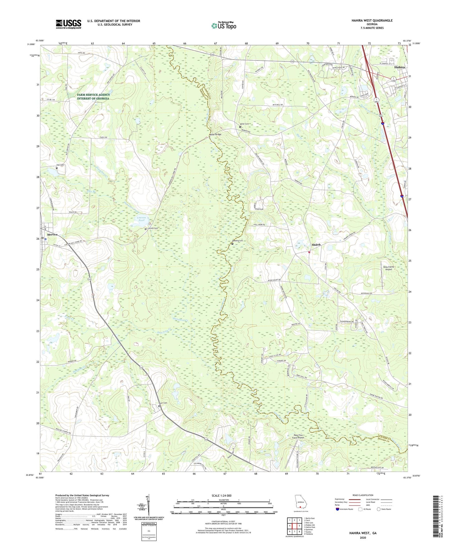
2024 topographic map quadrangle Hahira West in the state of Georgia. Scale: 1:24000. Based on the newly updated USGS 7.5' US Topo map series, this map is in the following counties: Brooks, Lowndes. The map contains contour data, water features, and other items you are used to seeing on USGS maps, but also has updated roads and other features. This is the next generation of topographic maps. Printed on high-quality waterproof paper with UV fade-resistant inks.
Quads adjacent to this one:
West: Pebble Hill
Northwest: Berlin East
North: Cecil
Northeast: New Lois
East: Hahira East
Southeast: Valdosta
South: Ousley
Southwest: Quitman
This map covers the same area as the classic USGS quad with code o30083h4.
Contains the following named places: Big Creek, City of Hahira, Corinth Cemetery, Corinth Church, Downing Creek, Elizabeth Church, Friendship Church, Hall Cemetery, Jones Creek, Lawson Pond, Lawson Pond Dam Number 2, Lawson Pond Dam Number One, Miller Bridge, Miller Cemetery, Morven, Morven Baptist Church, Morven Division, Morven Elementary School, Morven Police Department, Morven Post Office, Mount Zion Church, Paso Fino Farm Airport, Pauline Church, Pike Branch, Pineview Church, Providence Church, Redding Cemetery, Rizer Cemetery, Second Elizabeth Church, Shilo Farms Airport, Shiloh, Shiloh Church, Shiloh Volunteer Fire Department Station 6, Slaughter Creek, Tillman, Tucker Bridge, Webb-Miller School