MyTopo
Nicholls NE Georgia US Topo Map
Couldn't load pickup availability
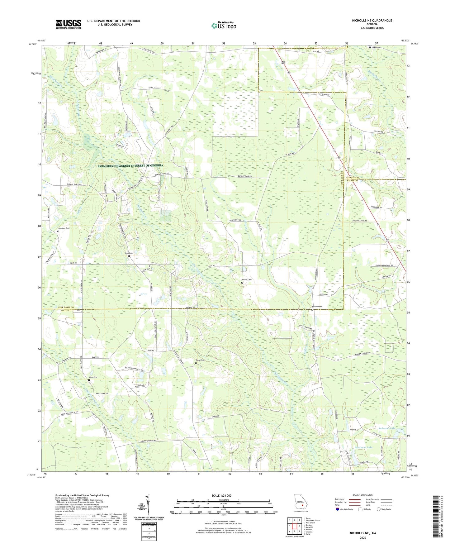
2024 topographic map quadrangle Nicholls NE in the state of Georgia. Scale: 1:24000. Based on the newly updated USGS 7.5' US Topo map series, this map is in the following counties: Jeff Davis, Bacon, Appling. The map contains contour data, water features, and other items you are used to seeing on USGS maps, but also has updated roads and other features. This is the next generation of topographic maps. Printed on high-quality waterproof paper with UV fade-resistant inks.
Quads adjacent to this one:
West: Denton
Northwest: Roper
North: Hazlehurst South
Northeast: Pine Grove
East: Alma NW
Southeast: Alma
South: Sessoms
Southwest: Nicholls
This map covers the same area as the classic USGS quad with code o31082f5.
Contains the following named places: Anderson Lake, Anderson Lake Dam, Bridgeford Church, Elizabeth Baptist Church, Holton Cemetery, Holton Church, Liberty Church, Little Creek, Mckinnon Lake, Mckinnon Lake Dam, Mill Branch, Mims Chapel, Mims Church Cemetery, Philadelphia Church, Simmons Cemetery, Taylor Cemetery, Whitehead Creek, Wilson Cemetery, Yawn Cemetery, Zoar Cemetery, Zoar Missionary Baptist Church