MyTopo
Nicklesville Georgia US Topo Map
Couldn't load pickup availability
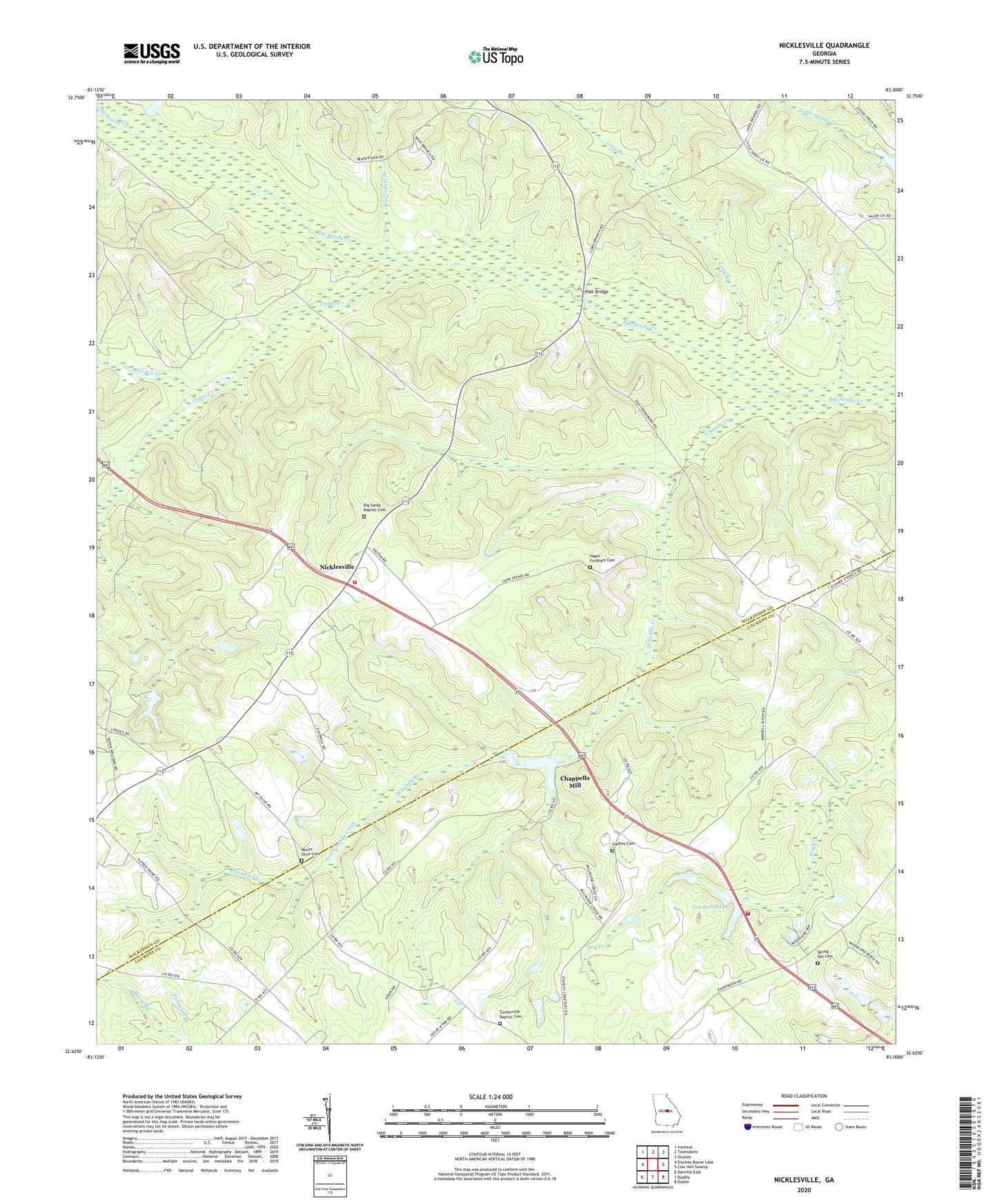
2024 topographic map quadrangle Nicklesville in the state of Georgia. Scale: 1:24000. Based on the newly updated USGS 7.5' US Topo map series, this map is in the following counties: Wilkinson, Laurens. The map contains contour data, water features, and other items you are used to seeing on USGS maps, but also has updated roads and other features. This is the next generation of topographic maps. Printed on high-quality waterproof paper with UV fade-resistant inks.
Quads adjacent to this one:
West: Stuckey Boone Lake
Northwest: Irwinton
North: Toomsboro
Northeast: Oconee
East: Cow Hell Swamp
Southeast: Dublin
South: Dudley
Southwest: Danville East
This map covers the same area as the classic USGS quad with code o32083f1.
Contains the following named places: Allentown-Toomsboro Division, Beaverdam Branch, Big Sandy Baptist Cemetery, Big Sandy Church, Cedar Creek, Centerville Baptist Cemetery, Centerville Baptist Church, Chappells Mill, Chappells Pond, Chappells Pond Dam, Greens Mill, Hagin - Fordham Cemetery, Hall Bridge, Hardy Chapel School, Horse Branch, Jordon Stream Church, Lindsey, Long Branch, Maiden Creek, Mills Lake, Mills Lake Dam, Mount Olive Cemetery, Mount Olive Church, Mount Tilla Church, Nicklesville, Nicklesville Volunteer Fire Department, Oconee Church, South Sandy Creek, Spring Hill, Spring Hill Cemetery, Spring Hill Church, Stanley Cemetery, Taylors Pond, Taylors Pond Dam, Townsend Lake, Townsend Lake Dam, Water Fork