MyTopo
Toomsboro Georgia US Topo Map
Couldn't load pickup availability
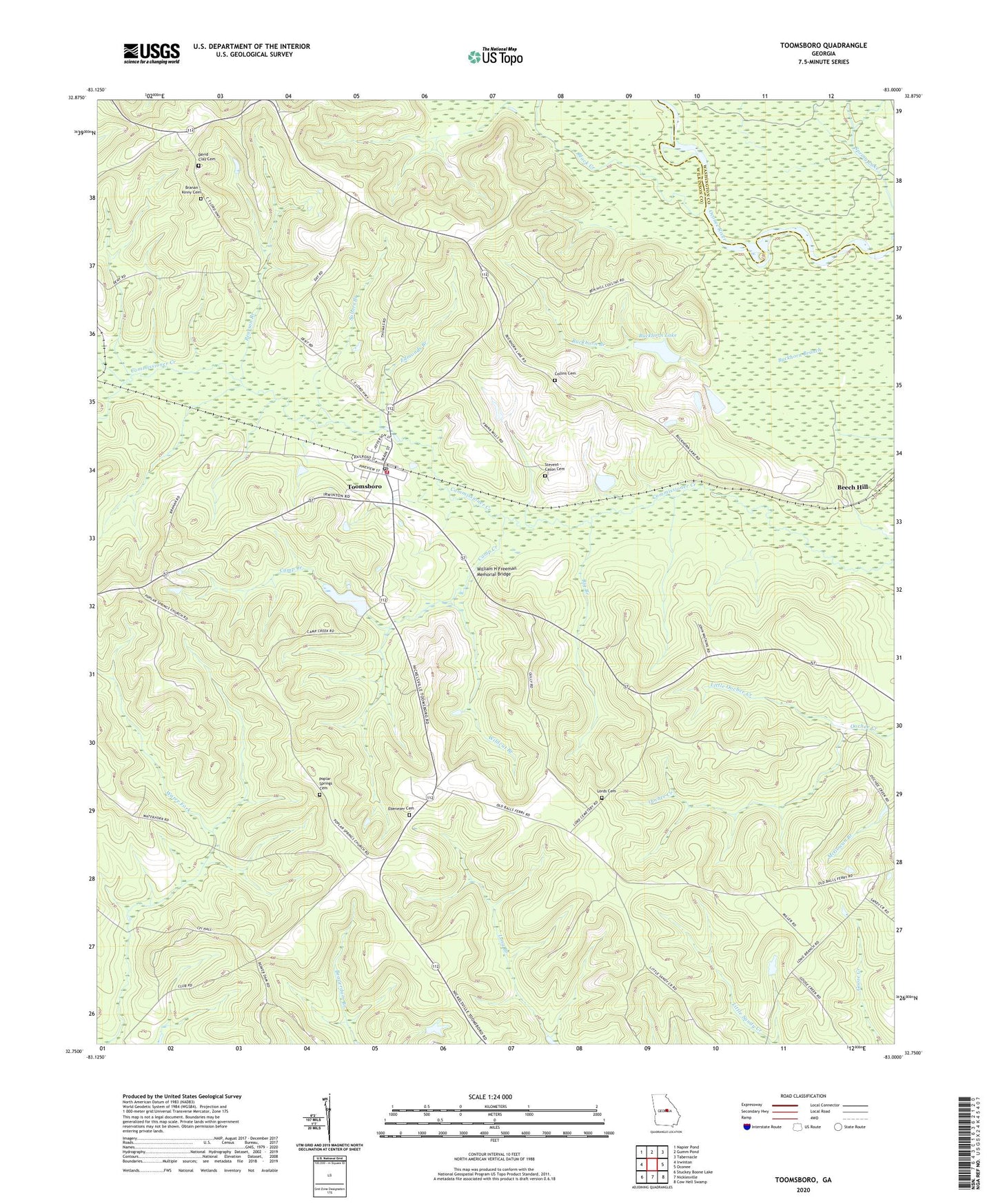
2024 topographic map quadrangle Toomsboro in the state of Georgia. Scale: 1:24000. Based on the newly updated USGS 7.5' US Topo map series, this map is in the following counties: Wilkinson, Washington. The map contains contour data, water features, and other items you are used to seeing on USGS maps, but also has updated roads and other features. This is the next generation of topographic maps. Printed on high-quality waterproof paper with UV fade-resistant inks.
Quads adjacent to this one:
West: Irwinton
Northwest: Napier Pond
North: Gumm Pond
Northeast: Tabernacle
East: Oconee
Southeast: Cow Hell Swamp
South: Nicklesville
Southwest: Stuckey Boone Lake
This map covers the same area as the classic USGS quad with code o32083g1.
Contains the following named places: Beech Hill, Big Branch, Black Creek, Branan - Kinny Cemetery, Buckhorn Lake, Buckhorn Lake Dam, Camp Creek, City of Toomsboro, Collins Cemetery, David Clay Cemetery, Ebenezer Cemetery, Ebenezer Church, Edmonds Branch, Hall Lake, Hall Lake Dam, Kemp School, Lake Jackson, Liberty School, Little Oochee Creek, Lords Cemetery, Myrtle Springs Cemetery, Myrtle Springs Church, Pearson Branch, Philadelphia Church, Poplar Head School, Poplar Springs Cemetery, Poplar Springs Church, Salters Branch, Stevens - Cason Cemetery, Thompson Lake, Thompson Lake Dam, Toomsboro, Toomsboro Division, Toomsboro Police Department, Toomsboro Post Office, Toomsboro Volunteer Fire Department, Union Hill Church, Union Hill School, Union School, Wildcat Branch, William H Freeman Memorial Bridge, Woodlawn School, ZIP Code: 31090