MyTopo
Dudley Georgia US Topo Map
Couldn't load pickup availability
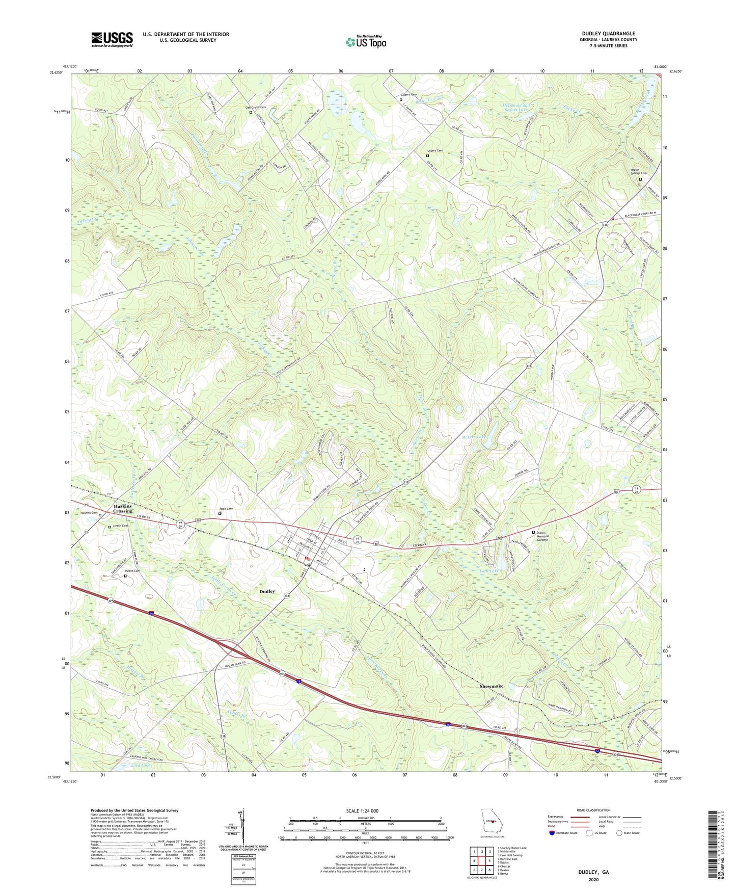
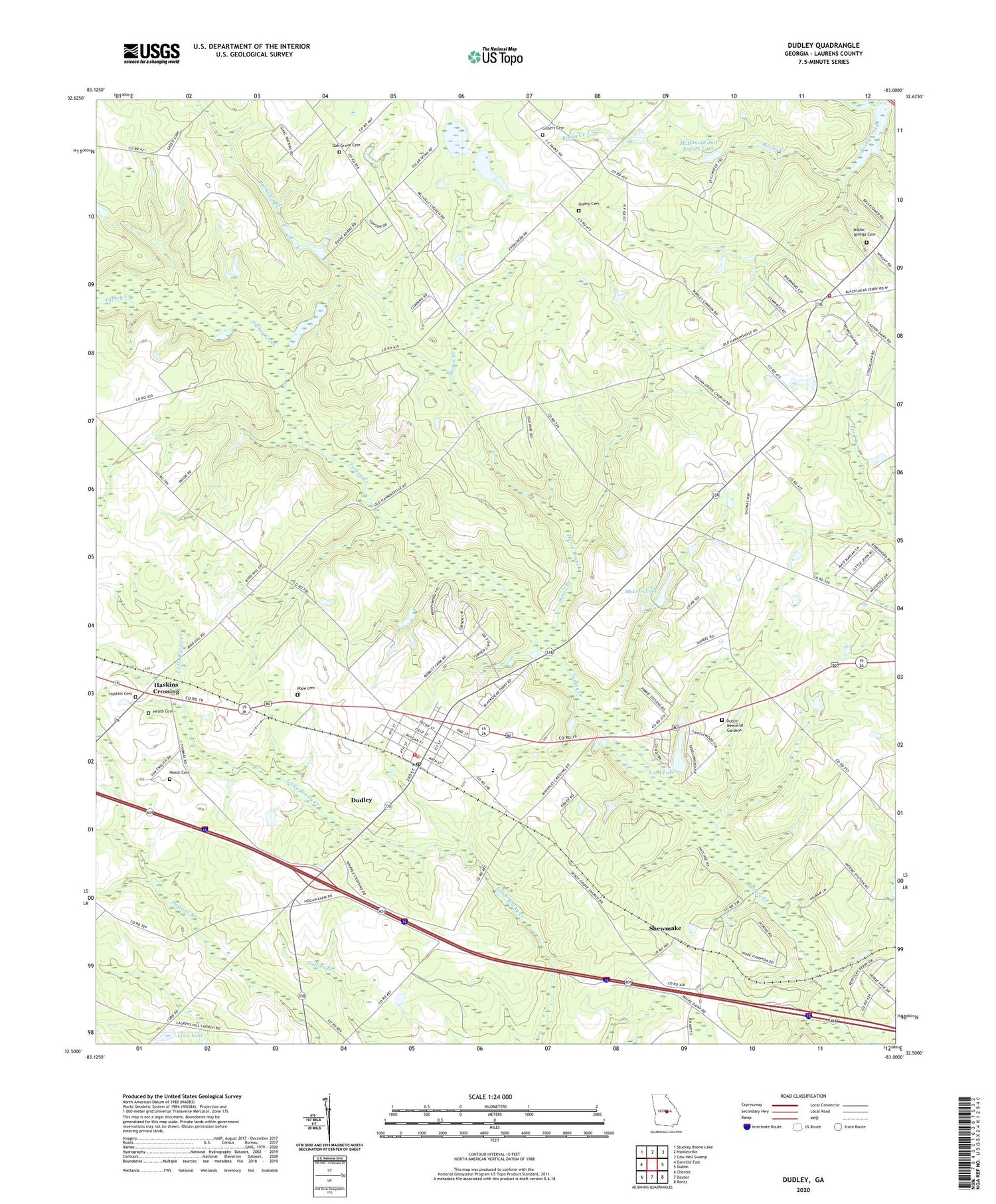
2024 topographic map quadrangle Dudley in the state of Georgia. Scale: 1:24000. Based on the newly updated USGS 7.5' US Topo map series, this map is in the following counties: Laurens. The map contains contour data, water features, and other items you are used to seeing on USGS maps, but also has updated roads and other features. This is the next generation of topographic maps. Printed on high-quality waterproof paper with UV fade-resistant inks.
Quads adjacent to this one:
West: Danville East
Northwest: Stuckey Boone Lake
North: Nicklesville
Northeast: Cow Hell Swamp
East: Dublin
Southeast: Rentz
South: Dexter
Southwest: Chester
This map covers the same area as the classic USGS quad with code o32083e1.
Contains the following named places: Bender, Bird Hill Church, Chapel Hill School, City of Dudley, Dublin Memorial Gardens, Dudley, Dudley Division, Dudley Post Office, Dudley School, Gilbert Cemetery, Haskins Cemetery, Haskins Crossing, Heath Cemetery, Hogan Grove Church, Hogan Lake Dam, Hogan School, Horse Branch, Industrial School, Laurens County Fire Department Station 3, Laurens County Fire Department Station 4, Lord Lake, Lord Lake Dam, McDonald and Segars Lake, McLees Lake, McLees Lake Dam, Millville Church, New Hope Church, Northwest Laurens School, Oak Grove Cemetery, Oak Grove Church, Olive Grove School, Palmetto Branch, Pope Cemetery, Poplar Springs Cemetery, Poplar Springs North Church, Shadow Grove School, Shady Grove Church, Shewmake, Starlight Church, Thomas Cross Roads, Ussery Cemetery, Whipples Crossing, ZIP Code: 31022