MyTopo
Ochlocknee Georgia US Topo Map
Couldn't load pickup availability
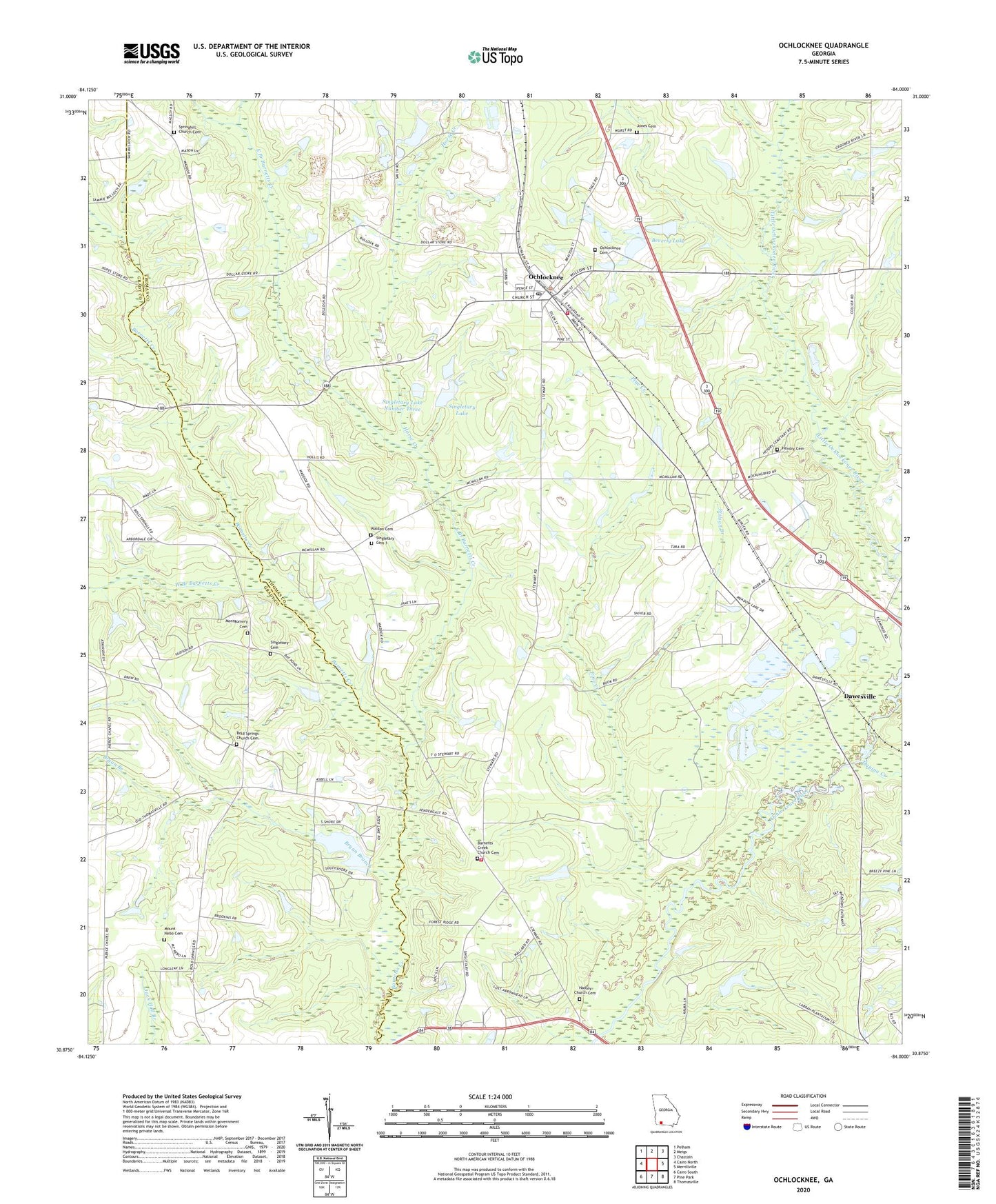
2024 topographic map quadrangle Ochlocknee in the state of Georgia. Scale: 1:24000. Based on the newly updated USGS 7.5' US Topo map series, this map is in the following counties: Thomas, Grady. The map contains contour data, water features, and other items you are used to seeing on USGS maps, but also has updated roads and other features. This is the next generation of topographic maps. Printed on high-quality waterproof paper with UV fade-resistant inks.
Quads adjacent to this one:
West: Cairo North
Northwest: Pelham
North: Meigs
Northeast: Chastain
East: Merrillville
Southeast: Thomasville
South: Pine Park
Southwest: Cairo South
This map covers the same area as the classic USGS quad with code o30084h1.
Contains the following named places: Arbordale Church, Barnett's Creek Baptist Church Cemetery, Barnetts Creek Church, Barnetts Creek Volunteer Fire Department Station 6, Beverly Lake, Beverly Lake Dam, Bold Springs Cemetery, Bold Springs Church, Bryan Branch, Bullock Mill, Children Center School, Dawes Chapel, Dawesville, East Branch Barnetts Creek, Hadley Church, Hadley Church Cemetery, Hendry Cemetery, Horse Creek, Jones Cemetery, Maranatha Church, Montgomery Cemetery, Mount Nebo Cemetery, Mount Nebo Church, Mount Phisby Church, Ochlocknee, Ochlocknee Cemetery, Ochlocknee Division, Ochlocknee Fire Department Station 8, Ochlocknee Post Office, Pine Creek, Roddenberry Camp, Scullys Store, Singletary Cemetery, Singletary Cemetery 1, Singletary Lake, Singletary Lake Dam, Singletary Lake Dam Number Three, Singletary Lake Dam Number Two, Singletary Lake Number Three, Spring Hill Church, Spring Hill School, Springhill Church Cemetery, Town of Ochlocknee, Union School, Walden Cemetery, Wesleyan Church, West Branch Barnetts Creek, Wilson Branch, ZIP Code: 31773