MyTopo
Chastain Georgia US Topo Map
Couldn't load pickup availability
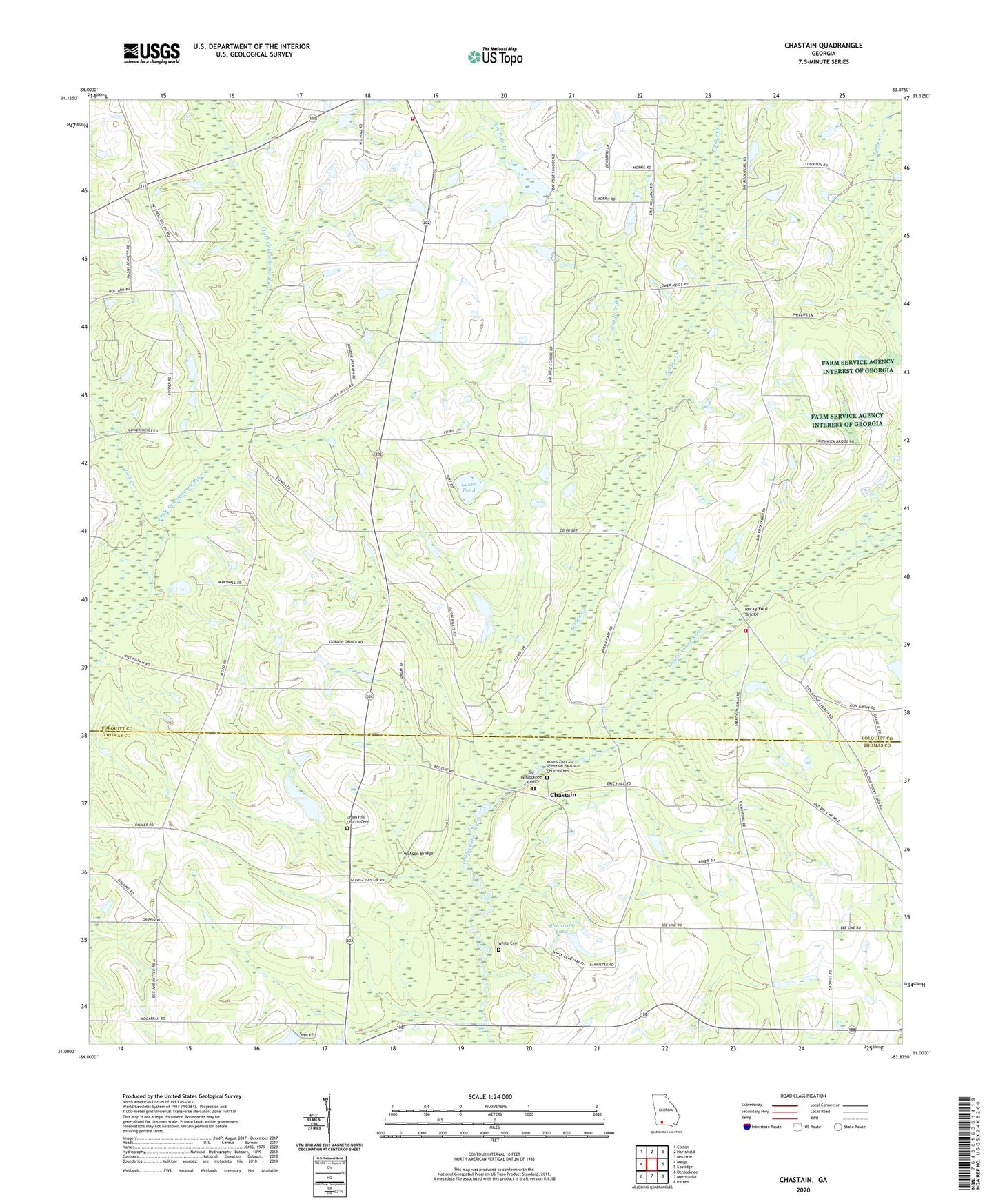
2024 topographic map quadrangle Chastain in the state of Georgia. Scale: 1:24000. Based on the newly updated USGS 7.5' US Topo map series, this map is in the following counties: Colquitt, Thomas. The map contains contour data, water features, and other items you are used to seeing on USGS maps, but also has updated roads and other features. This is the next generation of topographic maps. Printed on high-quality waterproof paper with UV fade-resistant inks.
Quads adjacent to this one:
West: Meigs
Northwest: Cotton
North: Hartsfield
Northeast: Moultrie
East: Coolidge
Southeast: Patten
South: Merrillville
Southwest: Ochlocknee
This map covers the same area as the classic USGS quad with code o31083a8.
Contains the following named places: Bannister Lake, Bannister Lake Dam, Bay Pole Branch, Big Ochlocknee Cemetery, Big Ochlocknee Church, Bridge Creek, Chastain, Colquitt County Volunteer Firefighters Association Fire Station 51 Hamilton, Colquitt County Volunteer Firefighters Association Fire Station 72 Rockyford, Griffin Lake, Griffin Lake Dam, Lost Creek, Lost Creek Farms Airport, Lukes Pond, McIntyre Academy, Mount Zion Church, Mount Zion Primitive Baptist Church Cemetery, New Bethel Cemetery, New Bethel Church, Pine Grove Baptist Church Cemetery, Pine Grove Church, Pine Grove School, Regan School, Rockhill School, Rocky Ford Bridge, Union Hill Church, Union Hill Church Cemetery, Watson Bridge, White Cemetery, Zion Grove Church