
MyTopo
Cairo South Georgia US Topo Map
Couldn't load pickup availability
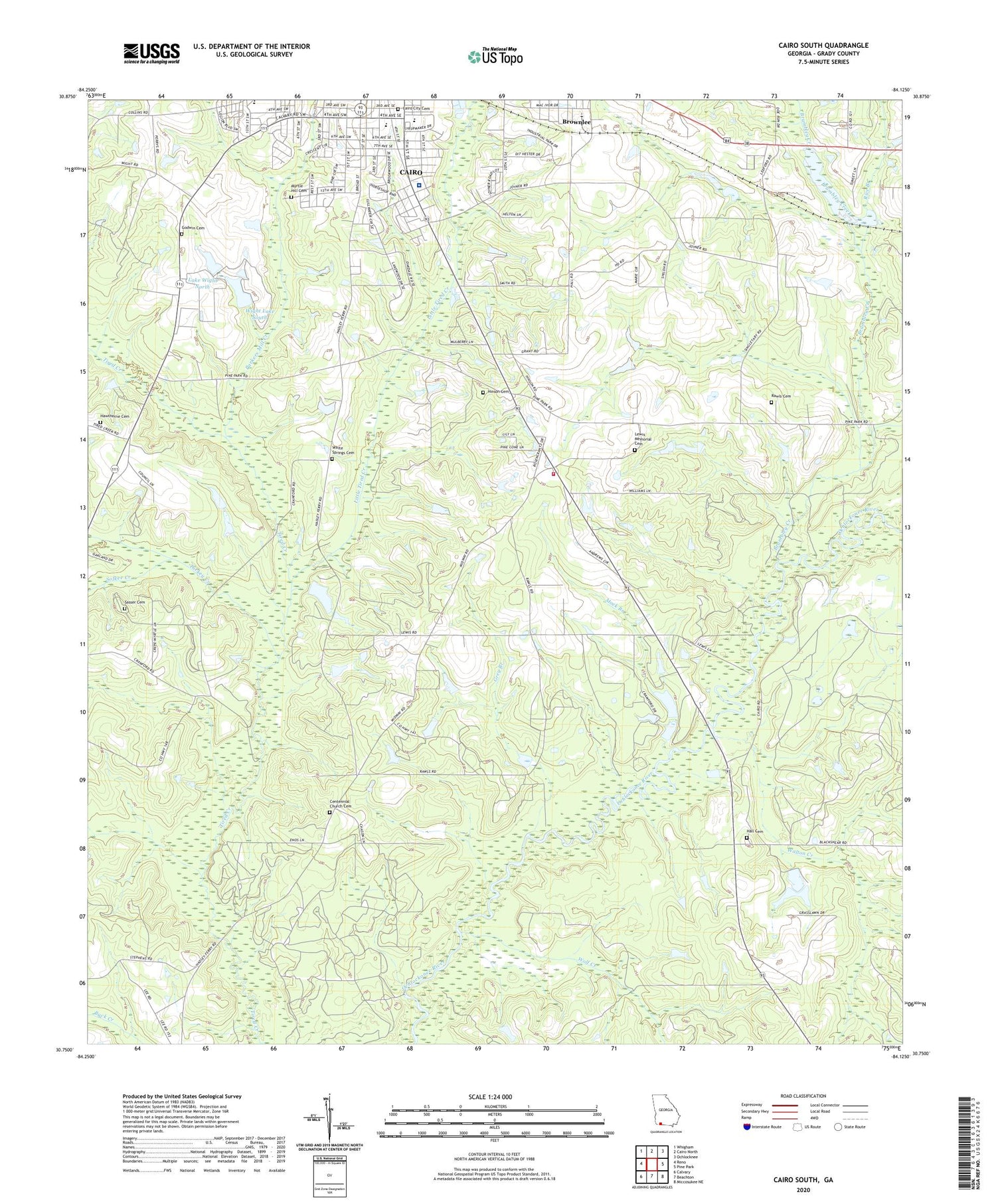
2024 topographic map quadrangle Cairo South in the state of Georgia. Scale: 1:24000. Based on the newly updated USGS 7.5' US Topo map series, this map is in the following counties: Grady. The map contains contour data, water features, and other items you are used to seeing on USGS maps, but also has updated roads and other features. This is the next generation of topographic maps. Printed on high-quality waterproof paper with UV fade-resistant inks.
Quads adjacent to this one:
West: Reno
Northwest: Whigham
North: Cairo North
Northeast: Ochlocknee
East: Pine Park
Southeast: Miccosukee NE
South: Beachton
Southwest: Calvary
This map covers the same area as the classic USGS quad with code o30084g2.
Contains the following named places: Bethlehem African Methodist Episcopal Church, Brownlee, Brumbley Creek, Cairo City Cemetery, Cairo High School, Centennial Church, Centennial Church Cemetery, Centennial School, First Born Church, First United Methodist Church, Godwin Cemetery, Gordon Heights Church, Grady County, Grady County Hospital, Grady County Volunteer Fire Department Midway Station, Grady General Hospital, Greater New Corinth Missionary Baptist Church, Grey Branch, Hall Cemetery, Hawthorne Cemetery, Hawthorne Store, Hinson Cemetery, Jack Hall Branch, Lake Wight North, Lake Wight North Dam, Lewis Memorial Cemetery, Little Tired Creek, Midway, Midway Church, Midway Church Cemetery, Midway School, Mock Branch, Mount Calvary Missionary Baptist Church, Myrtle Hill Cemetery, Parkers Mill Creek, Pilgrim Rest Missionary Baptist Church, Poplar Spring Church, Rawls Cemetery, Rice Branch, Shiloh Church, Sofkee Creek, Southern Terrace Park, Southside School, Tabernacle Church, Turkey Creek, Victory Baptist Church, Walton Creek, Washington School, White Springs Cemetery, White Springs Church, Wight Lake South, Wight Lake South Dam, Wolf Creek, ZIP Code: 39828


