MyTopo
Perkins Georgia US Topo Map
Couldn't load pickup availability
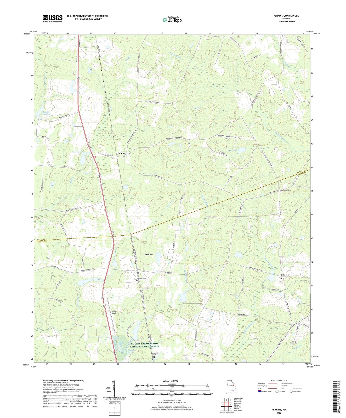
2024 topographic map quadrangle Perkins in the state of Georgia. Scale: 1:24000. Based on the newly updated USGS 7.5' US Topo map series, this map is in the following counties: Burke, Jenkins. The map contains contour data, water features, and other items you are used to seeing on USGS maps, but also has updated roads and other features. This is the next generation of topographic maps. Printed on high-quality waterproof paper with UV fade-resistant inks.
Quads adjacent to this one:
West: Bellevue
Northwest: Waynesboro
North: Idlewood
Northeast: Alexander
East: Sardis
Southeast: Bay Branch
South: Millen
Southwest: Birdsville
This map covers the same area as the classic USGS quad with code o32081h8.
Contains the following named places: Bardman Grove Church, Bo Ginn National Fish Hatchery and Aquarium, Brinson Millpond, Brinson Millpond Dam, Burke County Emergency Management Agency Engine Company 9, Burton School, Cullen Cemetery, Cullen School, Cullins School, Fellowship Church, Florence Church, Florence School, Green Fork Cemetery, Green Fork Church, Habersham, Habersham Cemetery, Habersham Church, Habersham School, Jackson Pond, Jenkins Lake, Jenkins Lake Dam, Lawtonville Cemetery, Magnolia Cemetery, Magnolia Church, Magnolia Spring, Magnolia Springs State Park, Magnolia Springs State Park Dam, Magnolia Springs State Park Lake, Magnolia View Lake, Magnolia View Lake Dam, McCullen Temple, Millen Airport, Millen National Fish Hatchery, Munnerlyn, Perkins, Perkins Census Designated Place, Perkins Post Office, Rock Branch, Rock Branch Church, Rocky Branch Cemetery, Union School, Wards Grove Church, Wilsons Store, Wood Pond, Wood Pond Dam