MyTopo
Alexander Georgia US Topo Map
Couldn't load pickup availability
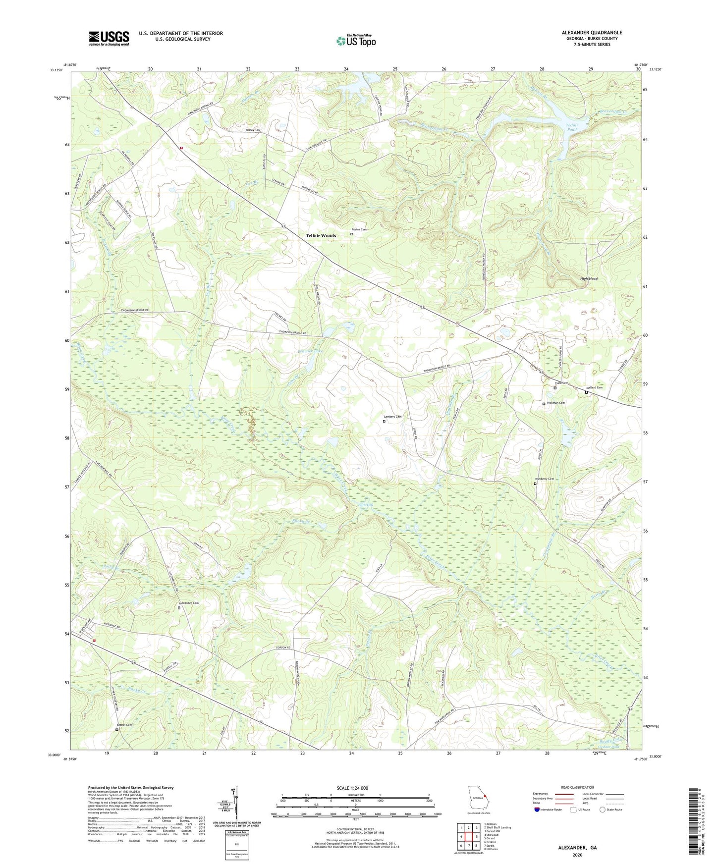
2024 topographic map quadrangle Alexander in the state of Georgia. Scale: 1:24000. Based on the newly updated USGS 7.5' US Topo map series, this map is in the following counties: Burke. The map contains contour data, water features, and other items you are used to seeing on USGS maps, but also has updated roads and other features. This is the next generation of topographic maps. Printed on high-quality waterproof paper with UV fade-resistant inks.
Quads adjacent to this one:
West: Idlewood
Northwest: McBean
North: Shell Bluff Landing
Northeast: Girard NW
East: Girard
Southeast: Hilltonia
South: Sardis
Southwest: Perkins
This map covers the same area as the classic USGS quad with code o33081a7.
Contains the following named places: Alexander Cemetery, Bargeron School, Barton Branch, Bates Branch, Bells Landing, Bethel Associate Reformed Presbyterian Church, Bethel Cemetery, Boggy Gut, Botsford Cemetery, Botsford Church, Burke County Emergency Management Agency Engine Company 10, Burke County Emergency Management Agency Engine Company 11, Chatman Branch, Chickasaw Branch, Clark Cemetery, Cox Branch, Cushner Pond, Cypress Pond, Daniels Branch, Ebenezer Church, Fenwick Lake, Fenwick Lake Dam, Foster Cemetery, Gordon Pond, Hickman Cemetery, High Head, High Head Branch, Hodgson Institute, Job Spring School, Jobs Branch, Jobs Spring Church, Lambert Cemetery, Little Hell, Mallard Cemetery, Peters Branch, Poley Branch, Rockville School, Rocky Creek, Sims Landing, Springfield Church, Springfield School, Telfair Pond, Telfair Pond Dam, Telfair Woods, Telfairs Mill, Wimberly Cemetery