MyTopo
Preston Georgia US Topo Map
Couldn't load pickup availability
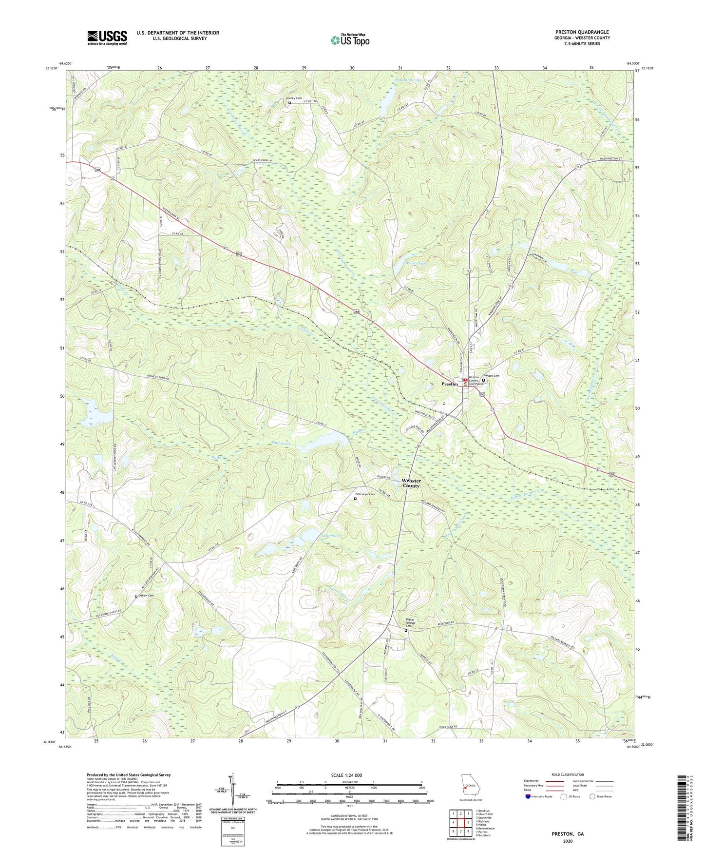
2024 topographic map quadrangle Preston in the state of Georgia. Scale: 1:24000. Based on the newly updated USGS 7.5' US Topo map series, this map is in the following counties: Webster. The map contains contour data, water features, and other items you are used to seeing on USGS maps, but also has updated roads and other features. This is the next generation of topographic maps. Printed on high-quality waterproof paper with UV fade-resistant inks.
Quads adjacent to this one:
West: Richland
Northwest: Brooklyn
North: Church Hill
Northeast: Draneville
East: Plains
Southeast: Bottsford
South: Parrott
Southwest: Benevolence
This map covers the same area as the classic USGS quad with code o32084a5.
Contains the following named places: Askew Cemetery, Bankston Lake, Bankston Lake Dam, Bethlehem Church, City of Preston, Clear Creek, Enterprise Church, Freedom Church, Good Hope Church, Gooseberry, Harrel Mill Creek, Kennedy Lake, Kennedy Lake Dam, Lake Doris, Lake Doris Dam, Lanahassee Creek, Lowrey Cemetery, Magnolia Church, Mud Creek, New Hope Cemetery, New Hope Church, Poplar Springs Cemetery, Poplar Springs Primitive Baptist Church, Preston, Preston Cemetery, Preston Division, Preston Fire Department, Preston Post Office, Shiloh Church, Unified Government of Webster County, Webster County, Webster County Courthouse, Webster County Elementary School, Webster County Fire Department, Webster County Sheriff's Office, West Fork Lanahassee Creek, Wilson Lake, Wilson Lake Dam, ZIP Code: 31824