MyTopo
Brooklyn Georgia US Topo Map
Couldn't load pickup availability
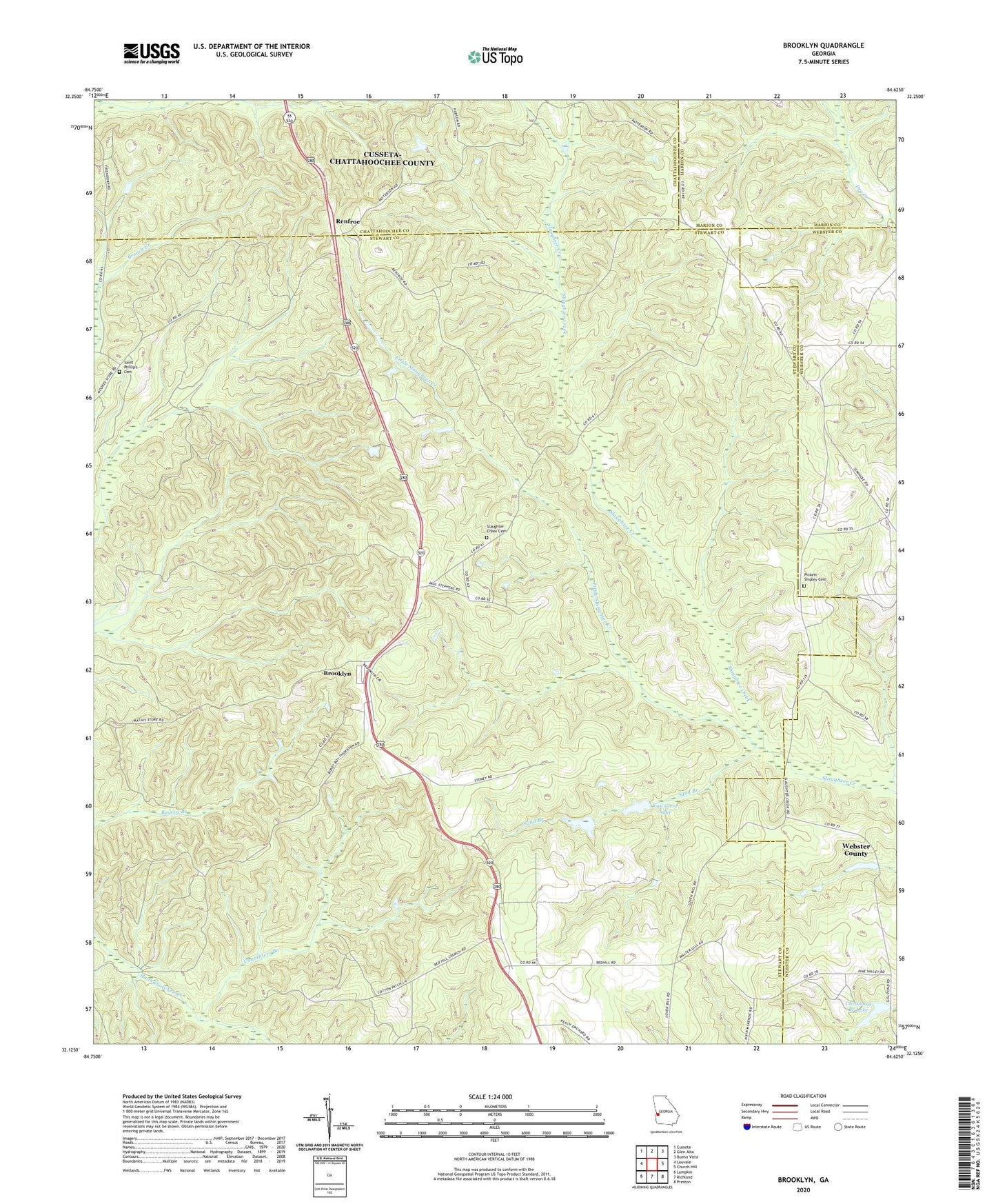
2024 topographic map quadrangle Brooklyn in the state of Georgia. Scale: 1:24000. Based on the newly updated USGS 7.5' US Topo map series, this map is in the following counties: Stewart, Webster, Chattahoochee, Marion. The map contains contour data, water features, and other items you are used to seeing on USGS maps, but also has updated roads and other features. This is the next generation of topographic maps. Printed on high-quality waterproof paper with UV fade-resistant inks.
Quads adjacent to this one:
West: Louvale
Northwest: Cusseta
North: Glen Alta
Northeast: Buena Vista
East: Church Hill
Southeast: Preston
South: Richland
Southwest: Lumpkin
This map covers the same area as the classic USGS quad with code o32084b6.
Contains the following named places: Brooklyn, Brooklyn Methodist Church, Chamblers Branch, Christmas Branch Dam, Christmas Branch Lake, Fellowship Church, Good Hope Church, Green Hill School, Little Slaughter Creek, Pickett - Shipley Cemetery, Pine Grove School, Red Hill Church, Renfroe, Saint Matthew Church, Saint Phillip's Cemetery, Saint Phillips Church, Sand Branch, Shady Grove, Shady Grove Church, Slaughter Creek, Slaughter Creek Cemetery, Slaughter Creek Primitive Baptist Church, Van Cleve Lake, Van Cleve Lake Dam