MyTopo
Richland Georgia US Topo Map
Couldn't load pickup availability
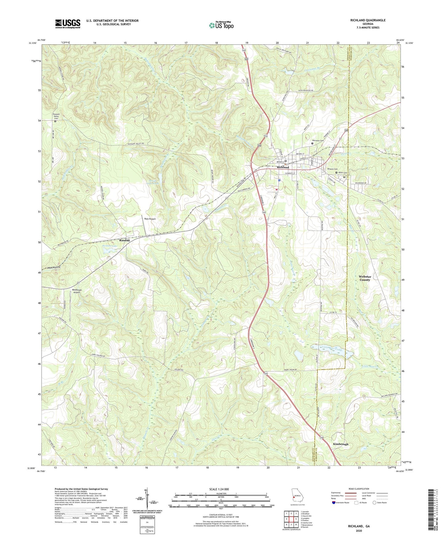
2024 topographic map quadrangle Richland in the state of Georgia. Scale: 1:24000. Based on the newly updated USGS 7.5' US Topo map series, this map is in the following counties: Stewart, Webster. The map contains contour data, water features, and other items you are used to seeing on USGS maps, but also has updated roads and other features. This is the next generation of topographic maps. Printed on high-quality waterproof paper with UV fade-resistant inks.
Quads adjacent to this one:
West: Lumpkin
Northwest: Louvale
North: Brooklyn
Northeast: Church Hill
East: Preston
Southeast: Parrott
South: Benevolence
Southwest: County Line
This map covers the same area as the classic USGS quad with code o32084a6.
Contains the following named places: Allen Chapel, Alston Mill, Ben Owens Creek, Bethel Church, Beulah Church, Bryants Cemetery, City of Richland, Harmony Cemetery, Hesters School, Horton School, Independence Church, Jackson Trail Monument, Kimbrough, Little Bear Creek, Mount Zion Church, Parish Lake, Parish Lake Dam, Parish Lake South, Parish Lake South Dam, Perkins Lake, Perkins Lake Dam, Pleasant Valley Cemetery, Raju Airport, Randall, Richland, Richland Division, Richland Elementary School, Richland Historic District, Richland Police Department, Richland Post Office, Richland Volunteer Fire Department, Sardis Church, Stewart Lookout Tower, Stewart Webster Hospital, Union Church, Upper Sardis Church, Westbrook Airport, Whitt Cemetery, Williams Lake, Williams Lake Dam, ZIP Code: 31825