MyTopo
Church Hill Georgia US Topo Map
Couldn't load pickup availability
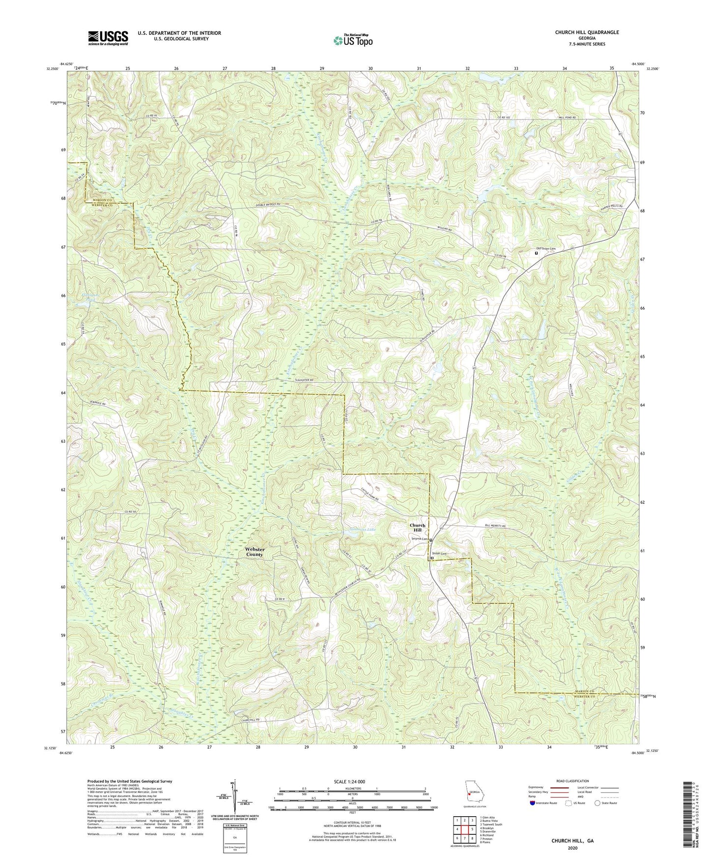
2024 topographic map quadrangle Church Hill in the state of Georgia. Scale: 1:24000. Based on the newly updated USGS 7.5' US Topo map series, this map is in the following counties: Marion, Webster. The map contains contour data, water features, and other items you are used to seeing on USGS maps, but also has updated roads and other features. This is the next generation of topographic maps. Printed on high-quality waterproof paper with UV fade-resistant inks.
Quads adjacent to this one:
West: Brooklyn
Northwest: Glen Alta
North: Buena Vista
Northeast: Tazewell South
East: Draneville
Southeast: Plains
South: Preston
Southwest: Richland
This map covers the same area as the classic USGS quad with code o32084b5.
Contains the following named places: Antioch Baptist Church, Christmas Branch, Church Hill, Dry Creek, Evans Chapel, Flanigans Pond, Golden Creek, Hoggs, Lanahassee Creek, New Friendship Church, Old Union Cemetery, Shiloh Cemetery, Shiloh-Marion-Church Hill Church, Simmons Lake, Simmons Lake Dam, Slaughter Creek, Smyrna Cemetery, Union Church, Weaver Lake, Weaver Lake Dam