
MyTopo
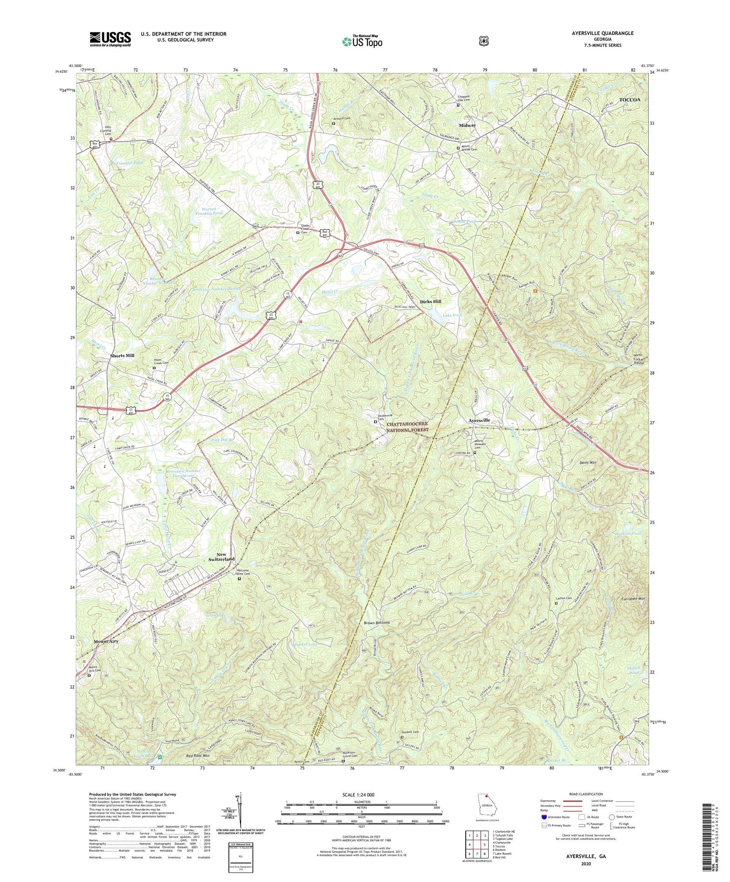
Ayersville Georgia US Topo Map
Couldn't load pickup availability
Also explore the Ayersville Forest Service Topo of this same quad for updated USFS data
2024 topographic map quadrangle Ayersville in the state of Georgia. Scale: 1:24000. Based on the newly updated USGS 7.5' US Topo map series, this map is in the following counties: Habersham, Stephens. The map contains contour data, water features, and other items you are used to seeing on USGS maps, but also has updated roads and other features. This is the next generation of topographic maps. Printed on high-quality waterproof paper with UV fade-resistant inks.
Quads adjacent to this one:
West: Clarkesville
Northwest: Clarkesville NE
North: Tallulah Falls
East: Toccoa
Southeast: Red Hill
South: Lake Russell
Southwest: Baldwin
This map covers the same area as the classic USGS quad with code o34083e4.
Contains the following named places: Antioch Cemetery, Antioch Church, Ayersville, Brown Bottoms, Camp Robert Toombs, Central Heights Church, Chopped Oak Cemetery, Chopped Oak Church, Community Church, Currahee Lookout Tower, Currahee Mountain, Davis Mountain, Dicks Creek, Dicks Hill, Ducket Lake, Erady Branch, Fern Springs Picnic Area, Franklin Pond, George W Carver Picnic Area, Georgia Mountains Christian Academy, Glade Creek Cemetery, Glade Creek Church, Habersham Central High School, Habersham County Fire Department Station 14, Hazel Creek Cemetery, Hazel Creek Church, Hazel Creek Structure 12 Dam, Hazel Creek Structure 19 Dam, Hazel Creek Structure 21 Dam, Hazel Grove Elementary School, Hills Crossing Cemetery, Hills Crossing Church, Hollywood Church, House of Prayer Church, Hurricane School, Irvin Lake, Kimbell Cemetery, Kimbell Creek, Kinney Mill, Lake Irvin, Lake Russell State Wildlife Management Area, Lathan Cemetery, Laudermilk Cemetery, Laudermilk Mill, Locust Stake ORV Area, Midway, Mill Creek, Mount Airy Baptist Church, Mount Airy Cemetery, Mount Bethel Cemetery, Mount Bethel Church, Mount Pleasant Cemetery, Mount Pleasant Church, Mountain Grove Baptist Church, Mountain Grove Cemetery, Nancy Town Lake, Nems Pond, New Switzerland, North Fork Broad River Structure Eight Dam, North Fork Trestle, Penick Pond, Pink Dill Branch, Red Root Mountain, Reservoir Number Nineteen, Reservoir Number Twelve, Reservoir Number Twenty-one, Rock Ford Branch, Shiflett Pond, Shorts Mill, Stottsville, Toccoa Pumping Station, Town of Mount Airy, Warren Franklin Pond, Watkins Pond, Welcome Church, Welcome Home Cemetery, Wells Pond, ZIP Code: 30563


