MyTopo
Reidsville East Georgia US Topo Map
Couldn't load pickup availability
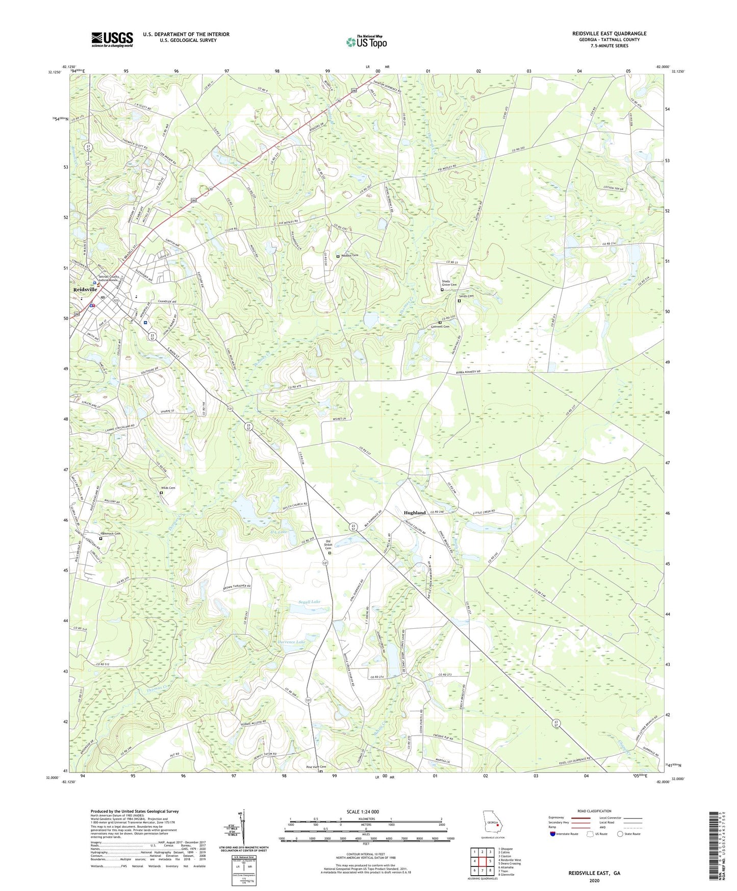
2024 topographic map quadrangle Reidsville East in the state of Georgia. Scale: 1:24000. Based on the newly updated USGS 7.5' US Topo map series, this map is in the following counties: Tattnall. The map contains contour data, water features, and other items you are used to seeing on USGS maps, but also has updated roads and other features. This is the next generation of topographic maps. Printed on high-quality waterproof paper with UV fade-resistant inks.
Quads adjacent to this one:
West: Reidsville West
Northwest: Ohoopee
North: Collins
Northeast: Claxton
East: Deans Crossing
Southeast: Glennville
South: Tison
Southwest: Altamaha
This map covers the same area as the classic USGS quad with code o32082a1.
Contains the following named places: Bradleys, City of Reidsville, D L Lake, D L Lake Dam, Douglas Branch, Durrence Lake, Durrence Lake Dam, Gainwell Cemetery, Hammock Cemetery, Hodges Pond, Hodges Pond Dam, Hughland, Jones Millpond, Jones Millpond Dam, Maddox Cemetery, Old Shiloh Cemetery, Optim Medical Center Tattnall, Pine Grove Church, Pine View Church Cemetery, Reidsville, Reidsville Division, Reidsville Elementary School, Reidsville Fire Department, Reidsville High School, Reidsville Police Department, Reidsville Post Office, Reidsville United Methodist Church, Saint Williams Church, Segull Lake, Segull Lake Dam, Shady Grove Cemetery, Shiloh Church, Shiloh School, Smith Cemetery, Tattnall County, Tattnall County Jail, Tattnall County Sheriff's Office, Tattnall Healthcare Center, Tootle Airport, Wilds Cemetery, Zion Union Church, ZIP Code: 30453