MyTopo
Saint Catherines Sound Georgia US Topo Map
Couldn't load pickup availability
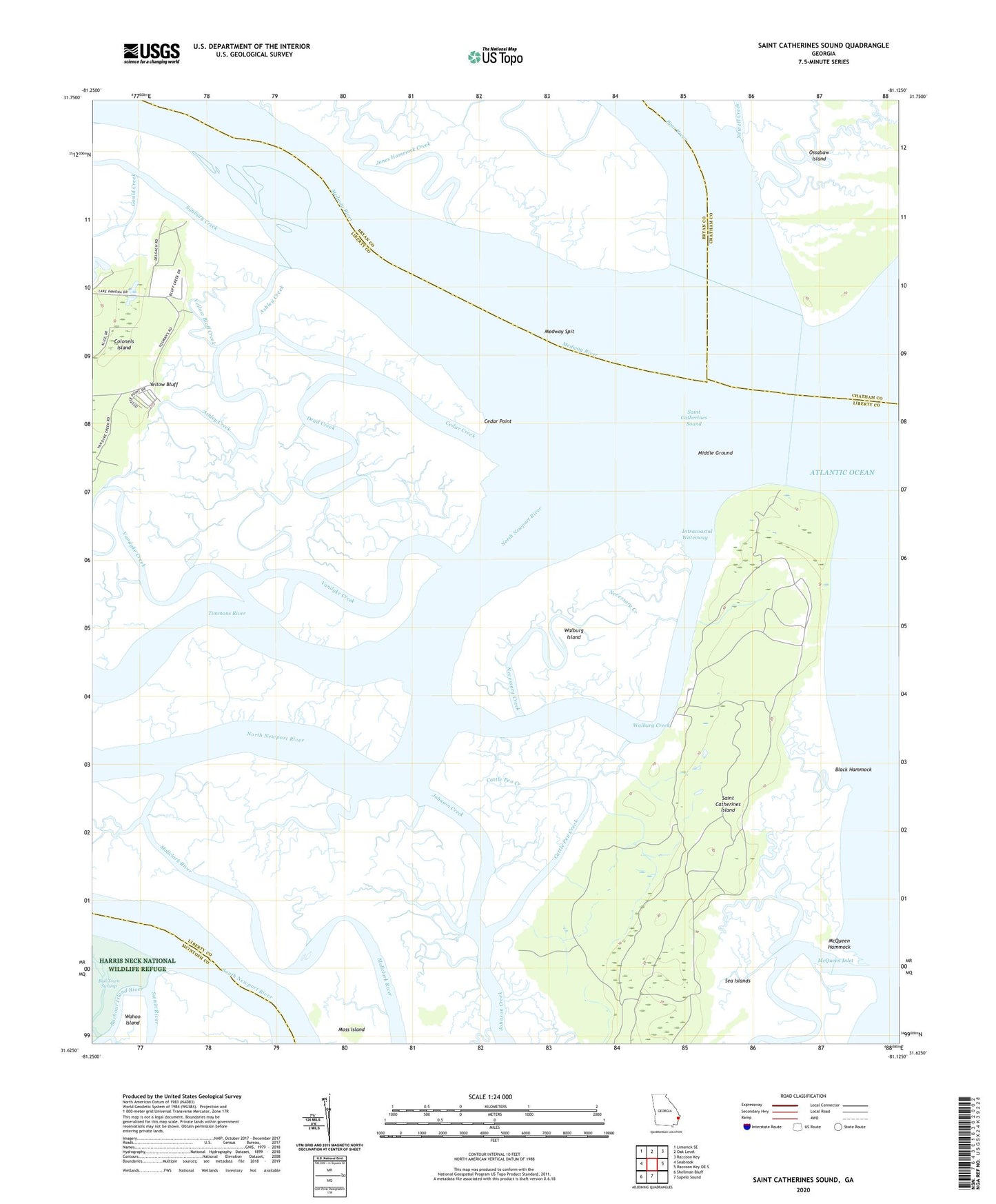
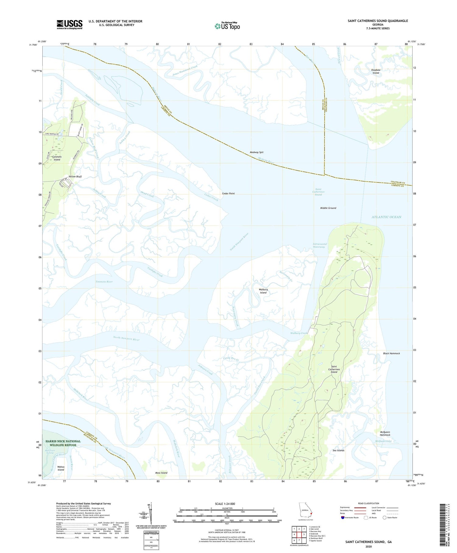
2024 topographic map quadrangle Saint Catherines Sound in the state of Georgia. Scale: 1:24000. Based on the newly updated USGS 7.5' US Topo map series, this map is in the following counties: Liberty, Bryan, Chatham, McIntosh. The map contains contour data, water features, and other items you are used to seeing on USGS maps, but also has updated roads and other features. This is the next generation of topographic maps. Printed on high-quality waterproof paper with UV fade-resistant inks.
Quads adjacent to this one:
West: Seabrook
Northwest: Limerick SE
North: Oak Level
Northeast: Raccoon Key
East: Raccoon Key OE S
South: Sapelo Sound
Southwest: Shellman Bluff
This map covers the same area as the classic USGS quad with code o31081f2.
Contains the following named places: Ashley Creek, Bear River, Black Hammock, Cattle Pen Creek, Cedar Creek, Cedar Point, Dead Creek, Gould Creek, Jacobs Creek, Jones Hammock Creek, McQueen Hammock, McQueen Inlet, Medway River, Medway Spit, Middle Ground, Moss Island, Necessary Creek, Newell Creek, North Newport River, Saint Catherines Island, Saint Catherine's Island Fire Department, Saint Catherines Sound, Sunbury Creek, Timmons River, Vandyke Creek, Walburg Creek, Walburg Island, Yellow Bluff, Yellow Bluff Creek, Yellow Bluff Fishing Camp, Youmans Landing Airfield