MyTopo
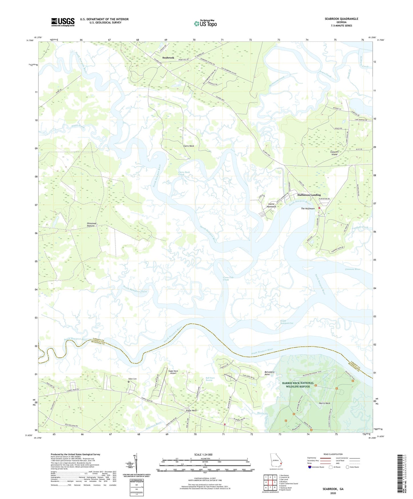
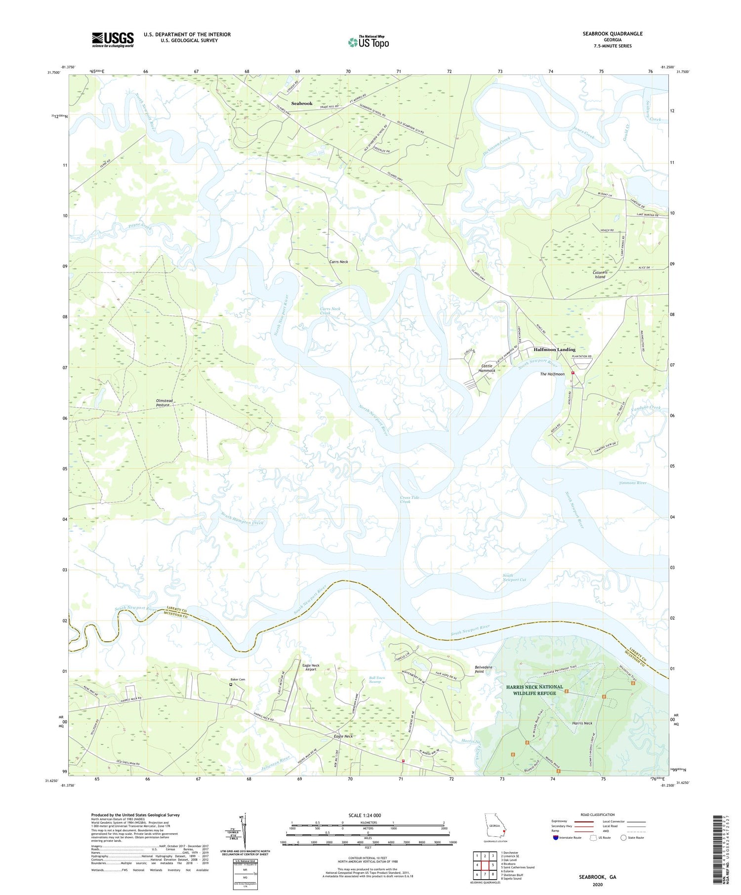
Seabrook Georgia US Topo Map
Couldn't load pickup availability
2024 topographic map quadrangle Seabrook in the state of Georgia. Scale: 1:24000. Based on the newly updated USGS 7.5' US Topo map series, this map is in the following counties: Liberty, McIntosh. The map contains contour data, water features, and other items you are used to seeing on USGS maps, but also has updated roads and other features. This is the next generation of topographic maps. Printed on high-quality waterproof paper with UV fade-resistant inks.
Quads adjacent to this one:
West: Riceboro
Northwest: Dorchester
North: Limerick SE
Northeast: Oak Level
East: Saint Catherines Sound
Southeast: Sapelo Sound
South: Shellman Bluff
Southwest: Eulonia
This map covers the same area as the classic USGS quad with code o31081f3.
Contains the following named places: Baker Cemetery, Belvedere Point, Carrs Neck, Carrs Neck Creek, Cattle Hammock, Church of God, Colonels Island, Cross Tide Creek, Drum Point Landing, Dunham, Eagle Neck Airport, Eastern District Fire and Rescue Station 2, Halfmoon Landing, Halfmoon Marina, Harris Neck Airport, Harris Neck Army Air Field, Harris Neck National Wildlife Refuge, Jones Creek, McIntosh County Fire Department Harris Neck Station, Midway Division, Olmstead Pasture, Palmyra Church, Payne Creek, Seabrook, South Hampton Creek, South Newport Cut, Stevens Airfield, Sunbury Church, The Halfmoon, Thomas Landing, Tidal Community School