MyTopo
Limerick SE Georgia US Topo Map
Couldn't load pickup availability
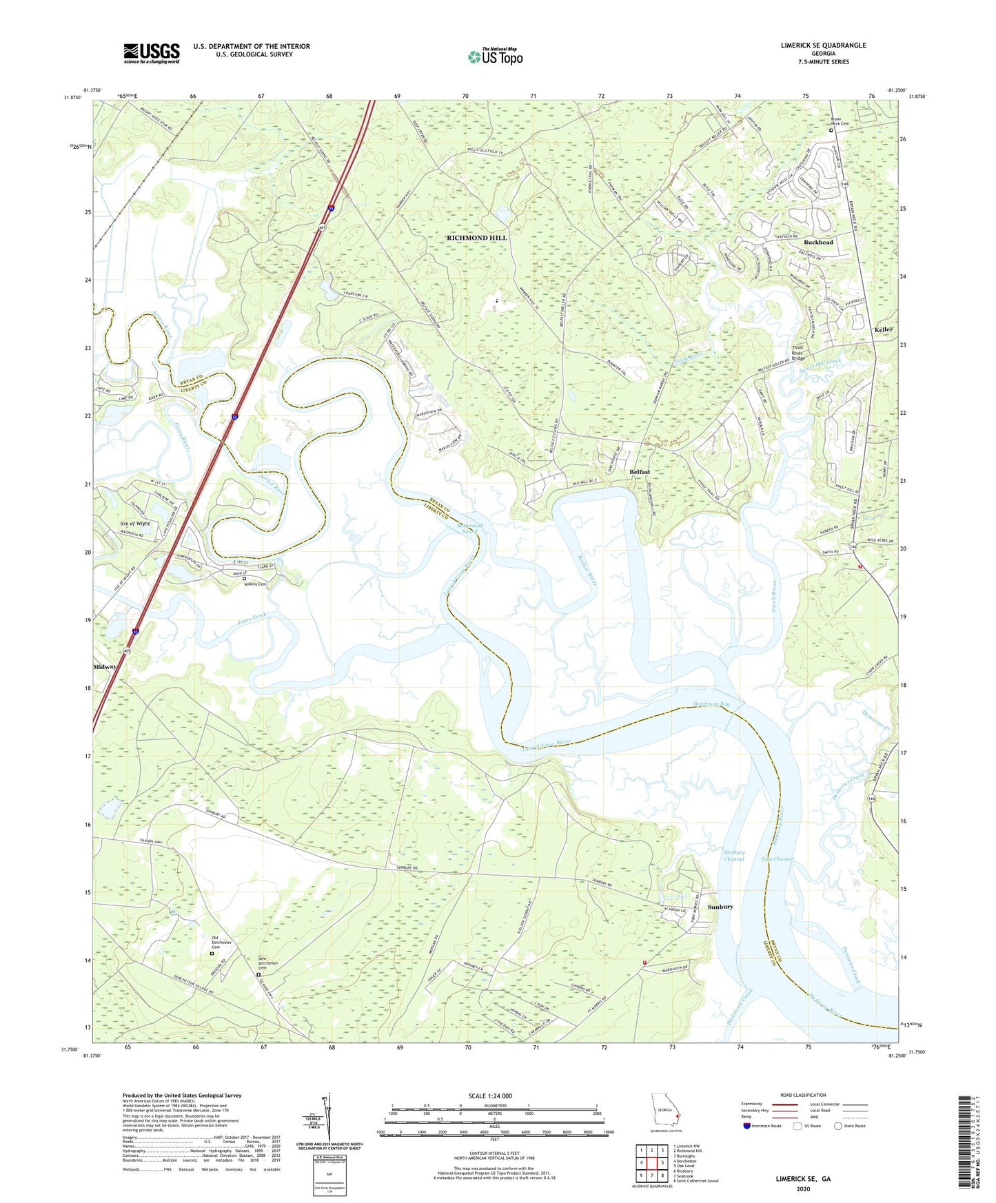
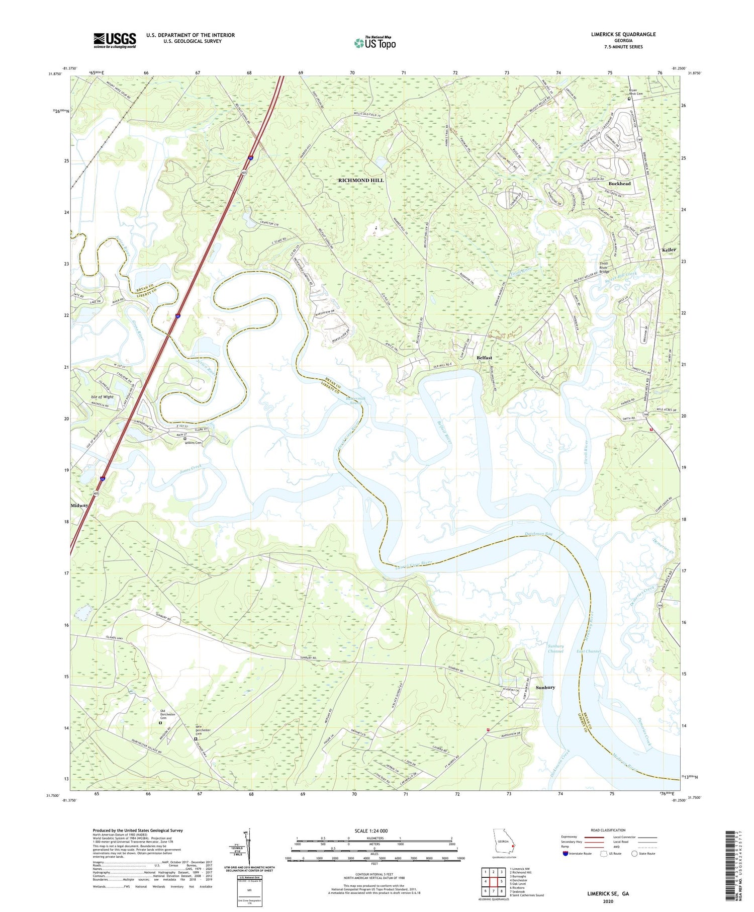
2024 topographic map quadrangle Limerick SE in the state of Georgia. Scale: 1:24000. Based on the newly updated USGS 7.5' US Topo map series, this map is in the following counties: Bryan, Liberty. The map contains contour data, water features, and other items you are used to seeing on USGS maps, but also has updated roads and other features. This is the next generation of topographic maps. Printed on high-quality waterproof paper with UV fade-resistant inks.
Quads adjacent to this one:
West: Dorchester
Northwest: Limerick NW
North: Richmond Hill
Northeast: Burroughs
East: Oak Level
Southeast: Saint Catherines Sound
South: Seabrook
Southwest: Riceboro
This map covers the same area as the classic USGS quad with code o31081g3.
Contains the following named places: Belfast, Belfast River, Bryan Neck Cemetery, Bryan Neck Church, Buckhead, Buckhead Census Designated Place, Buttermilk Sound, Corinth Church, Demeries Creek, Dickinson Creek, Dorchester Church, Dorchester Civic Center, Dorchester School, Dutchman Bay, East Channel, Eastern District Fire and Rescue Station 1, Fort Morris, Fort Morris State Historic Site, Gress River, Isle of Wight, Jerico River, Jones Creek, Keller, Kingdom Hall of Jehovahs Witnesses, Laurel View River, New Dorchester Cemetery, Old Dorchester Cemetery, Richmond Hill Division, South Bryan County Fire Department Station 3, Starr Creek, Sunbury, Sunbury Channel, Sweet Hill Creek, Tivoli River, Tivoli River Bridge, Waterford Landing Golf Club, Wilkins Cemetery, ZIP Codes: 31320, 31324