
MyTopo
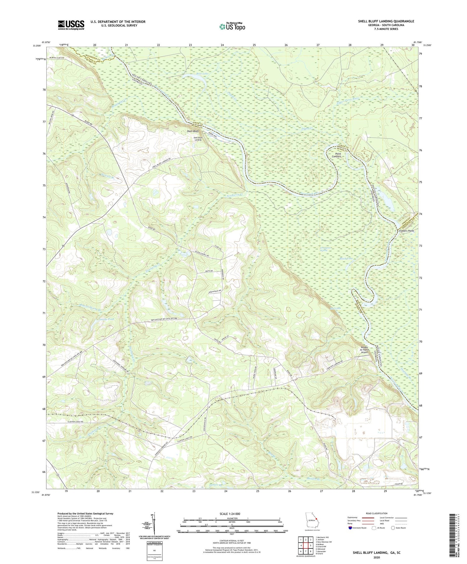
Shell Bluff Landing Georgia US Topo Map
Couldn't load pickup availability
Also explore the Shell Bluff Landing Forest Service Topo of this same quad for updated USFS data
2024 topographic map quadrangle Shell Bluff Landing in the states of Georgia, South Carolina. Scale: 1:24000. Based on the newly updated USGS 7.5' US Topo map series, this map is in the following counties: Burke, Aiken, Barnwell, Richmond. The map contains contour data, water features, and other items you are used to seeing on USGS maps, but also has updated roads and other features. This is the next generation of topographic maps. Printed on high-quality waterproof paper with UV fade-resistant inks.
Quads adjacent to this one:
West: McBean
Northwest: Mechanic Hill
North: Jackson
Northeast: New Ellenton SW
East: Girard NW
Southeast: Girard
South: Alexander
Southwest: Idlewood
Contains the following named places: Allens Chapel, Bent Lake, Black Lake, Boggy Gut Creek, Daniel Grove Church, D'Antignac Swamp, Demaries Ferry, Dog Ferry, Dog Ferry Landing, Ellenton, Fairfield Church, Fairfield School, Flowers Point, Flowery Gap Landing, Gobbie Grove Church, Hancock Landing, Island Creek, McBean Creek, McKinney Branch Church, Mineral Spring Branch, Newberry Creek, Point Comfort, Pump House Number 1, Pump House Number 3, Pump House Number 5, Red Branch, Red Lake, Rhodes Air Ranch Airport, Rouse Store, Shell Bluff, Shell Bluff Landing, Skinface Pond, Smiths Pond, Stewart Branch, Upper Three Runs, Vogtle Electric Generating Plant


